The National Weather Service in San Juan, Puerto Rico, has warned that the U.S. Virgin Islands and Puerto Rico will face a mix of weather hazards this week, including excessive heat and humidity, periods of rainfall and thunderstorms, gusty winds, and hazardous marine conditions.
Flooding, Gusty Winds and Lightning
In an update on Monday, forecasters at the NWS said unstable conditions could bring periods of thunderstorms and rainfall, which may be heavy at times, across the region through midweek.
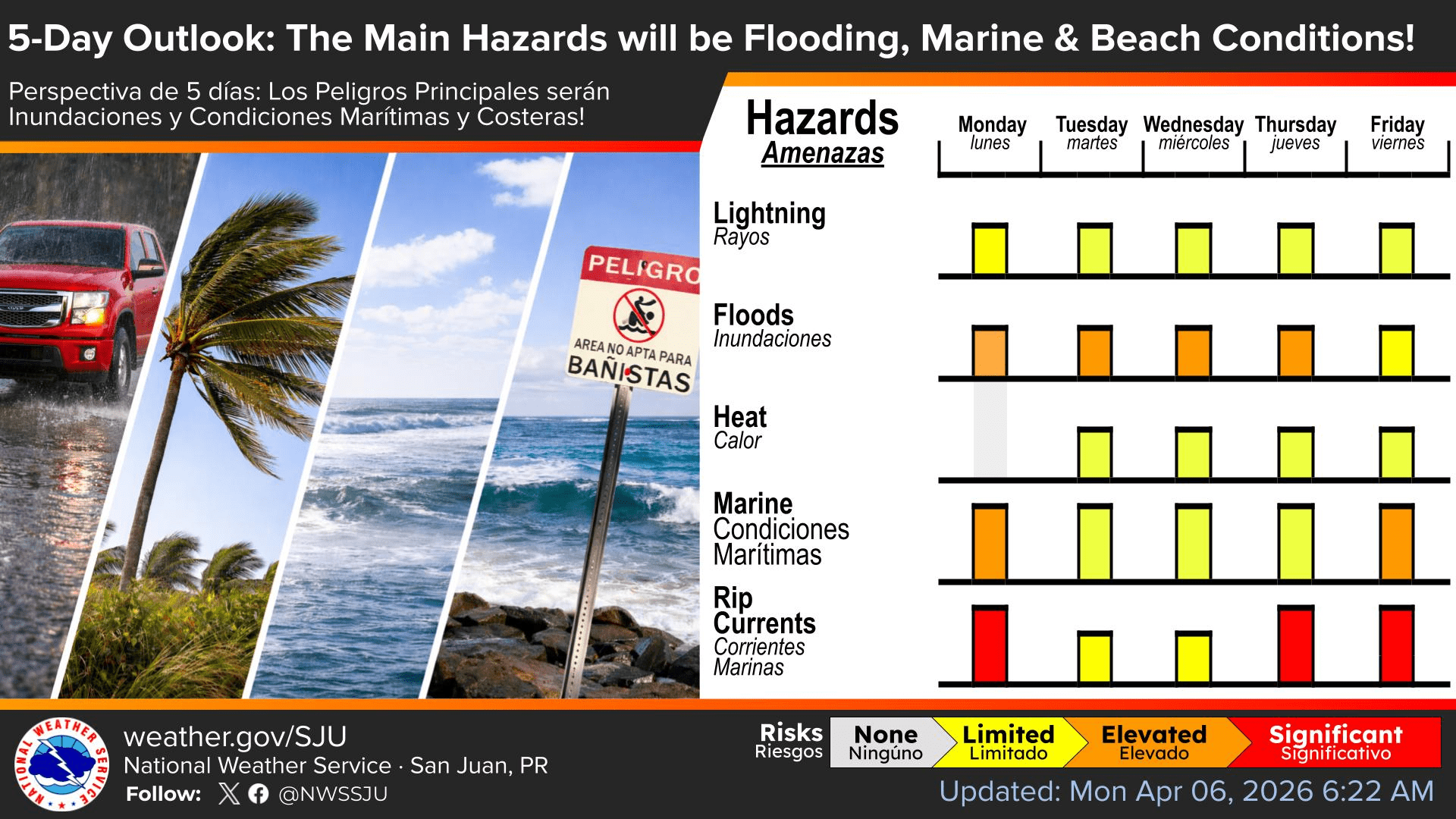
“The risk of flooding will increase this week, with the highest risk occurring through midweek,” the NWS said. “Afternoon and nighttime showers and thunderstorms may produce urban and small stream flooding, with isolated flash flooding possible across Puerto Rico and the U.S. Virgin Islands.”
The NWS added that flooding is not expected to be widespread, but localized flooding is possible during heavier downpours. Additionally, there may be times when precipitation does not occur.
“Although we expect periods with little or no rain, rounds of moderate to locally heavy rain will impact portions of the islands each day, especially across the USVI and Puerto Rico’s windward locations overnight and in the morning, and across the western and northern portions of Puerto Rico in the afternoon.”
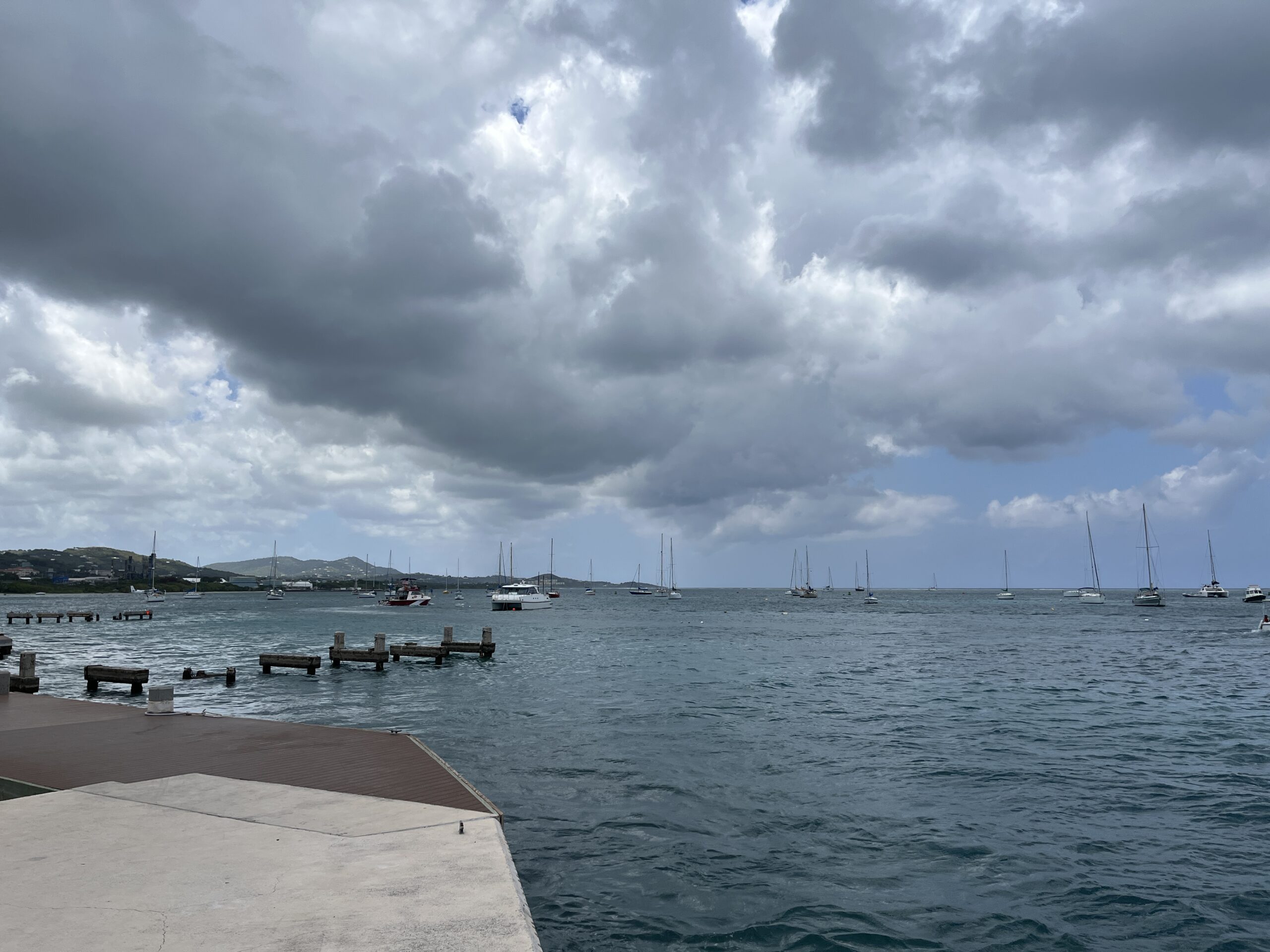
The NWS also warned of gusty winds affecting the islands, which could increase the frequency of showers and cause choppy seas.
“Breezy to locally windy conditions will persist. Winds will enhance shower activity and create hazardous marine and coastal conditions,” the NWS stated.
Heat Risk Builds Across the Islands
Excessive heat is also expected across the islands over the coming days.
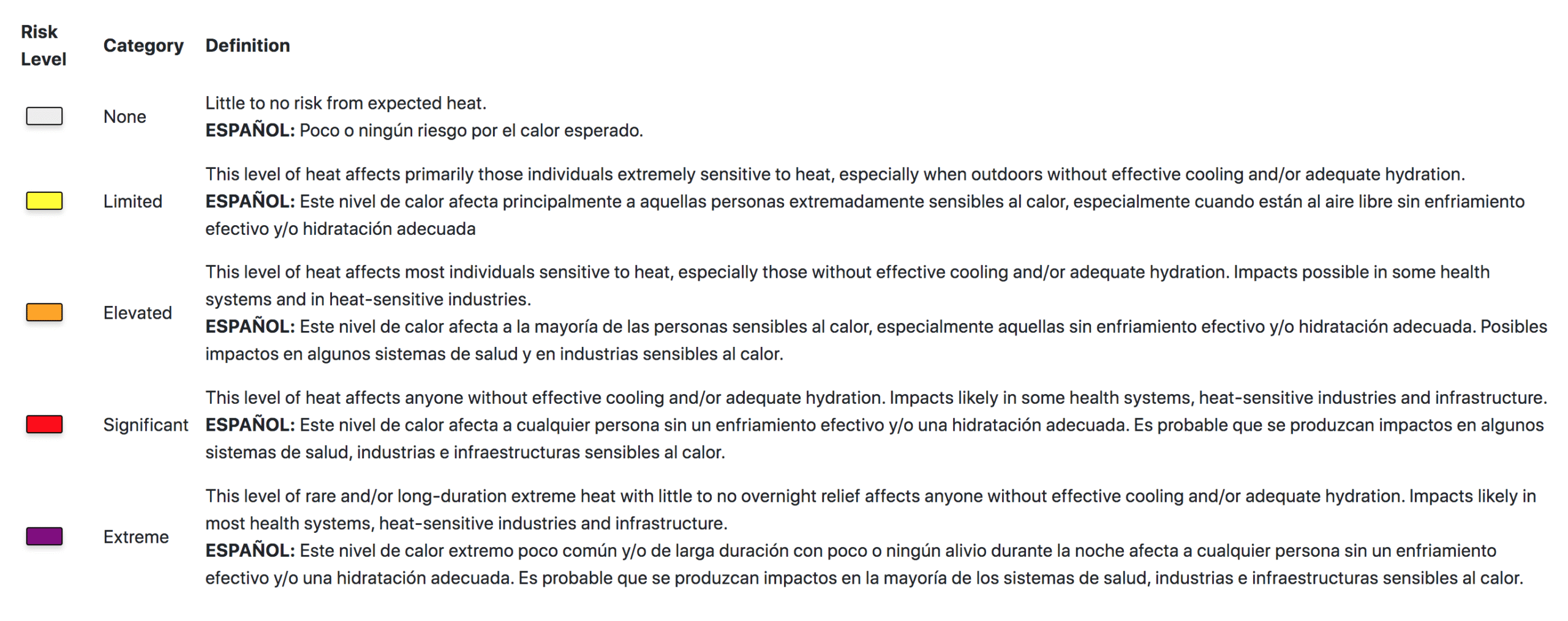
“Above-normal heat index values return Tuesday through Thursday,” the NWS reported. “Elevated heat indices will increase the risk of heat-related impacts, especially for sensitive individuals outdoors without adequate hydration or cooling,” the NWS cautioned.
According to the NWS, “The heat index, also known as the apparent temperature, is what the temperature feels like to the human body when relative humidity is combined with the air temperature.”
The Source contacted Manuel Ramos-Rodriguez, a meteorologist at the NWS in San Juan, for more details on the heat expected across the islands this week.
“We anticipate a Limited Heat Risk this week, but we do not expect to issue separate Heat Advisories,” Ramos-Rodriguez clarified. “Heat Advisories are issued for areas under an Elevated Heat Risk, while Extreme Heat Warnings are reserved for a Significant Heat Risk. However, we do not anticipate meeting those specific thresholds at this time,” he noted.
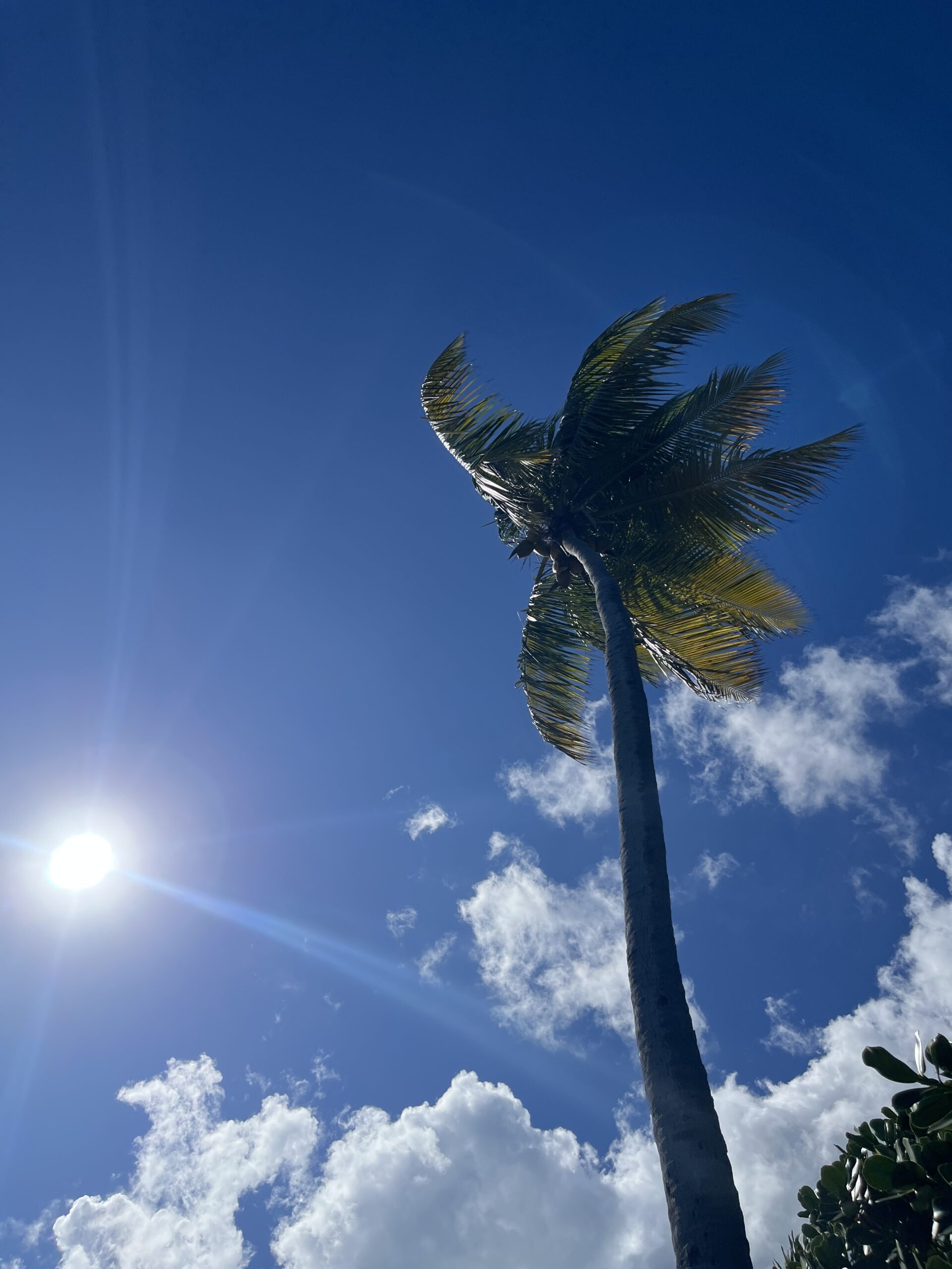
The NWS outlook says winds from the east-southeast will help push temperatures above normal while also increasing moisture. Current local forecasts for St. Thomas, St. John, and St. Croix call for breezy conditions and highs generally in the mid-80s Fahrenheit through much of the week, but the heat index will likely make the weather feel warmer.
Marine and Beach Conditions
Marine and beach hazards are also expected to remain a concern across the local waters, particularly during the second half of the week.
“An arriving swell will cause conditions to deteriorate again later this week,” the NWS reported. “Beachgoers, especially inexperienced swimmers, are strongly urged to stay out of the water, avoid areas near rocks or jetties, and follow all posted warnings and lifeguard instructions,” the NWS cautioned.
Gusty winds will also generate wind-driven, choppy seas, and the risk of rip currents is likely to increase. Ramos-Rodriguez said additional alerts could still be issued as conditions change.
“The NWS may issue Small Craft Advisories, High Risk of Rip Current Statements, thunderstorm alerts and flood-related warnings,” Ramos-Rodriguez said. “Please note that there is a high chance that flood notifications will be focused on Puerto Rico,” he concluded.
Local Weather Updates
Weather hazards can occur year-round, and it is crucial to be prepared. Information regarding the weather across the USVI, including marine forecasts, is available from the NWS and NOAA.
With the Atlantic hurricane season set to begin June 1, the Source recently covered AccuWeather’s latest 2026 hurricane season forecast, with a focus on an expected El Niño weather pattern. The story can be viewed here.
Additionally, the local forecast is regularly updated on the Source Weather Page, where a weekly video forecast is available.
Finally, residents and visitors can also view weather alerts and disaster preparedness information from the Virgin Islands Territorial Emergency Management Agency.