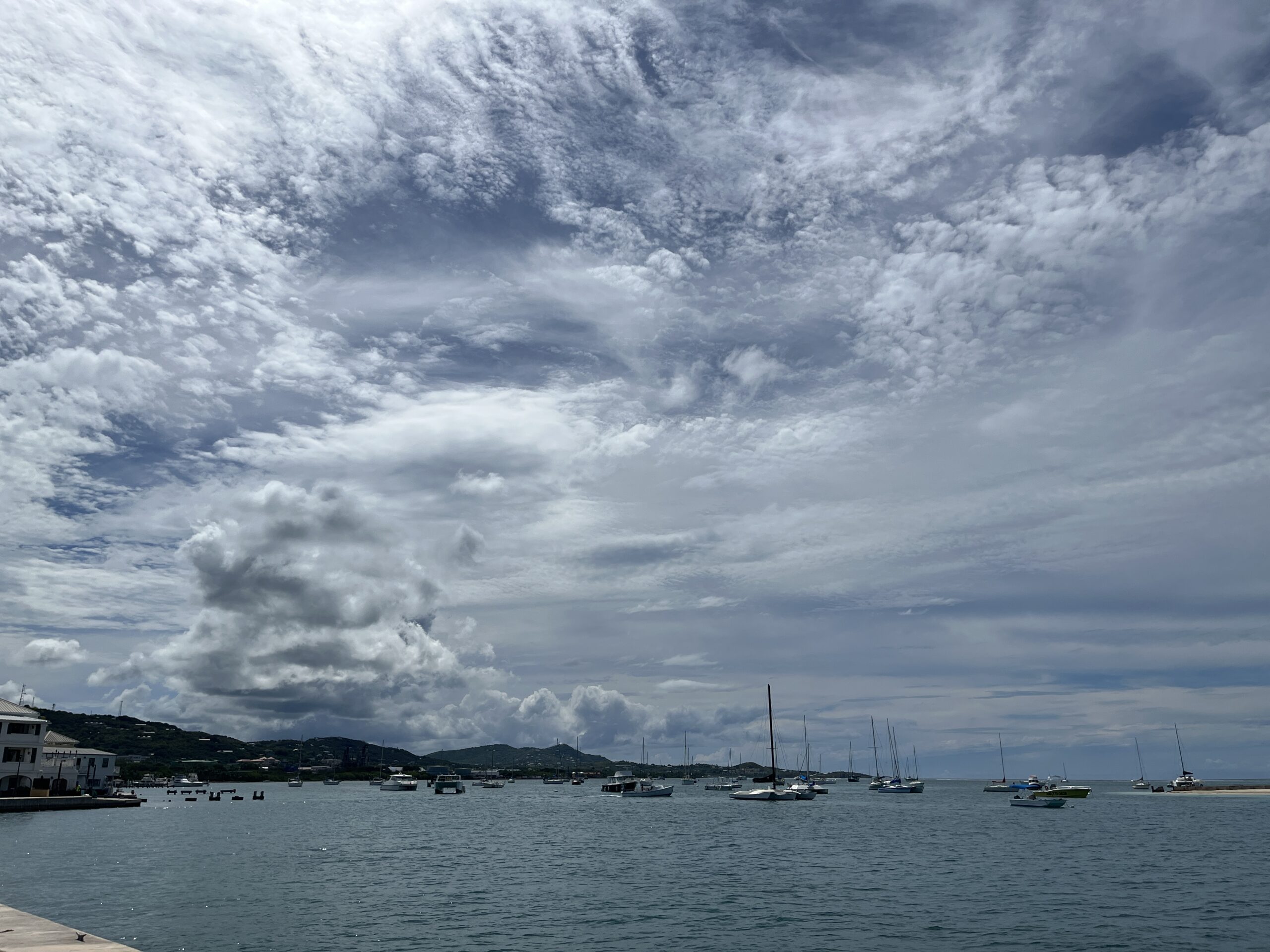
According to the National Weather Service in San Juan, Puerto Rico, warm and humid conditions, increasing showers, and isolated thunderstorms are forecast across Puerto Rico and the U.S. Virgin Islands this week.
Elevated Heat Risk Across the Region
The NWS reported that the anticipated warm conditions are due in part to a southerly wind flow across the islands.
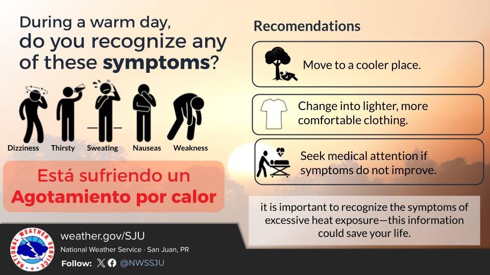
“Warmer-than-normal conditions will continue across urban and coastal areas of the islands, with heat indices reaching or exceeding 100 degrees Fahrenheit, affecting the more vulnerable individuals,” the NWS said in an update on Monday afternoon.
According to the NWS, “The heat index, also known as the apparent temperature, is what the temperature feels like to the human body when relative humidity is combined with the air temperature.”
The hot weather is forecast to affect both U.S. territories through the end of the week.
“Maximum surface temperatures will range from the upper 80s to low 90s Fahrenheit across coastal and urban areas and from the low to mid 80s Fahrenheit in higher elevations,” the NWS stated. “Combined with high humidity, heat indices are expected to exceed 100 degrees Fahrenheit daily, especially through Friday with slight moderation by late weekend.”
Residents and visitors are encouraged to stay hydrated, take breaks from the heat, and limit prolonged sun exposure in order to remain safe during periods of excessive heat, especially during the warmest parts of the day.
Showers and Thunderstorms Expected This Week
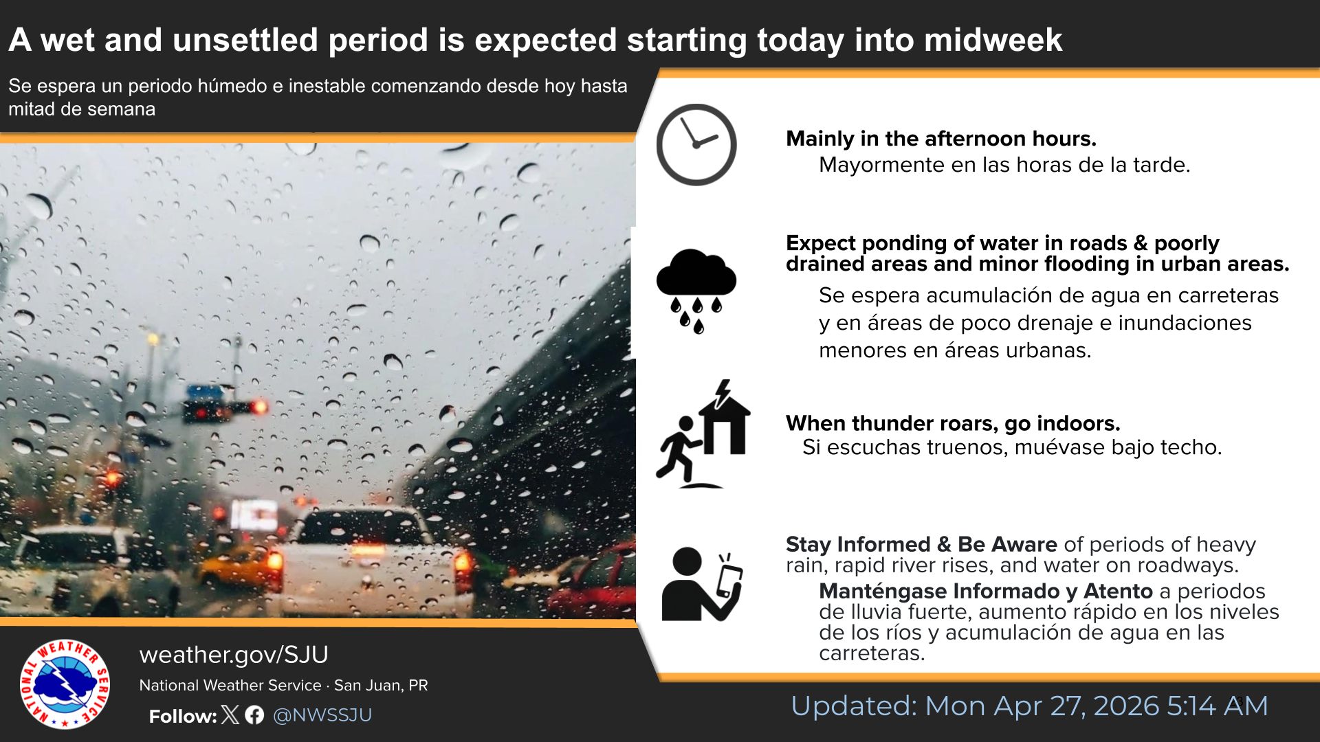
In addition to the warmer weather, the NWS explained that a wetter and more unstable weather pattern is expected throughout the week as moisture continues to move across the region from the Caribbean Sea and northern South America.
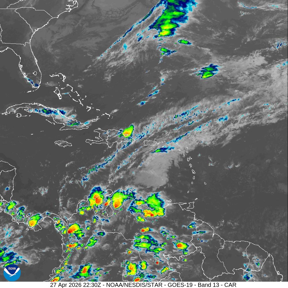
“The frequency of showers will increase late Monday night into early Tuesday across the U.S. Virgin Islands, with ponding of water over roadways and poorly drained areas,” the NWS said.
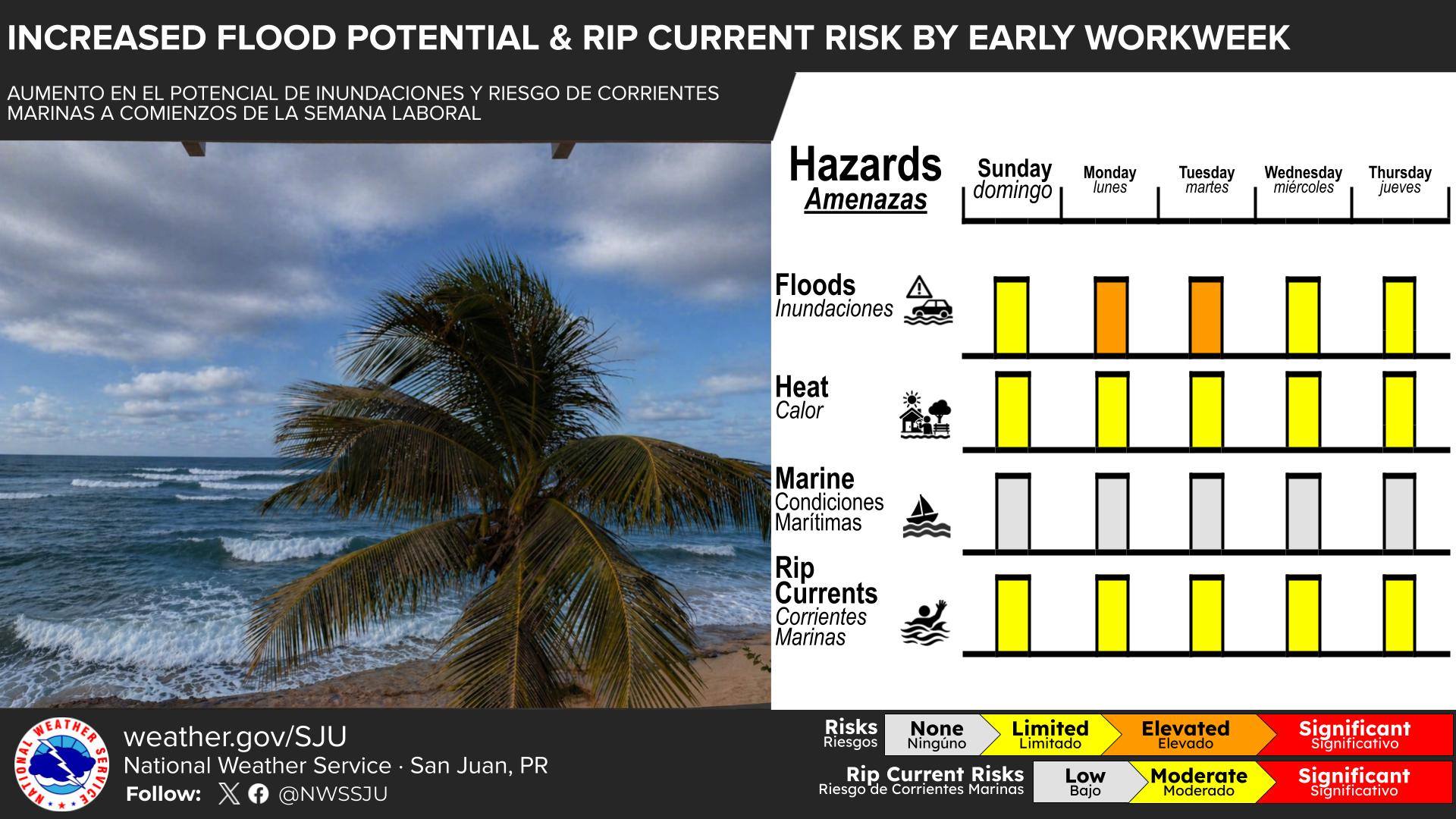
A limited to elevated flooding risk is expected to persist through much of the short-term forecast period. Rainfall across the U.S. Virgin Islands may be intermittent rather than constant. However, rainfall that does develop could be heavy at times, and decreasing winds may cause some showers and thunderstorms to move more slowly, leading to the increased chance of localized flooding.
Unsettled weather is possible through Friday, with the potential for daily showers and thunderstorms. The NWS reported that a gradual drying trend is expected by the upcoming weekend, with more stable conditions forecast from next Sunday into Monday.
Marine and Beach Conditions
Regarding the local marine conditions, the NWS said that pulses of a small, long-period northeasterly swell will affect the region over the coming days, leading to a low-to-moderate risk of rip currents, along northern and eastern coastlines of Puerto Rico and the USVI. Seas are forecast to remain between two and four feet.
Forecasters also reiterated the threat of rainfall and thunderstorms throughout the week.
“In addition to rip currents, beachgoers should remain weather alert as afternoon showers and thunderstorms are expected near northern coastal areas of Puerto Rico, resulting in heavy rainfall, gusty winds, and lightning,” the NWS advised.
Local Weather Forecast
Weather hazards can occur year-round, and it is crucial to be prepared. Information regarding the weather across the USVI, including marine forecasts, is available from the NWS and NOAA. With the Atlantic hurricane season set to begin June 1, individuals across the islands are also encouraged to begin preparing for hurricane season.
The local forecast is regularly updated on the Source Weather Page, where a weekly video forecast is available. Additionally, residents and visitors can view weather alerts and disaster preparedness information from the Virgin Islands Territorial Emergency Management Agency.