The 2024 Atlantic Hurricane Season has had a record-breaking start, with major hurricane Beryl’s recent destructive trek across the Caribbean. The cyclone’s rapid intensification and incredible power are stark reminders of the importance of being prepared throughout hurricane season.
The Source spoke with weather experts regarding Hurricane Beryl’s rapid intensification and what it could mean for the remainder of this year’s season.
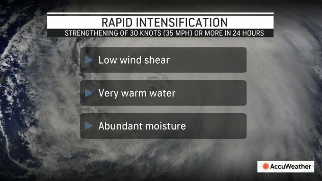
“Rapid intensification has a formal definition, [and] it [occurs] when a tropical cyclone’s maximum wind speed increases by at least 35 mph in 24 hours,” said Jake Carstens, a tropical meteorologist and assistant professor in the Department of Atmospheric Sciences at the University of North Dakota. “The small-scale dynamics can be tricky in how this happens, but fundamentally, it is fueled by warm waters, a moist [humid] environment, and favorable upper-level winds,” Carstens continued.
Carstens noted that tropical cyclones’ rapid strengthening may occur more often than in previous years.
“There have been hints of rapid intensification occurring more frequently in the Atlantic over the past 10 years, and a warming ocean/atmosphere adds to this potential,” Carstens stated. “Nonetheless, it remains a challenging aspect of hurricane forecasting due to both the small-scale features that influence it and the communication challenge of having little lead time to inform people in a storm’s path.”
Hurricane Beryl’s Quick Development
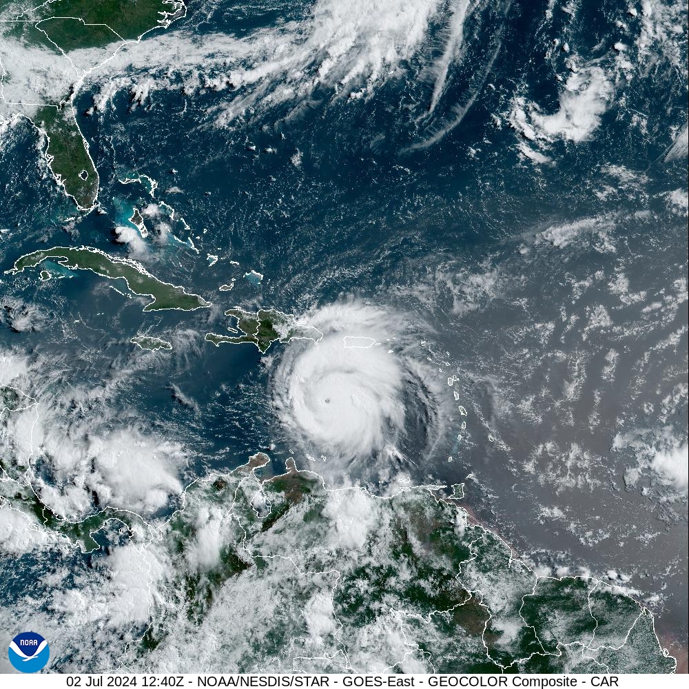
Hurricane Beryl underwent rapid intensification as it barreled toward the southern islands in the Lesser Antilles before making landfall as a high-end Category 4 hurricane and caused widespread, extensive damage over the region, particularly across portions of Grenada and St. Vincent and the Grenadines. The system then continued across the Caribbean, impacting areas such as Jamaica, and eventually made landfall on Monday as a Category 1 cyclone over the state of Texas.
“Beryl first formed as a tropical depression on June 28, 2024, with winds of 35 mph. Within the first 24 hours, the storm rapidly intensified into a hurricane with winds of 75 mph,” according to information from the National Oceanic and Atmospheric Administration (NOAA). “This was the farthest east that a hurricane has formed in the month of June,” NOAA added. “In the following 24 hours, Beryl underwent another instance of rapid intensification becoming an extremely dangerous Category 4 hurricane. At that point Beryl was the first Category 4 hurricane to form in the month of June,” NOAA said.
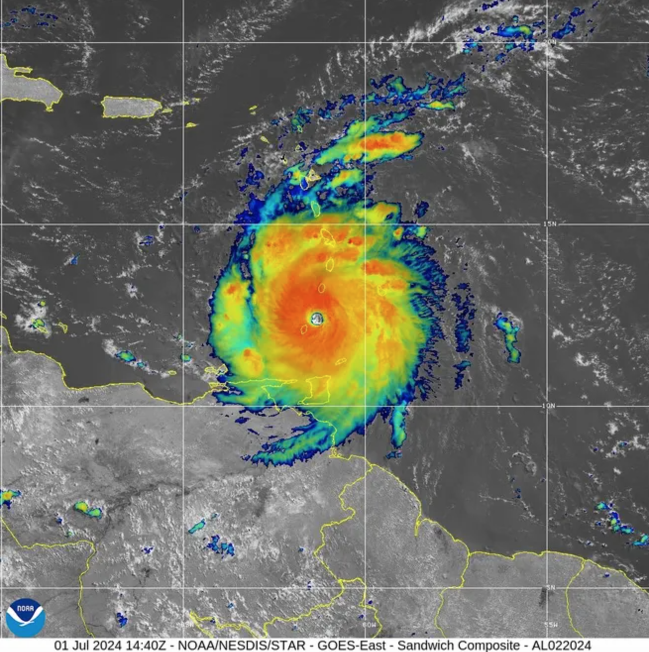
After landfall on July 1 over Carriacou, Grenada, the cyclone intensified into a Category 5 storm as it continued moving across the Caribbean.
“Perhaps the most noteworthy record that Beryl broke [is that the cyclone] was the earliest Category 5 hurricane on record in the Atlantic basin,” Carstens noted.
How to Plan for Rapidly Intensifying Storms
The rate at which Beryl intensified is particularly concerning and can affect how residents and visitors in the Virgin Islands and across the Caribbean should prepare for cyclones. For example, if a hurricane is forecast to make landfall as a Category 1 system with maximum sustained winds of at least 75 mph, but the system rapidly intensifies to a major Category 3 storm with maximum sustained winds of at least 111 mph, the impacts from the cyclone will be vastly different. Preparing well before a storm is essential.
When asked how Virgin Islanders should prepare for hurricanes, Carstens offered the following information:
“An informal tip that I have heard is [to] prepare for one category higher,” Carstens advised. “This is because intensity forecasts (in terms of [a cyclone’s] maximum wind speed) have average errors of about 15 mph multiple days out from an impact,” he said.
“However, my main piece of advice is to take time to absorb [all of the weather forecast] products developed by the National Hurricane Center in recent years,” Carstens stated. “There have been plenty of efforts [made] to better warn [residents about] water-related hazards, such as flooding rain and storm surge, and to deliver ‘Key Messages’ [about a specific storm] in a concise way. [Multiple advisories] better communicate the full range of hazards a hurricane can bring outside of the maximum wind speed, which only occurs over a small area,” he continued.
Regarding the possible influence of climate change on the formation and intensification of Beryl, Carstens stated the following:
“While I do not think it is fair to say, ‘climate change is why Beryl formed in the first place’ (after all, we have seen early-season hurricanes before), warming oceans are boosting the ‘speed limit’ to which a hurricane can strengthen. It is highly likely that it played a role in the magnitude of Beryl’s eventual intensification.”
The Source also contacted Matt Rosencrans, National Weather Service lead hurricane seasonal forecaster, regarding his thoughts about the rapid intensification of Hurricane Beryl, and what it may mean for the remainder of the season.
“Above-normal Oceanic Heat Content (OHC) and Tropical Cyclone Heat Potential (TCHP) increase the odds for a storm to rapidly intensify, though sometimes that can be mitigated by the wind shear or dry air,” Rosencrans explained. “The warmer [ocean water] temperatures, at the surface and at depth across the Caribbean, are factors that could contribute to rapid intensification of any storm that develops and moves across [the] region. OHC and TCHP are both forecast to be above normal, and wind shear is forecast to be below normal, for the most part, over the rest of the season. So, [the] odds are in favor of a [rapid intensification] event being more likely this year than many other years,” Rosencrans cautioned.
Rosencrans provided details on the weather conditions that contributed to Beryl’s intensification.
“Beryl moved over very warm waters, [and] at the same time, Beryl moved through a pocket of low wind shear and a relative absence of dry air [including dry, Saharan dust],” Rosencrans said. [Therefore,] all the factors [for the cyclone’s strengthening] came together. The OCH and TCHP are not likely to change much for the rest of the season, while [wind shear and dry air] are highly variable on a week-to-week basis. [However,] both wind shear and [dry, Saharan dust] are forecast to be favorable for intensification more often this year,” Rosencrans explained.
“As we saw with Beryl, response times may not be what we want, so preparing now is key,” he advised.
Looking Ahead: A Busy Season is Expected
NOAA has warned that a very active Atlantic Hurricane Season is expected, and a Source article explains that the main reasons for the potentially explosive season involve 1) a transition from an El Niño weather pattern to La Niña, likely reducing hurricane-shredding wind shear across the Atlantic, and 2) record-breaking warm sea surface temperatures across the North Atlantic Ocean.
Other forecasts have called for an active season, including Colorado State University’s (CSU) Tropical Meteorology Project. As recently as Tuesday, CSU increased their predicted number of cyclones that may develop this year.
“We have slightly increased our forecast and continue to call for an extremely active Atlantic hurricane season in 2024,” according to an update from CSU.
Hurricane Preparedness
Finally, the Source connected with Sim Aberson, Ph.D., a meteorologist at the Atlantic Oceanographic and Meteorological Laboratory’s Hurricane Research Division, part of the National Oceanic and Atmospheric Administration(NOAA). As a previous Source interview explains, Aberson is a “Hurricane Hunter,” and he is one of the researchers who diligently studies and examines tropical systems and their behavior.
Aberson acknowledged that while rapid intensification of storms may occur more frequently, the fundamental methods of preparing for cyclones have remained the same.
“There is a consensus that rapid intensification is becoming more common and faster than before, [and] this can happen near shore [or a coastline].”
“[However,] this doesn’t change how everyone should be prepared for hurricanes each year,” Aberson noted. “Very strong hurricanes have always hit the Virgin Islands and will continue to do so. What [meteorologists] like to say is, ‘Prepare for the worst and hope for the best.’ [Residents] should prepare for each hurricane as if it could become a Category 5 and hope that each one fizzles out before it reaches [land].”
“[Essentially,] there isn’t [any] difference in how one should prepare for a Category 1-3 hurricane [versus a storm] that is stronger,” Aberson declared.
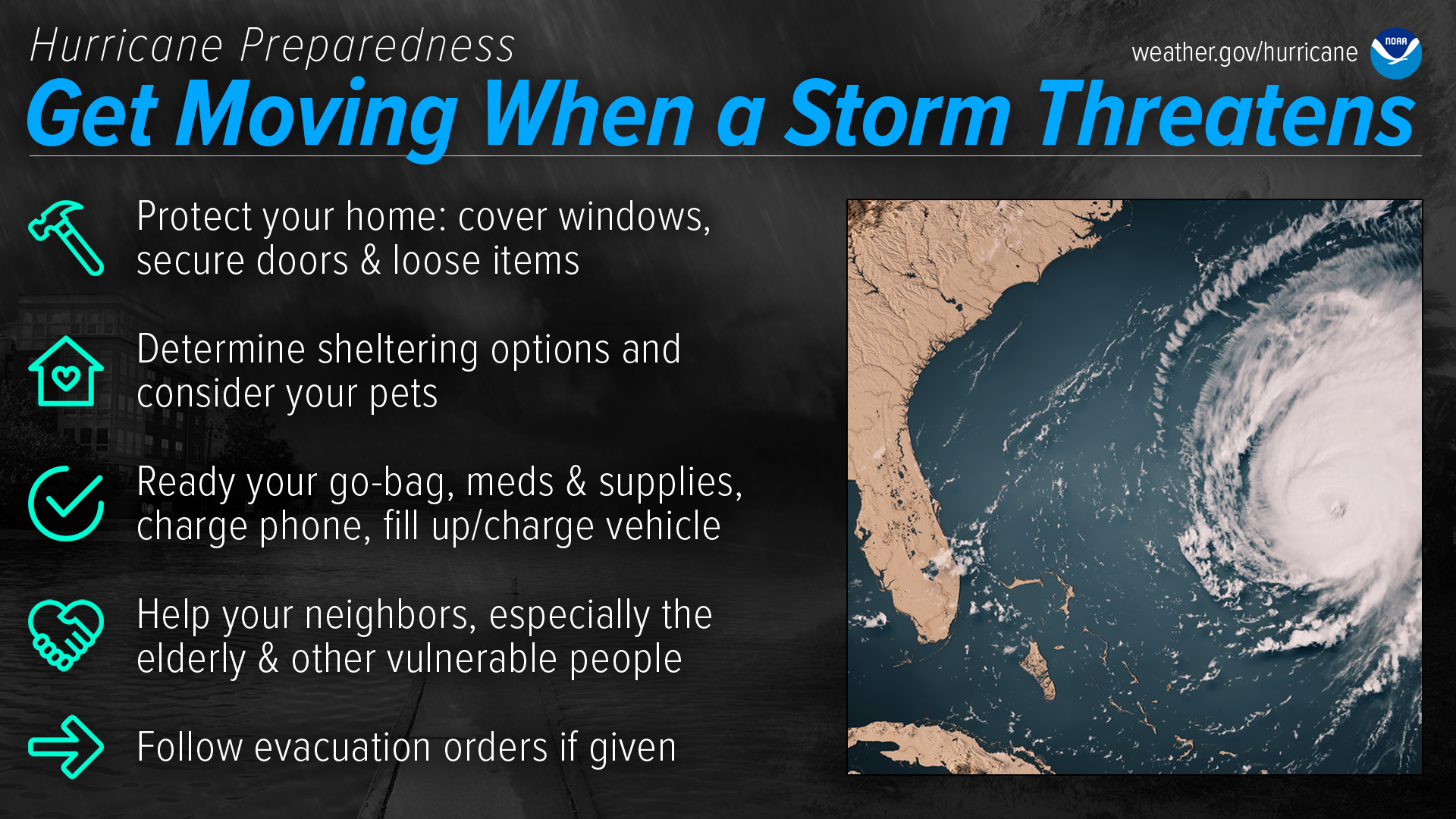
Helpful tips for hurricane safety and preparedness are available on NOAA’s official website.
“Be ready for hurricane season. Take action TODAY to be better prepared for when the worst happens,” according to the NOAA website. “Understand your risk from hurricanes and begin pre-season preparations now. Ensure you understand how to interpret forecasts and alerts and know what to do before, during, and after a storm.”
Weather Updates
Additional information regarding hurricane preparedness is available from the Virgin Islands Territorial Emergency Management Agency and the National Weather Service.
The Source Weather Page also publishes a daily weather forecast and offers readers the chance to view weather forecast videos and disaster preparedness video segments.