I recently received good news from a friend, Sarah Haynes-Brin, president for Trust for Virgin Islands Lands. It said, “I have been meaning to reach out to you to express my deepest gratitude for your decades of commitment to preservation of Maroon Ridge and the important ecological and cultural resources of this area. Your commitment and perseverance are an inspiration to me and our team at Trust for Virgin Islands Lands. We also have goods news of 139 acres of Perseverance Bay in St. Thomas that will be forever preserved by the Territorial Park closing tomorrow!”
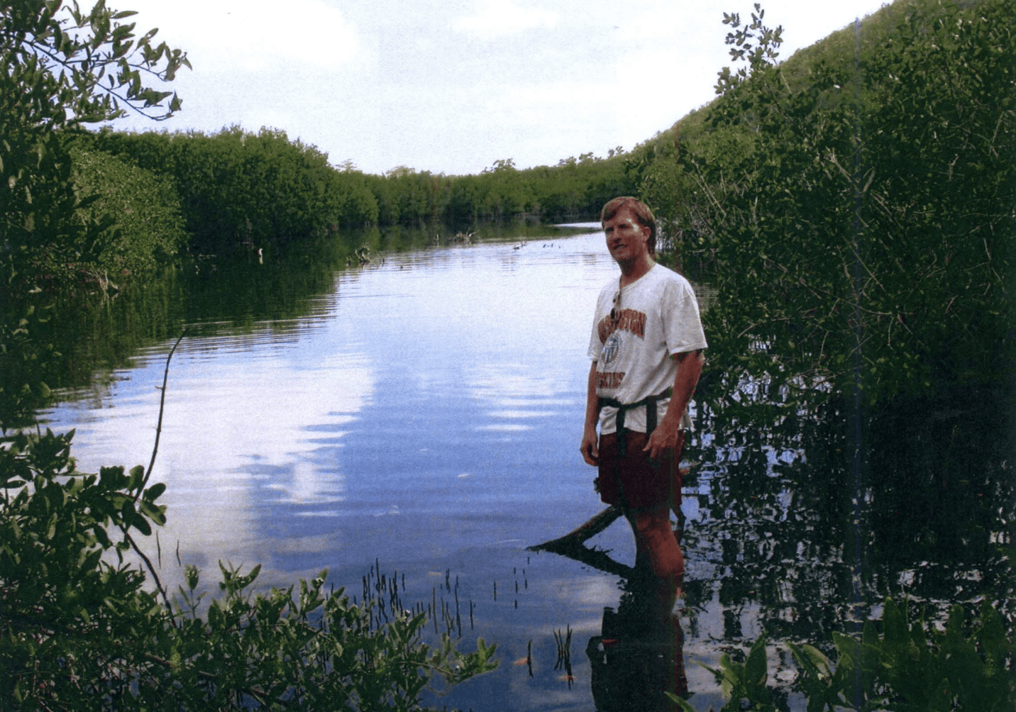
As a child or youth, I have been connected to Perseverance Bay coastal environment, locally called “Flamingo Pond,” from the late 1960s, but particularly from the early or middle 1970s hiking this wilderness area of the West End of St. Thomas. I would ride my bike from Savan (Savanne’s) and meet Frank “Akanni” Francois, a good friend now deceased, and others at what was known back in the day as “Down the Roads,” Estate Bournefield, or the “Thatch Farm” area where we boys met and trekked to John Brewer Bay by foot into Perseverance Bay wilderness area.
Historically, the Great West End of St. Thomas was known for its runaway slaves or maroons due to the surrounding cays, inlets, or small islands where they escaped to and then onto Puerto Rico for their freedom. Historically, the first part of St. Thomas to be developed was the natural harbor on the South Side of the island in the 1700s. Originally it was known as Taphus and later renamed Charlotte Amalie in 1691. Thus, the development of St. Thomas concentrated from Fort Christian, spreading along the coastal natural harbor of the island serving as a maritime trading hub.
The West End estates of St. Thomas such as Fortuna, Botany Bay, Perseverance Bay, Catharina’s Hope and others began to be developed and settled prior to the turn of the 18th century. These estates began to expand between 1703 and the 1750s. However, the rugged topography and remote areas of the West End was one of the last frontiers on St. Thomas to be cultivated heavily by planters. Most of the settlers in the West End of St. Thomas were Englishmen and Dutchmen from neighboring Caribbean islands such as Tortola, St. Kitts, and St. Maarten.
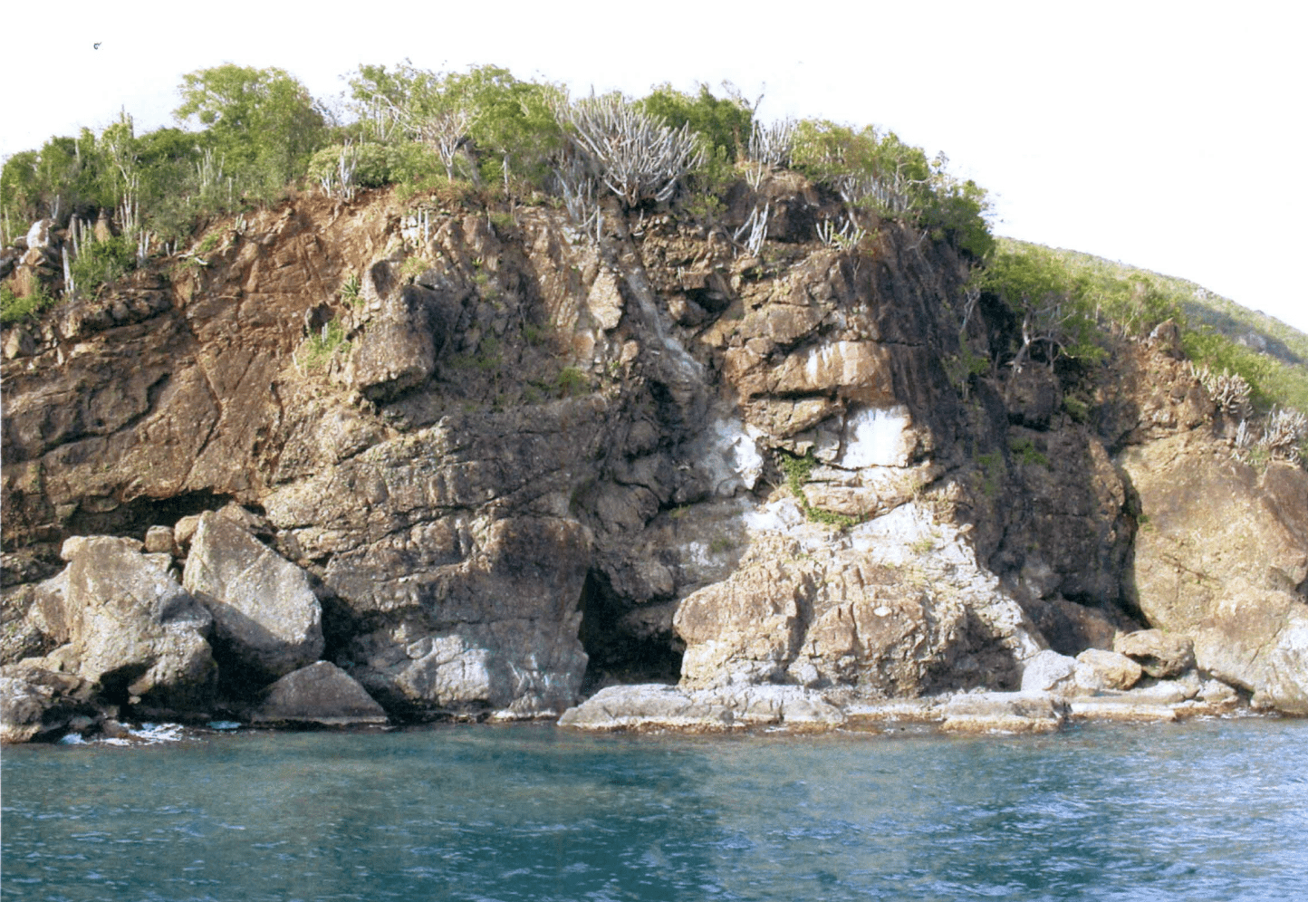
The newly acquired 139 acres of Perseverance Bay for our park system has historic ruins that date to the 1820s. The historic structure at Perseverance Bay was a sugar factory that probably produced molasses or rum. The factory was once linked to an animal mill. Nevertheless, under the ownership of Thomas Armstrong in 1783, and Nathaniel Alt in 1778, some estates in the West End of St. Thomas shifted focus from cotton back to sugar. There is a great possibility that Perseverance Bay plantation could have once grown cotton. However, an archaeological study needs to be conducted to verify if Perseverance Bay was once both a sugar and a cotton plantation.
During the early colonial history of St. Thomas, cotton was a profitable crop on the estates of the island. It also had been grown by many planters on the new colony of St. John. In 1733, there were 80 cotton plantations on St. Thomas and 60 on St. John. This accounted for more than half of all plantations on both islands. Cotton accounted for roughly 20 percent of the Danish West Indies exports to Denmark. The estates in the West End, like other parts of St. Thomas, were reliant on enslaved African labor.
Botany Bay plantation, for example, in 1804 to 1805 had 91 enslaved laborers with a high mortality rate, in some cases two to one according to Danish historic recorded between 1803 and 1848. Following the emancipation of 1848, the West End estates struggled economically. By the 1850s, the sugar plantations, including at Perseverance Bay, ceased their sugar operation. Eventually, the estates were converted into livestock farming. As time continued, the West End of St. Thomas grew back to forest.
However, a few years later large acres of estate lands on the West End of St. Thomas were abandoned. Nonetheless, Perseverance Bay is one of the 18 Area of Particular Concern (APC’s). The mandate to set aside land in the Virgin Islands as Areas of Particular Concern and create management policies to protect them originated in the National Coastal Zone Act. The guiding principle of this Act was to provide “procedures whereby specific areas may be designated for the purpose of preserving or restoring them for conservation, recreational, ecological, or aesthetic values.”
In 1979, Perseverance Bay was designated by the Planning Office and public hearing as a significant natural, cultural, and recreational area. In 1993, a law was passed to protect all 18 APCs in the Virgin Islands. That same year, the late Gov. Alexander A. Farrelly signed the bill into law. Over the years, studies of the Perseverance Bay watershed have been conducted by UVI students as well as other researchers.
The research findings were part of the grant application to National Oceanic and Atmospheric Administration (NOAA) to purchase Perseverance Bay that Kitty Edwards and her staff of DPNR submitted. Toni Thomas and I from the University of the Virgin Islands, School of Agriculture, worked behind the scenes and submitted technical research and historical information to Haynes-Brin of the Trust for Virgin Islands Lands, and Kitty Edwads director of V.I. Territorial Parks and Protected Areas, a division of DPNR, and others for the land acquisition of Perseverance Bay.
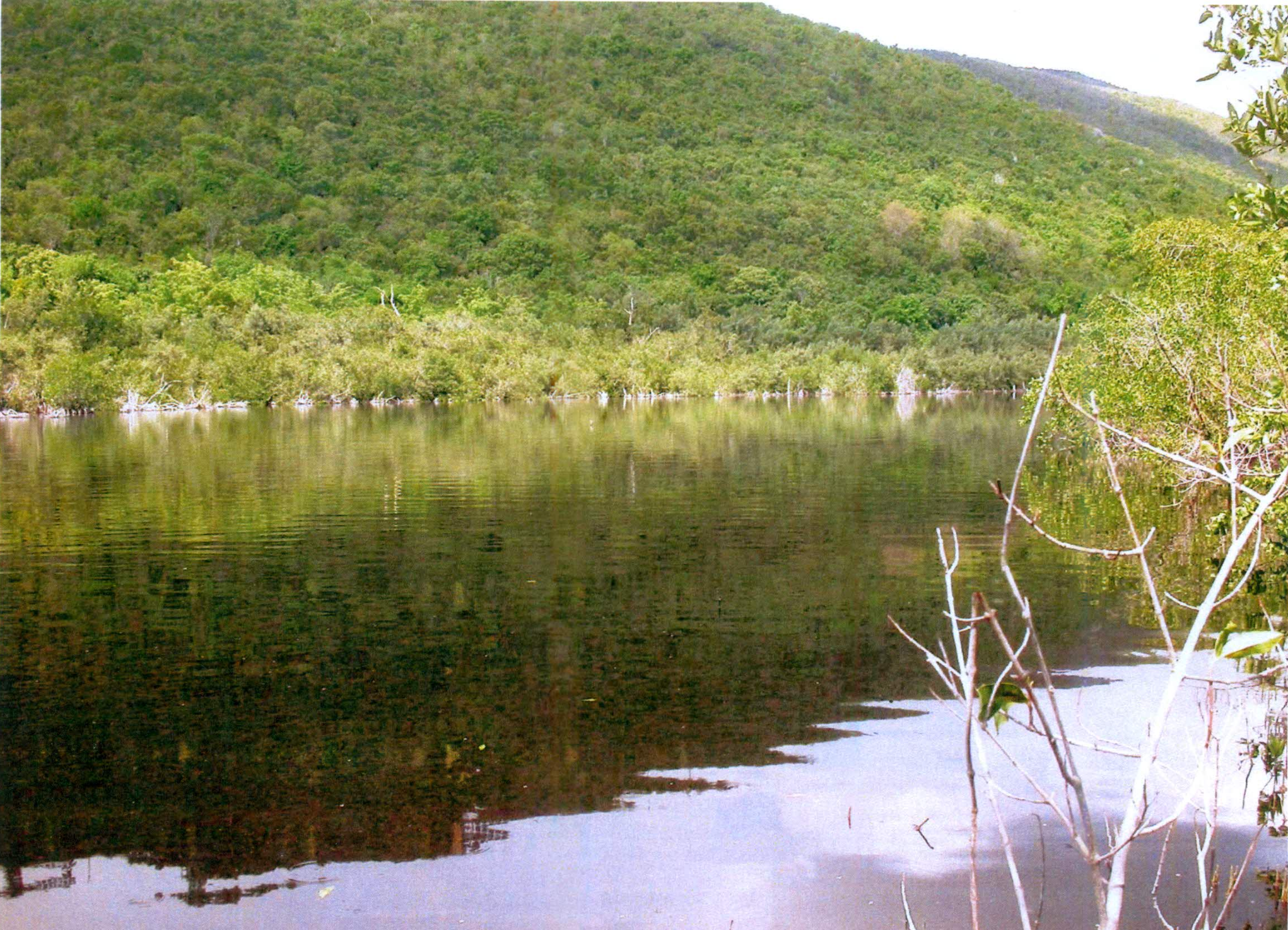
Believe me, Kitty worked extremely hard in the negotiation with the property owners of Perseverance Bay and the federal government (NOAA) who are funding us the funds to acquire the 139 acres. It was a partnership with UVI, DPNR, Trust for Virgin Islands Lands, and others in the community to protect this critical habitant — a jewel of wildlife, marine and terrestrial living organisms. Perseverance Bay Pond should be designated as a Wildlife Refuge as well as creating carefully planned hiking trails in the watershed.
There are rare endangered species plants on the property. In fact, there are two endemic succulent plants species on the property as well as native endangered plant species such as Malpiighia woodburyana.Mangroves forests, coastal forests, upland forests, and moist basin forests in the guts (streams) environment make up the critical habitat of this remote area of the Great West End of the island. There are several guts in the area. The Jumbie Gut headwater starts from Hawk Hill 1,376 feet above sea level and deposits at Perseverance Bay and Brewers Bay.
Other guts in the area are Upper Billy Gut and Lower Billy Gut, which are located above the historic ruins. The marine environment is breathtaking and very diverse with plants and coral organisms. I am happy my childhood backyard in the west is now protected forever and forever, Amen. Whenever I fly into Cyril E. King Airport, Perseverance Bay welcomes me back to my place of birth.
— Olasee Davis is a bush professor who lectures and writes about the culture, history, ecology and environment of the Virgin Islands when he is not leading hiking tours of the wild places and spaces of St. Croix and beyond.
Editor’s Note: Opinion articles do not represent the views of the Virgin Islands Source newsroom and are the sole expressed opinion of the writer. Submissions can be made to visource@gmail.com.