(This is the second in a two-part series about the local assessment of needs in coastal areas to be answered with federal grant funds. Part One focused on territory wetlands.)
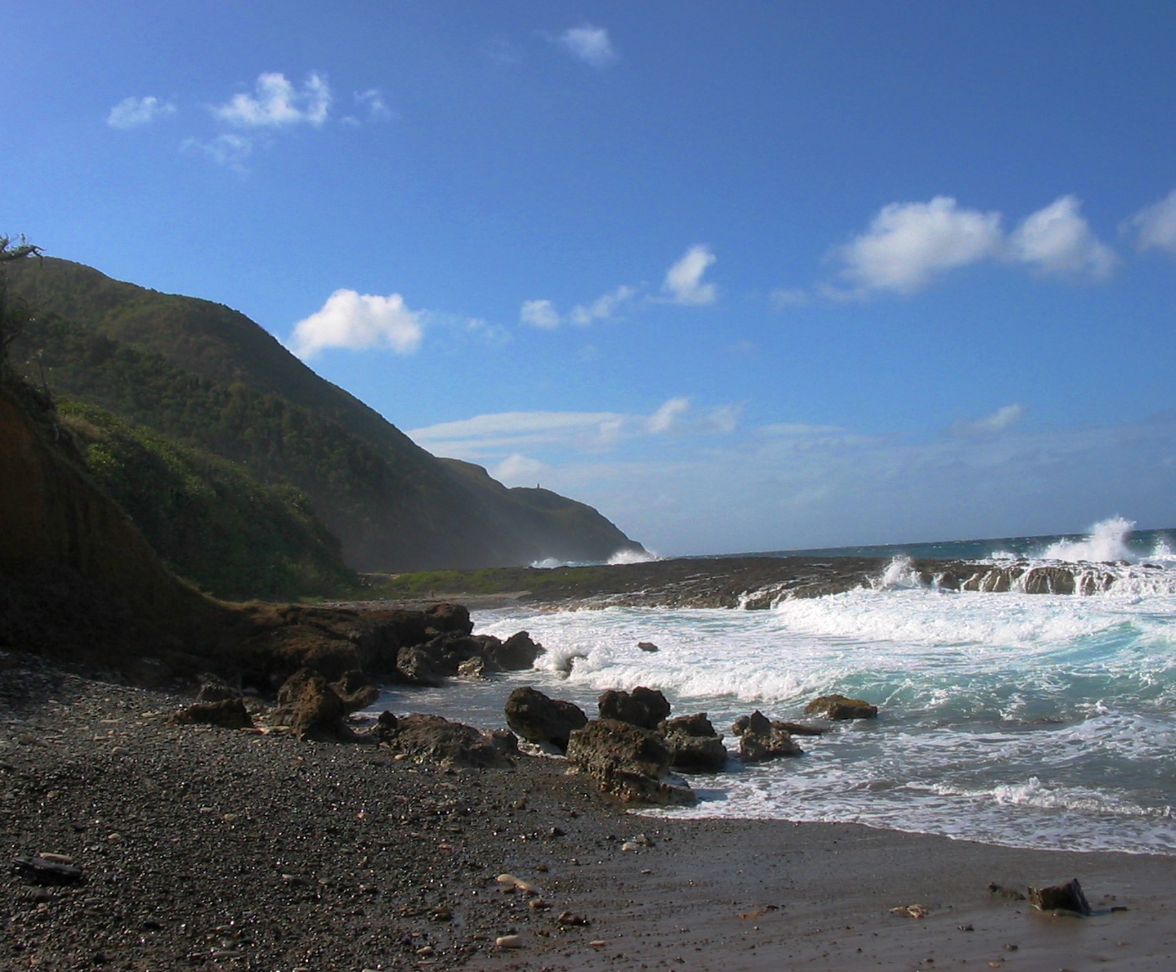
There is something alluring about a coastline. It offers a glimpse of unparalleled beauty. It whispers dreams of romance and adventure. It stirs the heart and quiets the soul.
It also invites danger.
There is a long list of natural phenomena that are considered “coastal hazards” by the National Oceanic and Atmospheric Administration, and many of them are common occurrences in the Virgin Islands.
Islanders don’t have to look far back for a chilling example.
In 2017, the combined forces of hurricanes Irma and Maria damaged 85 percent of the homes in the territory. They sunk at least 400 vessels. They pelted the land with more than 20 inches of rain and whipped the people with winds topping 170 miles per hour. They left no one and almost nothing untouched. Before they were through, they had caused an estimated $11.25 billion worth of damage.
The statistics are from the USVI Disaster Recovery Action Plan of 2019. They are cited in a recent report coming from the V.I. Coastal Zone Management division of the Department of Planning and Natural Resources, as part of a periodic assessment that CZM prepares when seeking federal funding to improve conditions in coastal areas.
NOAA recently approved a grant of up to $80,000 a year for three years to address two priorities discussed at length in the report: wetlands preservation and coastal hazards.
While hurricanes may be the most universally feared event among V.I. residents, there are other dangers that concern CZM as much or even more.
The assessment report lists flooding, shoreline erosion, and sea level rise as “high-risk” events for the territory. Hurricanes and tropical storms are categorized as “medium to high” risk, because of the variation in their intensity.
And geographic risks, such as a major earthquake and/or a tsunami triggered by an earthquake are considered “medium” risks. That rating reflects the fact that the likelihood of an occurrence is relatively small, although the outcome could be catastrophic.
“There are potential tsunami sources near the territory,” the report notes. The potential danger to human life and to infrastructure is exceptionally high, given that much of the population lives at or near the coast, and that almost all of the tourism attractions and hotels are also there.
But the report concentrates more on the “high-risk” categories and ways to ameliorate them.
Flooding
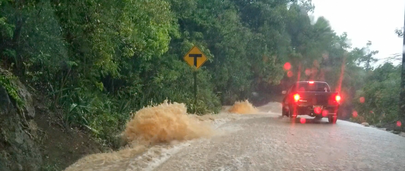
“Riverine flooding is a serious threat to the territory,” it states, and the danger has risen as the territory has paved over much of the ground, eliminating vast amounts of permeable surface, which used to soak up water, and replacing it with surfaces like roads and driveways that slough off water.
When you change ground cover “you change the way that water behaves,” CZM director Marlon Hibbert said in an interview with the Source about the report.
A heavy rainfall, such as one in 2018 that dropped more than two and a half inches of rain at a rate of an inch per hour, can be expected to happen about once a year, according to the experts. So, researchers at the University of the Virgin Islands designed a computer model of such a downpour and the amount of run-off it would create.
Then they ran a test using data about development existing in 1985, and another test using development data from 2018.
“Land cover is the only variable that was changed between the runoff simulations for 1985 and 2018,” the report states.
The result was telling. For each island, there was a significant increase in the amount of rainwater that turned into run-off. The St. Croix model showed the highest increase, 397 percent. St. John was next with an increase of 240 percent, and St. Thomas showed the least increase in run-off: 143 percent.
That does not mean that St. Thomas does a better job in containing excess water. Rather, Hibbert said, the differences attest to the timing of development. In 1985, St. Croix and St. John were just getting started on large-scale development. In contrast, St. Thomas had already laid down a lot of the concrete it maintained at the time of the study in 2018, hence its percentage increase was relatively less than the other islands.
Besides flooding from heavy rainfall and overflowing guts, the territory is vulnerable to a globally rising sea level, shoreline erosion and storm surge from tropical storms.
Hazards Related to Global Warming
“Beach erosion data indicates that all beaches in the territory are eroding, particularly in exposed areas,” the report says. Rising seas and resulting erosion are generally attributed largely to climate change.
Despite decades of global attention to the phenomenon, the report describes a tepid response to climate change in the Virgin Islands, where it has received lip service but little else.
An executive order in 2015 directed all departments and agencies to conduct a climate change risk assessment and plan and “to integrate climate change adaptation into project and programmatic designs,” the report notes. It also created a V.I. climate change council and a technical advisory group.
But neither of those entities are functioning, the report notes. And CZM is the only agency to work out a risk assessment and plan.
“[T]here have been few substantive efforts or actionable outputs as a result of (the executive order),” the report states. But it “had the potential to create significant change within the wider government to address vulnerability to climate change.”
Emerging Issues
The report notes two problems that seem to be getting worse and could turn into priorities in the future: prolonged dry spells and floating mats of sargassum seaweed. More information is needed on both.
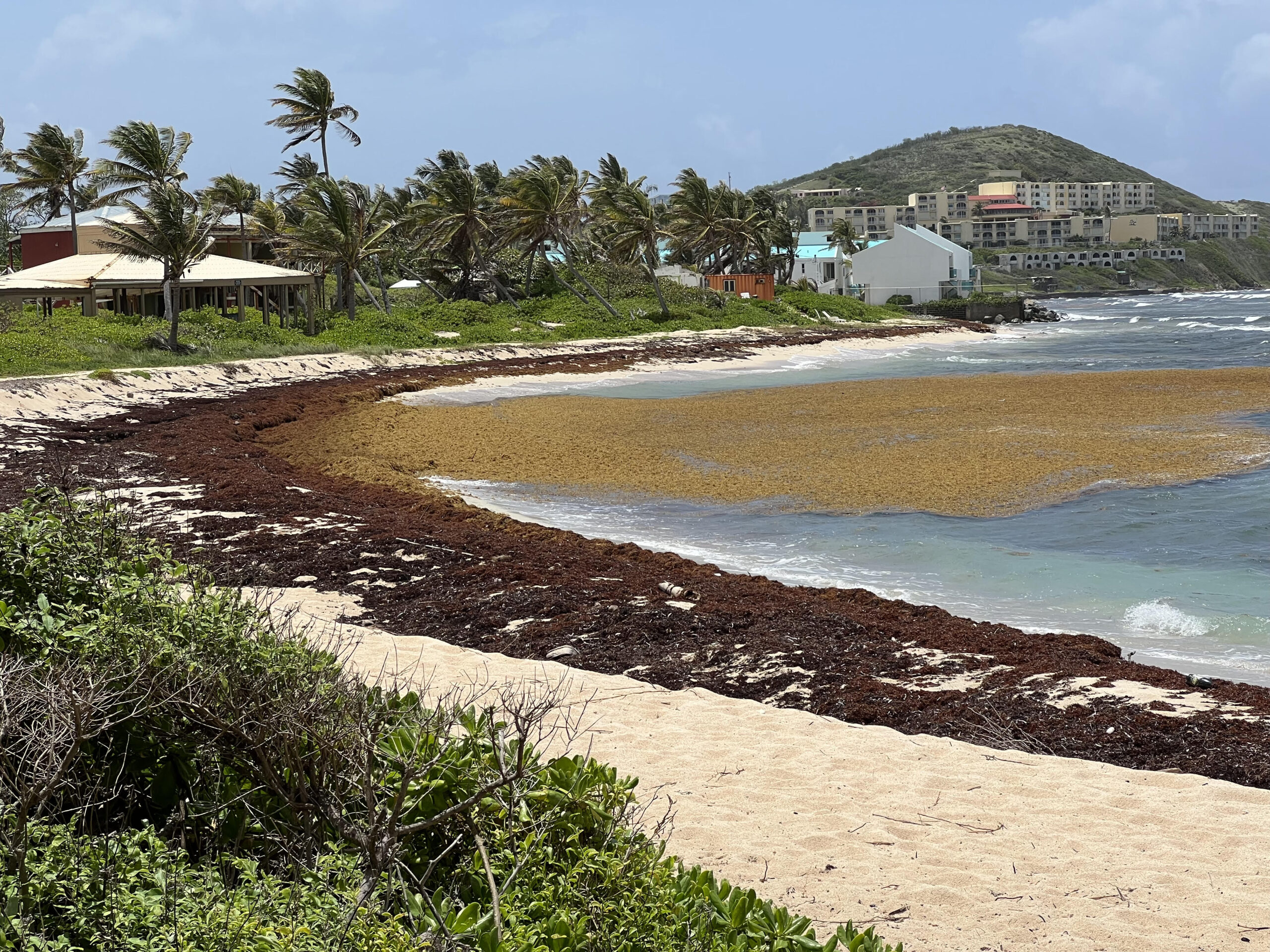
The amount of sargassum floating into V.I. waters and landing on its shorelines has been steadily increasing for about 10 years and is becoming less of a nuisance and more like a hazard. Last summer, it threatened to clog water intakes at the Water and Power Authority and disrupt both potable water and electricity production.
Long-term solutions may depend on ongoing research into uses for sargassum. More immediately, DPNR is working to develop a blueprint to govern its safe removal, according to the report.
“It’s a multi-faceted problem,” Hibbert said. DPNR has been working with “private partners” experimenting with the use of deflection booms to direct incoming sargassum mats to areas where it can be collected in piles.
As is often the case, there is some overlap between the two “emerging issues.” Fresh water is needed to wash sargassum before it is stockpiled. But that is never abundant in the territory, and increasingly more often it is scarce.
“Drought is becoming a chronic hazard rather than an intermittent one,” the report states. A lack of consistent rainfall is especially concerning because the territory has minimal surface and groundwater resources.
In 2019, the U.S. Virgin Islands was included in the U.S. Drought Monitor, which releases a map every Thursday showing drought-affected areas. The territory also participates in the Community Collaborative Rain, Hail, and Snow Network, a volunteer organization that collects real-time data on precipitation.
But it is short on historical rain data, as there has been a lack of long-term monitoring. It also needs detailed soil and land cover assessments. And residents need a better understanding of water conservation methods.
“Increasing resiliency to drought should inform permitting conditions such as the use of permeable versus impermeable surfaces or special conditions for larger developments to increase rain capture and cistern capacity,” according to the report.
Resiliency vs. Vulnerability
“Don’t look for trouble.”
“Avoid problems.”
“Get out of the line of fire.”
A rudimentary approach to mitigating coastal hazards is to get people and infrastructure off the coast.
Some jurisdictions have implemented buy-out programs to move homes inland. That may not be practical in a cash-strapped territory where much of the buildable land is at or near the shoreline. It isn’t listed as a recommendation in the report.
“That involves a lot more steps than people realize,” Hibbert said. “That’s certainly not the easiest of solutions.” But, he added, “it has to be a consideration. It could be a future consideration.”
For now, CZM is taking an approach of discouraging further development in coastal areas and nudging people away from the shoreline.
“There are regulatory, policy, and enforcement gaps and insufficiencies that allow development and redevelopment to continue in high-risk and vulnerable locations,” the report states. CZM wants to close those gaps.
In a joint effort with the University of the Virgin Islands, CZM is studying coastal vulnerability with an eye toward adjusting the minimum setback distance for construction.
It is also proposing a zoning change meant to ameliorate the loss of green space/permeable surface.
“The residential lot density zoning law needs to be amended,” the report states. Currently, an R-1 designation allows for two dwelling units per lot but they cannot take up more than 25 percent of the lot. A designation of R-2 limits the two dwelling units to 30 percent of the lot.
At first glance, that means that an R-1 lot is at least 75 percent green space, and an R-2 lot is 70 percent green, ie permeable ground surface. But the current designation doesn’t factor in a driveway or parking area or any other ground cover beside the dwellings. CZM proposes that it should.
Likewise, subdivisions need only minor permits that don’t address hydrology, rainfall, or climate impacts — all of which CZM says should be considered.
Among the other gaps in the law the agency wants to close is the determination of what constitutes a major CZM permit. It should not be based on the project cost or the tier in which it is to be constructed, but rather, the agency recommends, the expected impact of the project.
Private Partners/Public Input
While CZM and DPNR have taken the lead on addressing needs in the territory’s coastal areas, Hibbert said they are far from alone in the effort. They’ve been working with other government agencies such as the Department of Public Works and VITEMA (Virgin Islands Territorial Emergency Management Agency) as well as many non-profit organizations and various arms of UVI.
The CZM report, known as the 309 Assessment and Strategy for 2023-2025, was completed in the fall of 2022 and finalized and approved in January. It dovetails in numerous ways with another major undertaking: the Comprehensive Land and Water Use Plan.
Considerations of fashioning that plan date back 30 years and more. It is now, as the CZM report states, “in the earliest stages of development” and is a “potentially significant change for addressing impacts from coastal hazards.” There will likely be opportunities for “cross-pollination” between the two projects, the report states.
DPNR recently announced it will hold a series of hearings to get public input. The schedule is:
St. Thomas: 5:30-7:30 p.m. Feb. 28 and noon-2 p.m. March 1, at the DPNR offices in the Tutu Park Mall
St. John: 5:30-7:30 p.m. March 2 at the legislative chambers and noon-2 p.m. March 3, at the legislative garage
St. Croix: 5:30-7:30 p.m. March 7 and noon-2 p.m. March 8 at the UVI Great Hall