The National Weather Service has indicated that the current wet weather pattern across the region is likely to continue through at least Tuesday. Flash flooding and heavy rain are possible before conditions gradually improve.
“Periods of heavy rains from the showers and thunderstorm activity will continue to cause ponding of water over roadways and poorly drained areas and flash flooding across the islands,” according to an afternoon update from the NWS on Monday.
As of Monday afternoon, severe weather alerts, including flood watches, have been terminated across USVI and Puerto Rico. However, because the ground is saturated and rainfall is forecast to continue, the NWS cautions that flooding could still occur early this week. Additional alerts may be issued.
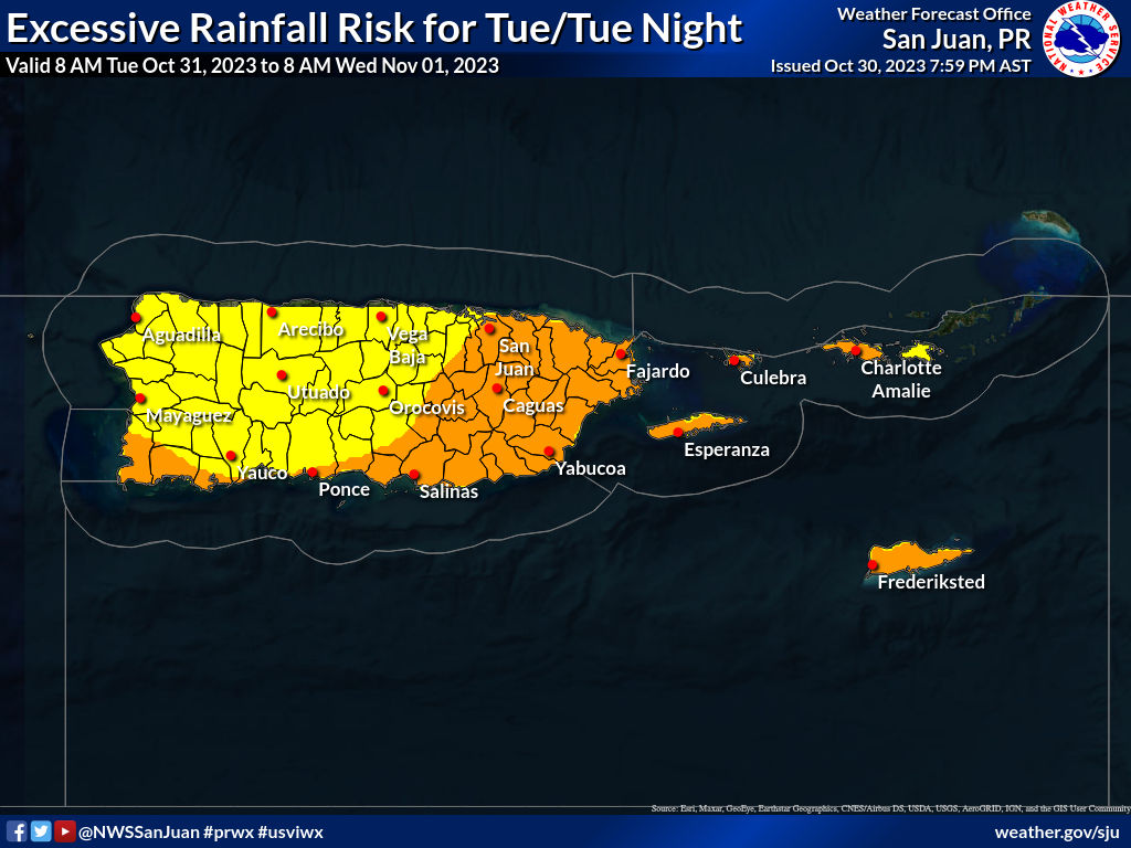
“The weather conditions will still be favorable for localized urban and flash flooding and therefore ‘flash flood’ warnings will remain likely for some areas at least through Tuesday,” the NWS noted. A drier air mass is forecast to arrive during the second half of the week and into next weekend.
Marine conditions, which have been hazardous, will also continue to improve. In the meantime, the NWS encourages swimmers and boaters to remain vigilant as choppy seas and the potential for strong rip currents continue to impact the islands for the next few days.
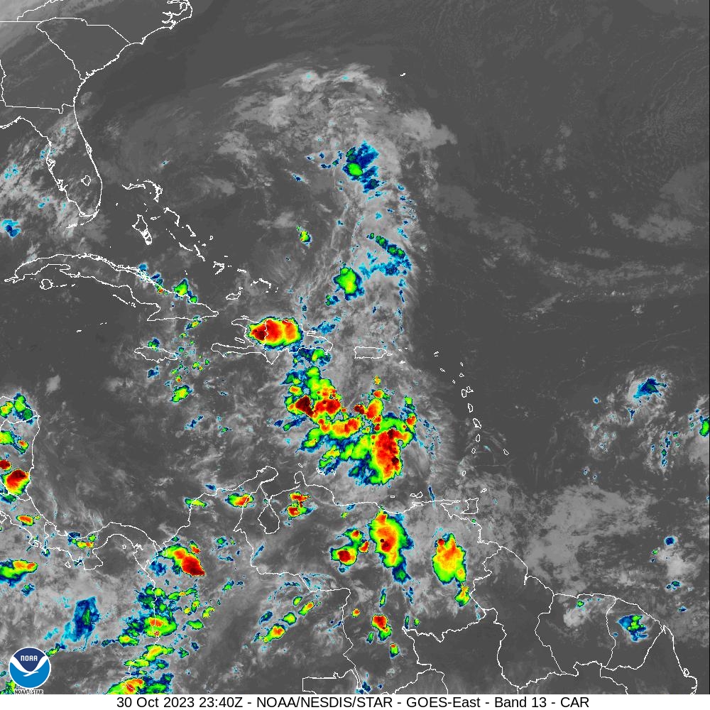
Abundant Tropical Moisture Across the Caribbean
The current weather pattern, along with an abundance of tropical moisture across the Caribbean, has resulted in the recent rainfall in the USVI and P.R.
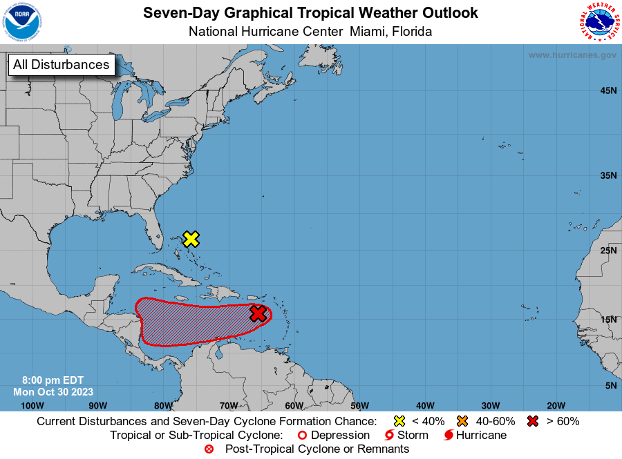
The National Hurricane Center has been monitoring a couple of areas for potential tropical cyclone development, including “Invest 96L,” located to the north of the Caribbean, and another disturbance, currently dubbed “Disturbance #1,” located to the southwest of the local islands. While direct impacts from the systems are not expected, the weather features will continue to influence the forecast. And if either system strengthens into a tropical storm, with maximum sustained winds of at least 39 mph, it will acquire the name “Vince,” the next cyclone name of this year’s busy hurricane season.
The 2023 Atlantic Hurricane Season will officially end in one month, on Nov. 30. Visitors and residents in the USVI and Puerto Rico are advised to stay updated regarding the latest weather alerts from the Virgin Islands Territorial Emergency Management Agency website and the National Weather Service.
Additionally, the weather forecast is published at least once per day on the Source Weather Page.