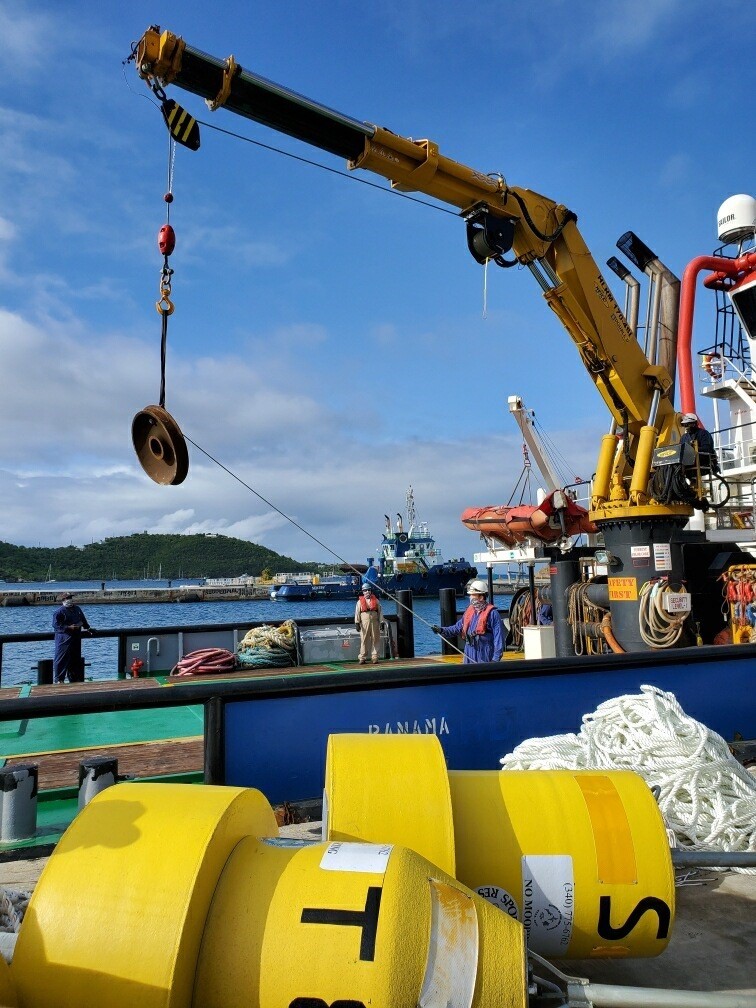
The V.I. Department of Planning and Natural Resources deployed new fish aggregating devices (FAD) in the St. Thomas-St. John District on Thursday, Aug. 27 and in the St. Croix District on Friday, Aug. 28, according to Commissioner Jean-Pierre L. Oriol. Deployment of the FADs benefits the U.S. Virgin Islands by shifting fishing pressure from heavily fished inshore areas to offshore areas with more abundant populations of pelagic sportfish species such as tuna, dolphin and wahoo.
The FAD program will also provide enhanced and improved fishing opportunities to recreational anglers in the U.S.V.I. The FADs were constructed with federal U.S. Fish and Wildlife Service Sportfish Restoration program funding. They were generously deployed by Limetree Bay Terminals LLC, staged by Virgin Islands Port Authority and transported by Franklin Benjamin.
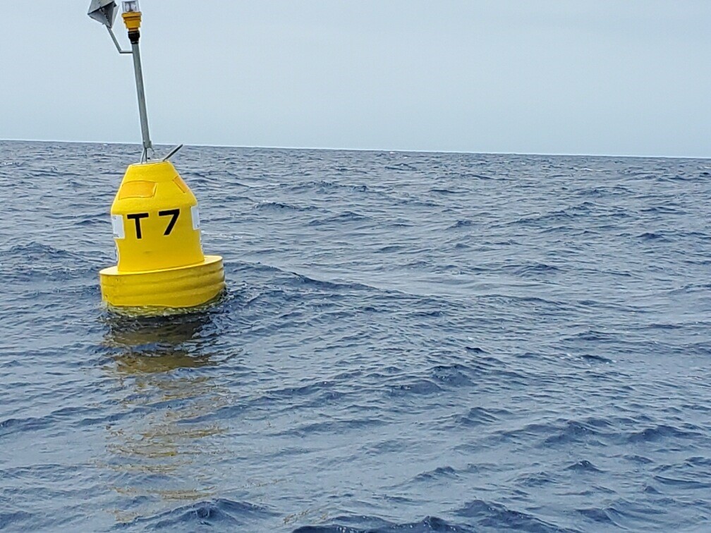
FAD T7 was deployed north of St. Thomas, approximately 15 miles north of Cricket Rock.
FAD T8 was deployed north of St. Thomas, approximately 16 miles north of Outer Brass.
FAD S was deployed west of St. Croix, approximately 8 miles west of Ham’s Bluff.
All FADs deployed are a yellow surface buoy that contains a radar reflector and flashing light to facilitate navigation. Commissioner Oriol reminds boaters that mooring vessels to the FADs is not permitted as it weakens the buoy components and can cause the FADs to break away.
The GPS coordinates are as follows:
FAD # — Latitude ——Longitude —- (Reference)
T7 —18° 38.158’ N — 65° 03.562’ W — 15 miles north of Cricket Rock, St. Thomas
T8 — 18° 38.252’ N — 64° 58.614’ W — 16 miles north of Outer Brass, St. Thomas
X22 (S) — 17° 46.966’ N — 65° 01.302’ W — 8 mi west of Ham’s Bluff, St. Croix
For locations of existing FADs or for more information, contact DPNR at 773-1082 or at https://dpnr.vi.gov/fish-and-wildlife/fish/.