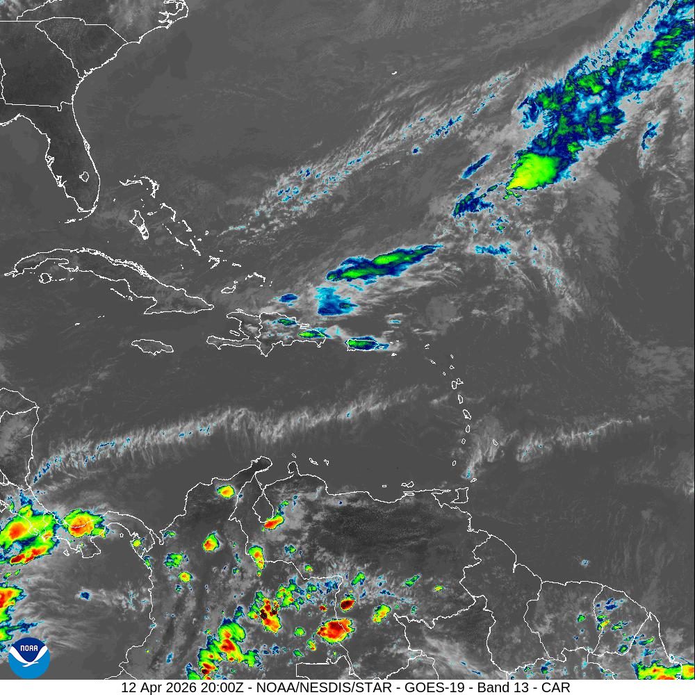
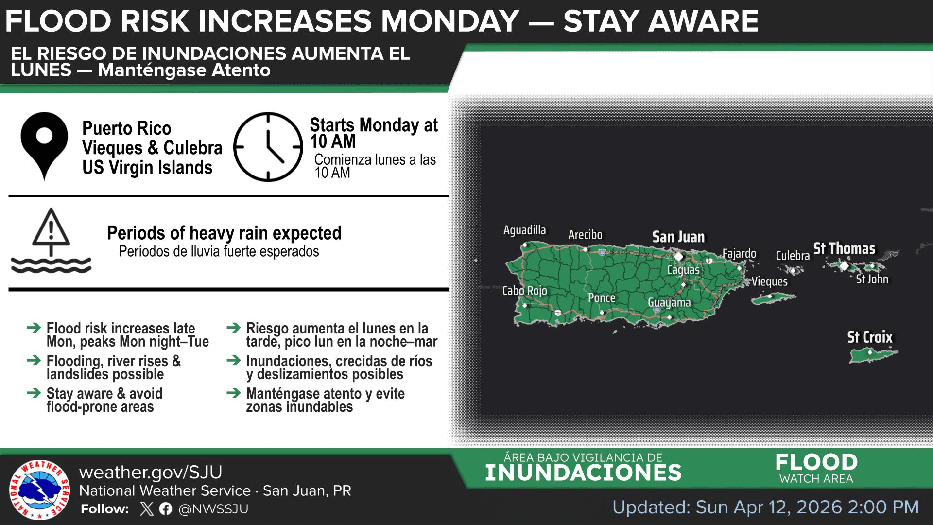
The National Weather Service in San Juan, Puerto Rico, has issued a Flood Watch for the U.S. Virgin Islands and Puerto Rico. Forecasters warn of periods of heavy rainfall, with the greatest impacts expected Monday night into Tuesday.
Flood Watch and Rainfall Threat
The NWS has reported that the Flood Watch will be in effect from 10 a.m. Monday through 8 a.m. Wednesday as inclement weather affects the islands. Meteorologists said that the unsettled conditions are likely to generate thunderstorms with lightning.
“A wetter and more unstable pattern will develop across Puerto Rico and the U.S. Virgin Islands beginning late Monday into Tuesday as a mid- to upper-level trough of low-pressure approaches,” according to the NWS. “This will support more widespread showers and thunderstorms, with the greatest impacts expected Monday afternoon into early Wednesday morning,” the NWS said.
The NWS warned that prolonged periods of potentially heavy precipitation could lead to dangerous conditions, including flooding and landslides.
“Impacts from this weather event may include urban and small stream flooding, isolated flash flooding, rapid river rises, and landslides, and saturated soils will enhance runoff,” the NWS stated. “Rainfall of one to three inches per day, with locally higher amounts, is expected. The highest risk is Monday afternoon through Tuesday, though the exact placement of impacts remains uncertain,” the NWS added.
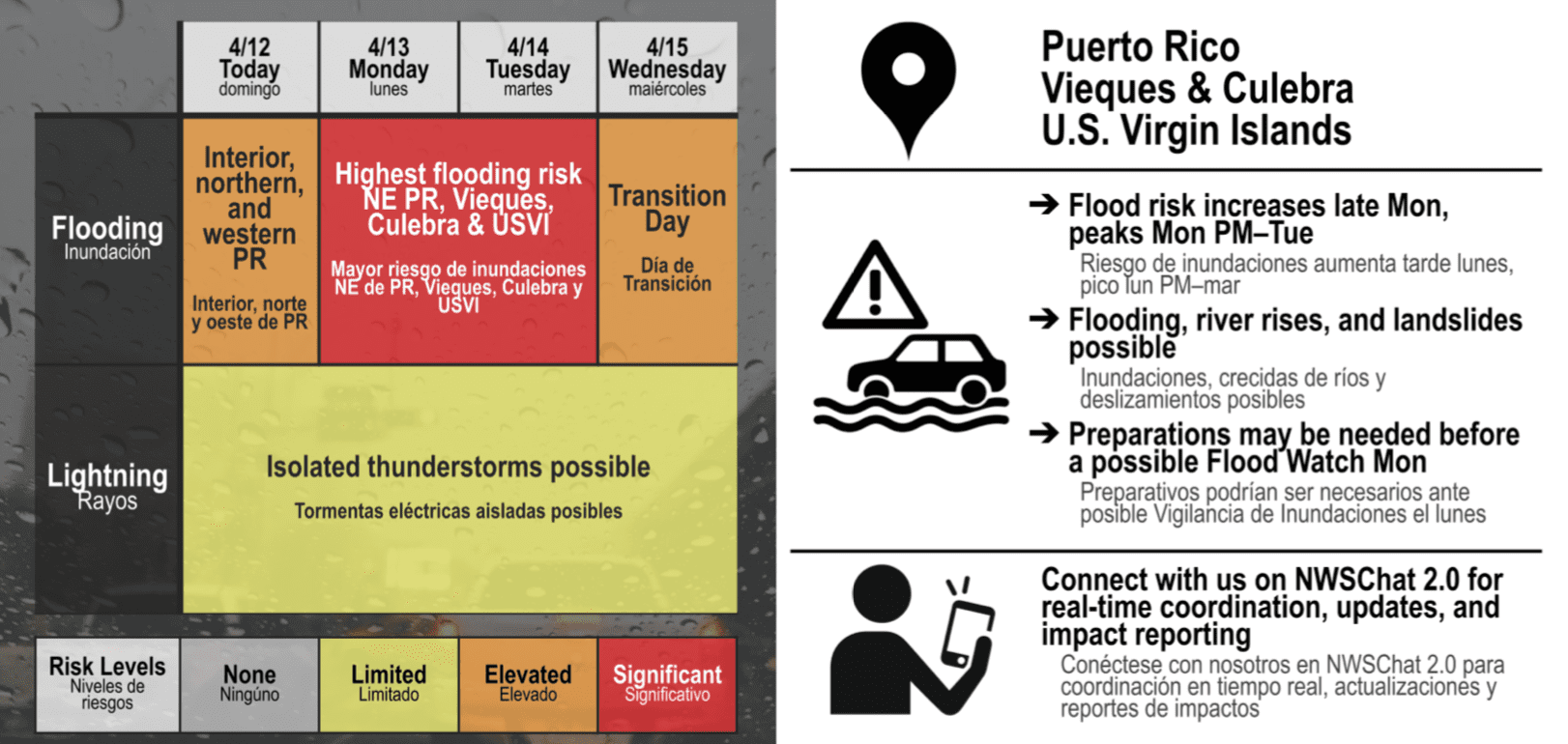
Even after the current Flood Watch expires Wednesday morning, unsettled conditions may continue through the latter part of the week. The NWS said abundant moisture and the lingering influence of the trough could keep a limited to elevated flooding threat in place through at least next Saturday, with moderate to locally heavy showers and isolated thunderstorms still possible across Puerto Rico and the USVI.
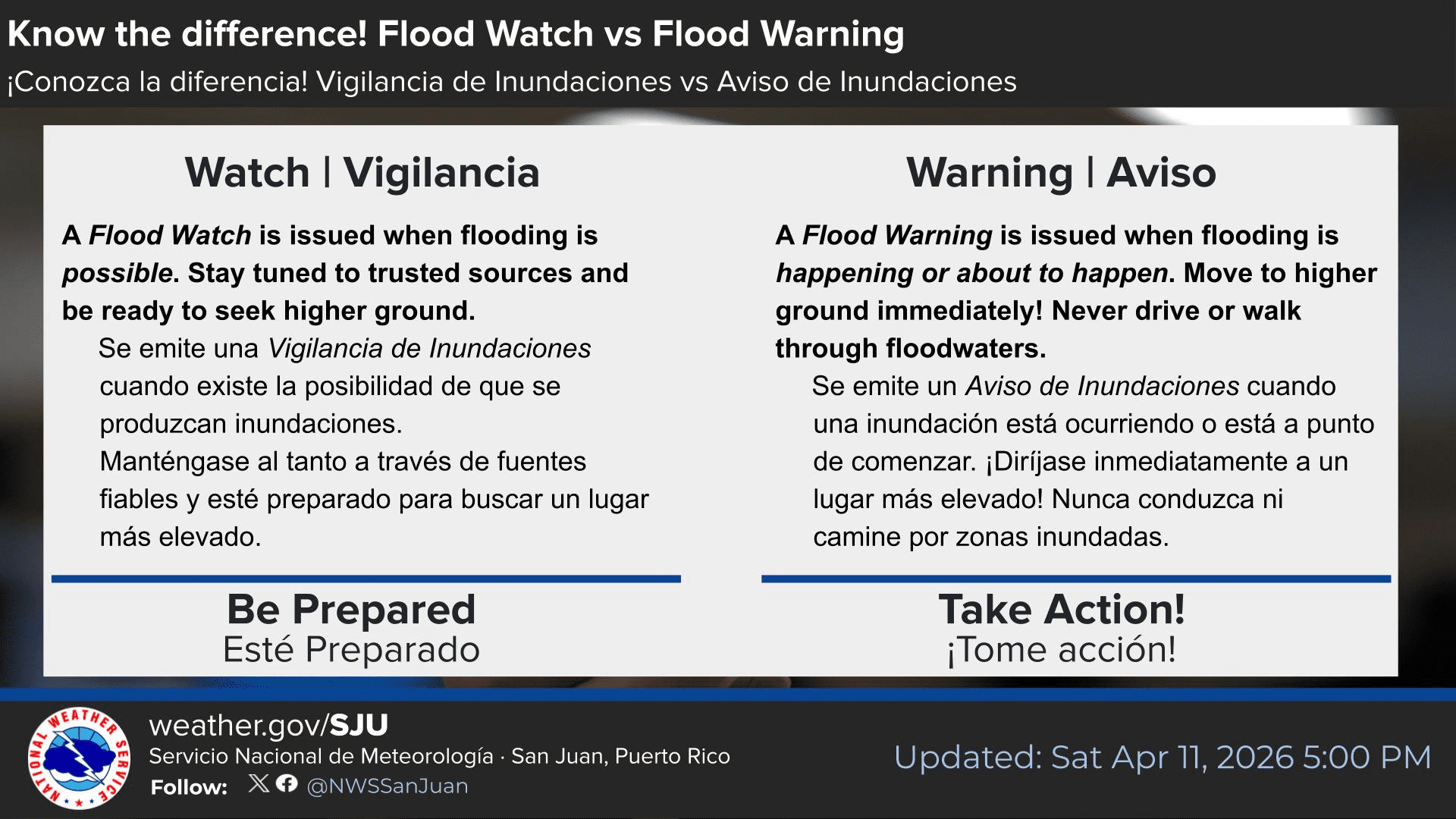
“Residents and visitors are urged to remain alert to changing weather conditions and to avoid flooded roadways,” the NWS advised.
Marine Conditions
Hazardous marine and coastal conditions are also expected to persist. The NWS said pulses of a northerly swell will continue to arrive, and increasing showers, gusty winds, and thunderstorms from Monday through Wednesday could also create locally hazardous marine conditions.
“Small Craft Advisory conditions are expected across the Atlantic waters as seas build up to seven feet through midweek,” the NWS reported.
Additionally, the risk of rip currents will remain elevated, with further deteriorating seas expected later in the week.
“A moderate risk of rip currents is expected to develop across northern exposed beaches by Tuesday, with conditions becoming more hazardous again by the end of the workweek,” the NWS said. “Beachgoers and inexperienced surfers should avoid entering the water, especially near jetties, as life-threatening rip currents remain possible. Heed the advice of lifeguards, beach patrol flags, and posted signs. Access to hazardous beaches may be limited, and individuals should follow all posted warnings and safety guidance.”
Local Weather Updates
Information regarding the weather across the USVI, including marine forecasts, is available from the NWS and NOAA. Additionally, the local forecast is regularly updated on the Source Weather Page, where a weekly video forecast is available.
Finally, weather hazards can occur year-round, and it is crucial to be prepared. Residents and visitors can view weather alerts and disaster preparedness information from the Virgin Islands Territorial Emergency Management Agency.