The National Weather Service in San Juan, Puerto Rico, continues to monitor a tropical system that is forecast to track northeast of the region in the coming days, and any potential impacts it may have on local conditions.
“There is substantial uncertainty, and an increase in shower and thunderstorm activity cannot be ruled out,” the NWS San Juan said in its hazardous weather outlook Monday morning.
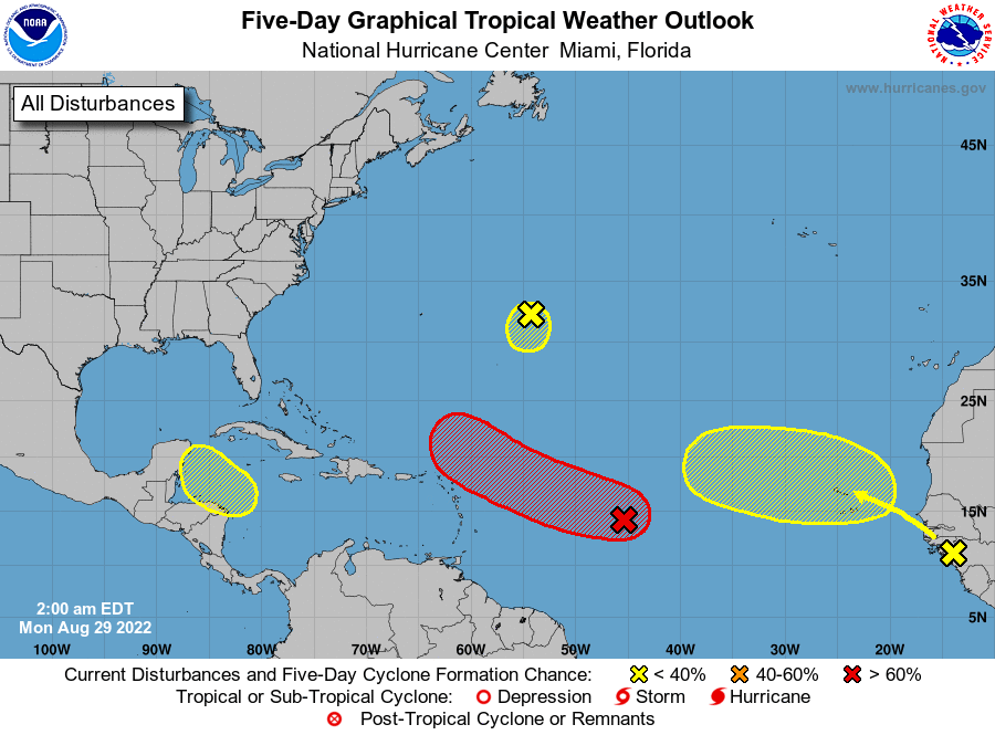
Invest 91L, as the disturbance is currently named, has an 80 percent chance of cyclone formation in the next five days, according to the National Hurricane Center.
The broad area of low pressure was located over the central tropical Atlantic early Monday and is producing a large area of disorganized cloudiness and showers, according to the center.
“Although environmental conditions ahead of the system are currently only marginally favorable, some gradual development of this system is expected over the next several days and a tropical depression is likely to form later this week,” the NHC said in its 2 a.m. update.
“The disturbance is forecast to move slowly toward the west and then west-northwest at 5 to 10 mph, toward the waters east and northeast of the Leeward Islands,” it said.
The center also is monitoring three other systems as the region enters the peak of hurricane season, including a disturbance about 600 miles east of Bermuda that currently is of no consequence to land, and another that is expected to move off the coast of Africa later Monday.
Some gradual development of the system is possible after that time while it moves generally westward across the far eastern tropical Atlantic, according to the center.
In the northwestern Caribbean, a trough of low pressure could develop during the middle part of this week and move generally west-northwestward toward the Yucatan Peninsula of Mexico.