
The National Weather Service in San Juan, Puerto Rico, expects a windy weather pattern to continue across the region over the coming days, along with passing showers. Additionally, seas will remain hazardous due to ocean swells and breezy conditions, and marine alerts are in effect.
Breezy Conditions Across the Islands
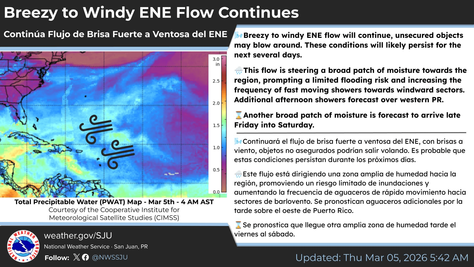
The NWS explained in an update on Thursday that persistent high pressure over the central Atlantic is helping to generate gusty east-to-east-northeast winds across the area.
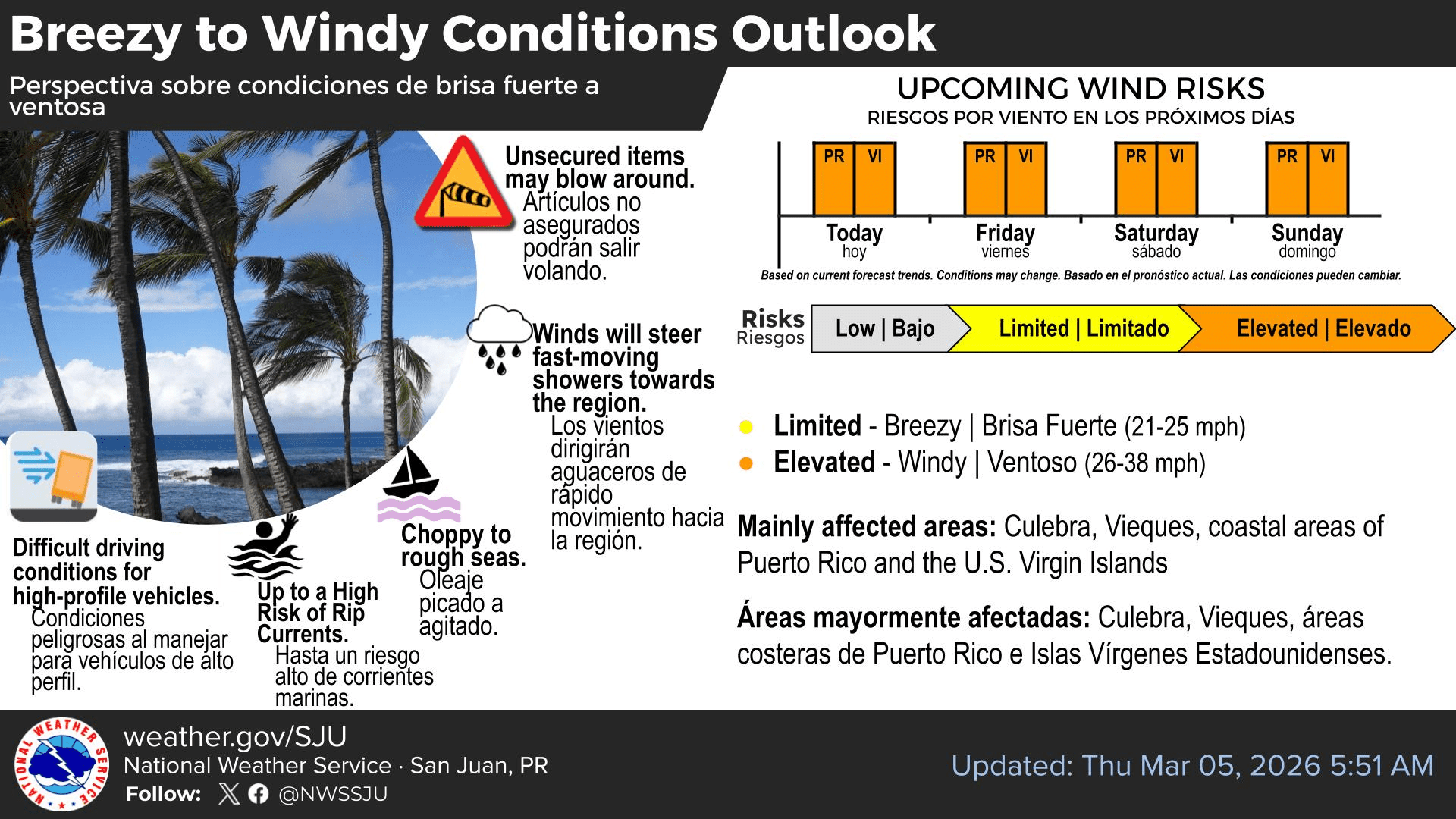
“Breezy to windy conditions will continue, particularly across coastal areas of the islands, and unsecured outdoor objects may blow around. These conditions will likely persist for the next several days,” the NWS said.
The NWS local forecast for the USVI calls for wind speeds of between 15 and 25 knots, approximately 17 and 29 mph, with higher gusts through at least early next week.
“Patches of both more humid and drier air will continue to be steered towards the islands under the breezy to windy east-northeast flow, along with low concentrations of Saharan dust,” the NWS noted.
Marine Alerts in Effect
In addition to the windy weather, marine conditions around Puerto Rico and the USVI will be dangerous for boaters and swimmers. The NWS noted that choppy seas are being generated by strong winds, combined with energy from a northeast wind swell, and several marine alerts are in effect for portions of both U.S. territories.
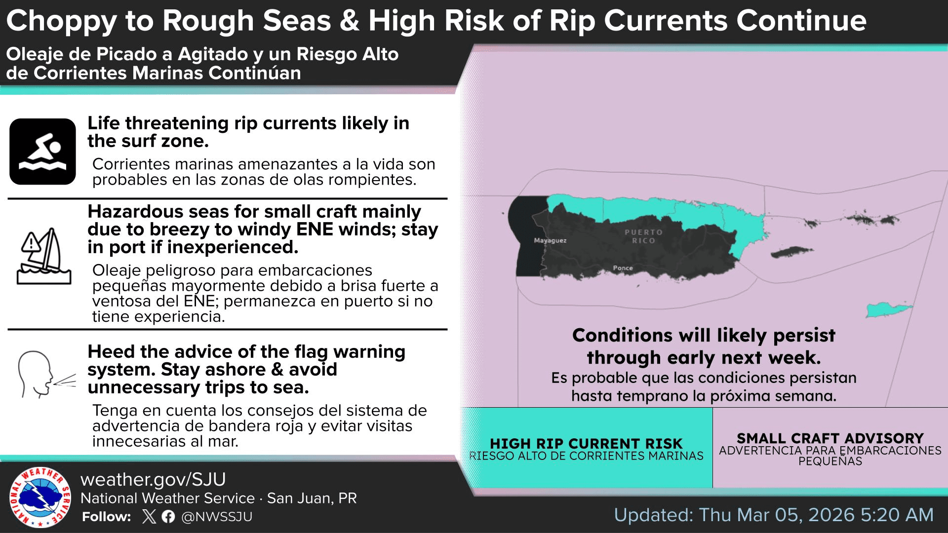
Small Craft Advisories are in effect through at least Sunday afternoon for areas of the local waters. High Rip Current Statements are also in effect through at least Sunday, with the possibility of marine alerts being extended into next week.
“Inexperienced mariners, especially those operating smaller vessels, should avoid navigating in hazardous conditions, and beachgoers should continue to exercise caution,” the NWS advised.
Detailed rip current safety information is available on the National Oceanic and Atmospheric Administration website, as well as in a previous Source article regarding rip currents.
Precipitation Chances
While heavy rainfall is not expected to be a major concern in the coming days, the NWS notes that showers may occur and could bring brief downpours along with minor ponding in poor drainage spots.
“The east-northeast wind flow will continue to steer broad patches of moisture toward the region at times during the forecast period, increasing fast-moving shower frequency,” the NWS reported.
Still, as of Thursday, the risk of flooding is expected to be minimal.
“Periods of moderate rainfall with passing showers could lead to brief ponding of water in poor drainage areas, but the overall flooding risk remains low,” the NWS said.
Local Weather Updates
As the Source reported in a recent interview with the NWS, weather hazards can occur year-round. Information regarding the weather across the USVI, including marine forecasts, is available from the NWS and NOAA.
Additionally, the local forecast is regularly updated on the Source Weather Page, where a weekly video forecast is available.
Residents and visitors can also view weather alerts and disaster preparedness information from the Virgin Islands Territorial Emergency Management Agency.