The National Weather Service in San Juan, Puerto Rico, has issued multiple marine weather alerts that will be in effect for most of this week as strong swells will continue to impact the area.
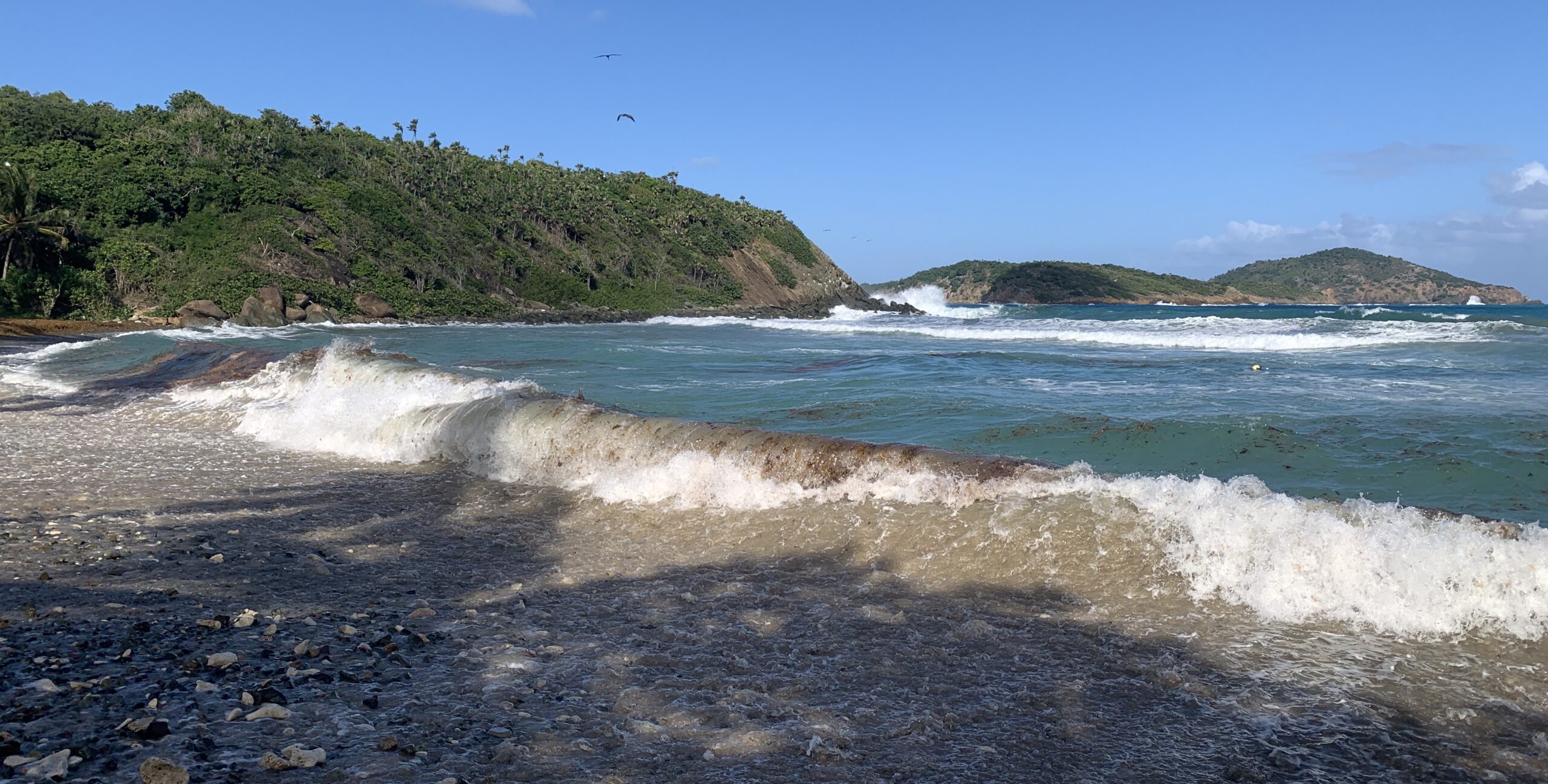
“It cannot be overly emphasized that beach conditions on all beaches with north and northeast exposures will have unsafe conditions due to rip currents and high surf, and these beaches will, with few exceptions, continue to have hazardous conditions through the latter part of this week,” an update from the NWS on Sunday explained.
According to the NWS, waves could reach up to 11 feet, and there is a possibility of coastal flooding and beach erosion.
A “High Surf Advisory” has been issued for areas of northern Puerto Rico and the northern USVI. This alert will be in effect until at least 6 p.m. AST on Friday.
A “Small Craft Advisory” will be in effect for portions of the local waters around the USVI and Puerto Rico until at least 8 a.m. AST on Friday. Additionally, a “High Rip Current Risk” will be in effect through at least 6 p.m. AST on Friday.
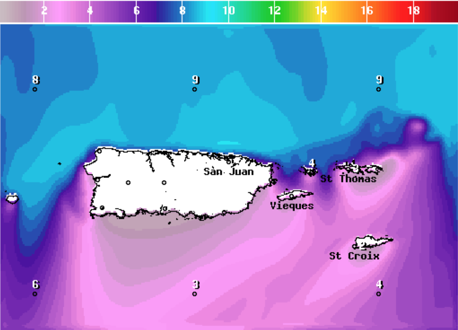
The USVI and parts of Puerto Rico have been affected by northerly and northeasterly swells throughout the past week. A major storm system in the central Atlantic contributed to rough seas last week, and the system had been monitored for tropical or subtropical development. However, the storm has since moved into the north Atlantic and cooler waters near the Azores islands, and it will not acquire tropical or subtropical characteristics.
Local weather updates will be posted to the Source Weather Page as they become available.