The National Hurricane Center (NHC) is closely watching a tropical wave as it travels across the Atlantic.
The disturbance, currently designated “Invest 92L,” is currently moving westward toward the Caribbean and showing signs of tropical development. (An “invest” is an area under investigation by the National Weather Service.)
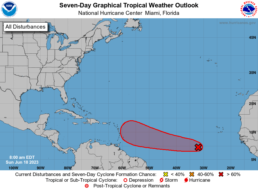
As of Sunday morning, “Invest 92L” has a high chance of strengthening over the next several days. However, at this time, computer forecasting models are not in agreement about the direction of where the system may go. There is a chance that the disturbance may continue moving in a westerly direction toward the Caribbean islands, or it may take a turn toward the north-northeast.
“The latest guidance from the global [forecast] models disagree with their solutions for the tropical wave tracked by the Hurricane Center, now more defined, and with a 90 percent of formation chance in the next seven days,” according to an update from the National Weather Service on Sunday.
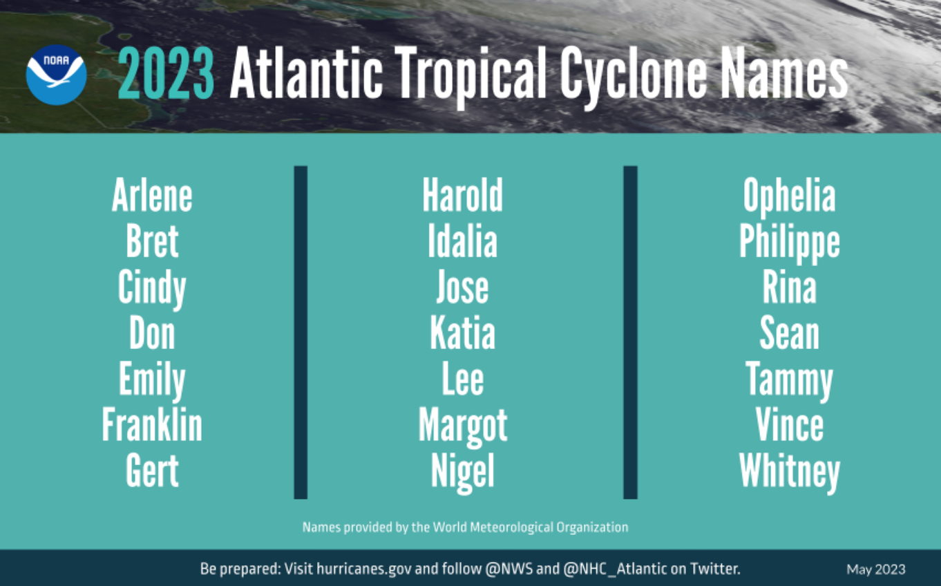
If this storm strengthens into tropical storm status (with maximum sustained winds of at least 39 mph), it will be named “Bret,” the second named storm of the 2023 Atlantic Hurricane Season.
Regardless of this tropical wave’s exact track or intensity, it is vital to be prepared in the event of a cyclone. Click here to read a detailed list from the National Weather Service about hurricane preparedness.
USVI visitors and residents can find information about emergency shelters and alerts from the Virgin Islands Territorial Emergency Management Agency. Additionally, weather alerts from the National Hurricane Center will constantly be updated on the Source Weather Page.