The National Hurricane Center will resume daily Tropical Weather Outlooks Thursday, before the official June 1 start of the 2025 Atlantic Hurricane Season. USVI residents are encouraged to monitor the updates for any signs of tropical development.
While the NHC monitors the tropics throughout the year, regular updates are issued daily between May and November. The Source contacted the National Oceanic and Atmospheric Administration and was provided with details about the tropical outlooks from Larry Kelly, NHC Hurricane Specialist.
“The NHC constantly provides a close eye on the tropics across the Atlantic Basin and Eastern North Pacific Basin year-round. However, tropical weather outlooks are only routinely issued from May 15 until November 30,” Kelly said. “Still, if a disturbance has the possibility of tropical development outside of that period, a Special Tropical Weather Outlook will be issued.”
Seven-Day Outlooks and 48-Hour Forecasts
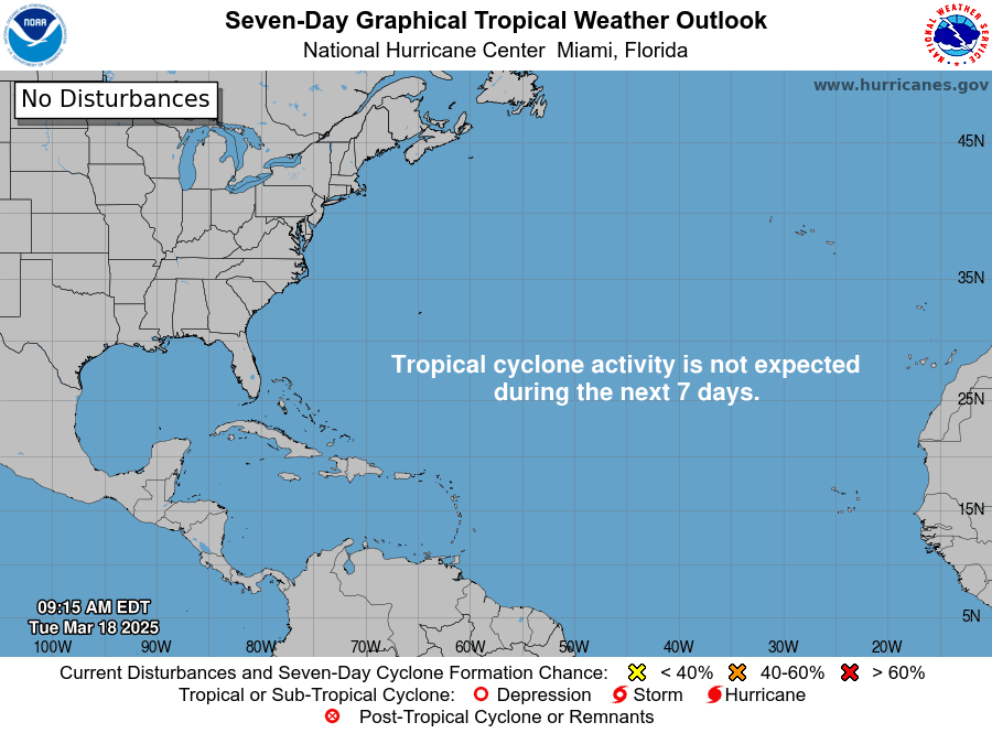
Starting Thursday, the NHC daily outlooks will allow individuals to view a two-day tropical weather forecast and a seven-day forecast.
“The Tropical Weather Outlook discusses significant areas of disturbed weather and their potential for development during the next seven days, including a categorical forecast of the probability of tropical cyclone formation during the first 48 hours and during the entire seven-day forecast period,” Kelly explained.
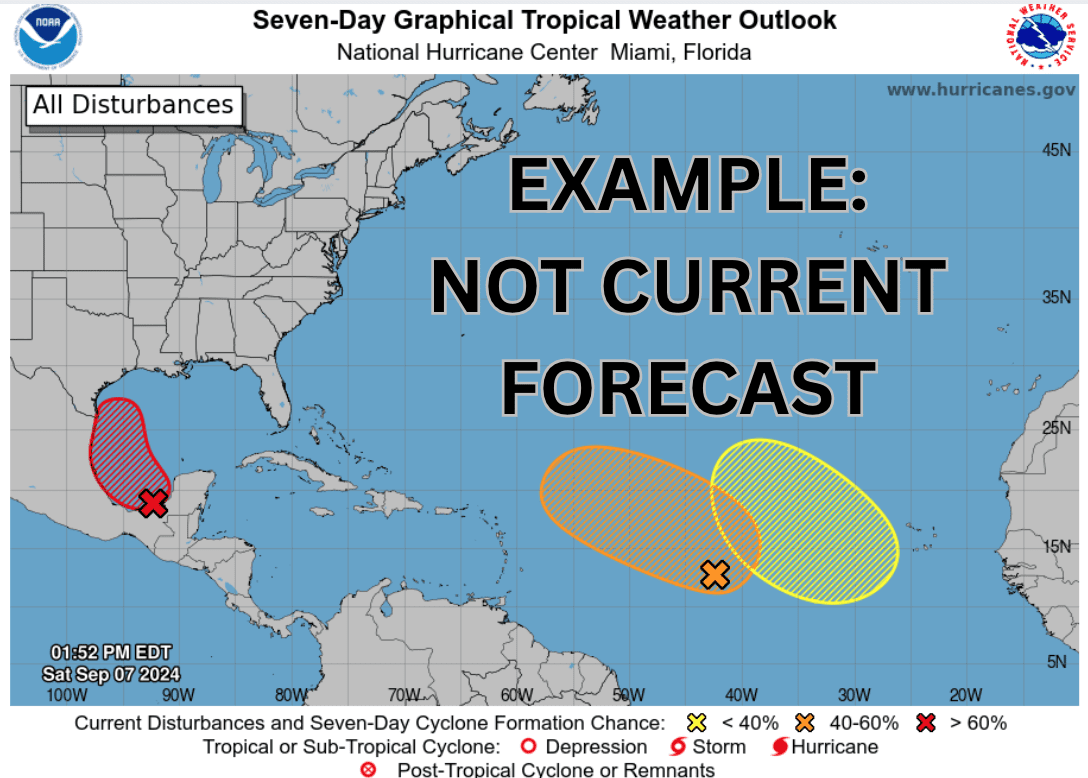
To help the public better understand the NHC Tropical Weather Outlook, Kelly described how the graphics and probabilities are presented, including how cyclonic development is categorized and what the shaded areas on the map represent.
“The 48-hour and seven-day probabilities of formation for each disturbance are forecast to the nearest 10 percent and expressed in terms of one of the following categories: low probability of development zero to 30 percent and depicted in yellow, medium probability of development 40 to 60 percent and depicted in orange, and a high probability of development 70 to 100 percent and depicted in red,” Kelly stated.
“The marked areas on the graphics will represent the potential formation area during the forecast period, and it is important to note that it is not a forecast track, it is only the expected cyclonic formation area,” Kelly said. “The outlook also includes a general description of locations of any active cyclones and the corresponding World Meteorological Organization and Advanced Weather Interactive Processing System information during the first 24 hours of a cyclone’s existence.”
“The daily tropical weather outlooks are issued every six hours for the Atlantic Basin and for the Eastern North Pacific Basin, at 00:00, 06:00, 12:00, and 18:00 Coordinated Universal Time,” he added.
The Significance of NHC Outlook Maps
Kelly reminded readers why it is crucial to monitor the tropical weather updates and how the outlooks can help individuals prepare for severe weather.
“The tropical outlook forecasts highlight the location, movement, and development potential of these systems over the next two to seven days,” Kelly asserted. “This information is important for early preparation and awareness during hurricane season so you can be prepared for the hazards that systems can bring, including storm surge, flooding, strong winds, tornadoes, and hazardous marine and beach conditions,” he said.
Kelly concluded his remarks by recommending that individuals prepare for hurricane season now, ahead of the official start of the season on June 1.
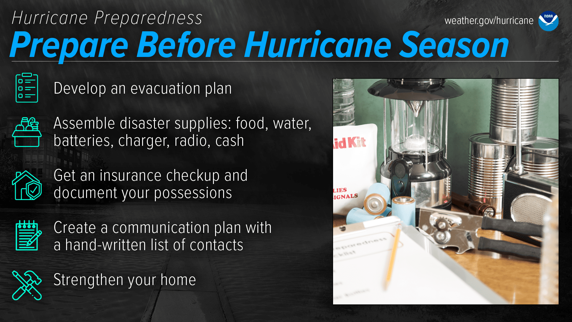
“Now is the time to prepare before the season begins,” Kelly urged. “Be ready for hurricane season and take action today to be better prepared for when the worst happens.”
“Understand your risk from hurricanes and begin preseason preparations now,” Kelly emphasized. “Ensure you have multiple ways of receiving forecasts and alerts, and know what to do before, during, and after a storm. Stay informed throughout the season at hurricanes.gov and follow the NHC on Facebook, YouTube, and on X (formerly known as Twitter),” he recommended.
Staying Informed About Weather Events
The Atlantic Hurricane Season begins on June 1 and lasts until Nov. 30. USVI residents and visitors are encouraged to be prepared, particularly with uncertainty surrounding federal cuts to weather service operations and the Federal Emergency Management Agency.
In addition to obtaining weather information from the NWS and NOAA, the local weather forecast for the U.S. Virgin Islands is regularly updated on the Source Weather Page and VI Source YouTube Channel. Individuals can also find helpful weather information and alerts from the Virgin Islands Territorial Emergency Management Agency.