The National Oceanic and Atmospheric Administration is forecasting a below-normal 2026 Atlantic hurricane season, citing the likely development of El Niño, which can help to suppress tropical activity across the Atlantic basin. Still, officials warned that residents should not let a potentially quieter seasonal outlook change how they prepare.
NOAA Releases 2026 Outlook
NOAA announced its 2026 Atlantic hurricane season outlook Thursday morning during a news conference held at NOAA’s Aircraft Operations Center in Lakeland, Florida, home to the agency’s Hurricane Hunter aircraft. The Source attended the briefing virtually, which included officials from agencies such as NOAA, the National Weather Service and the Federal Emergency Management Agency.
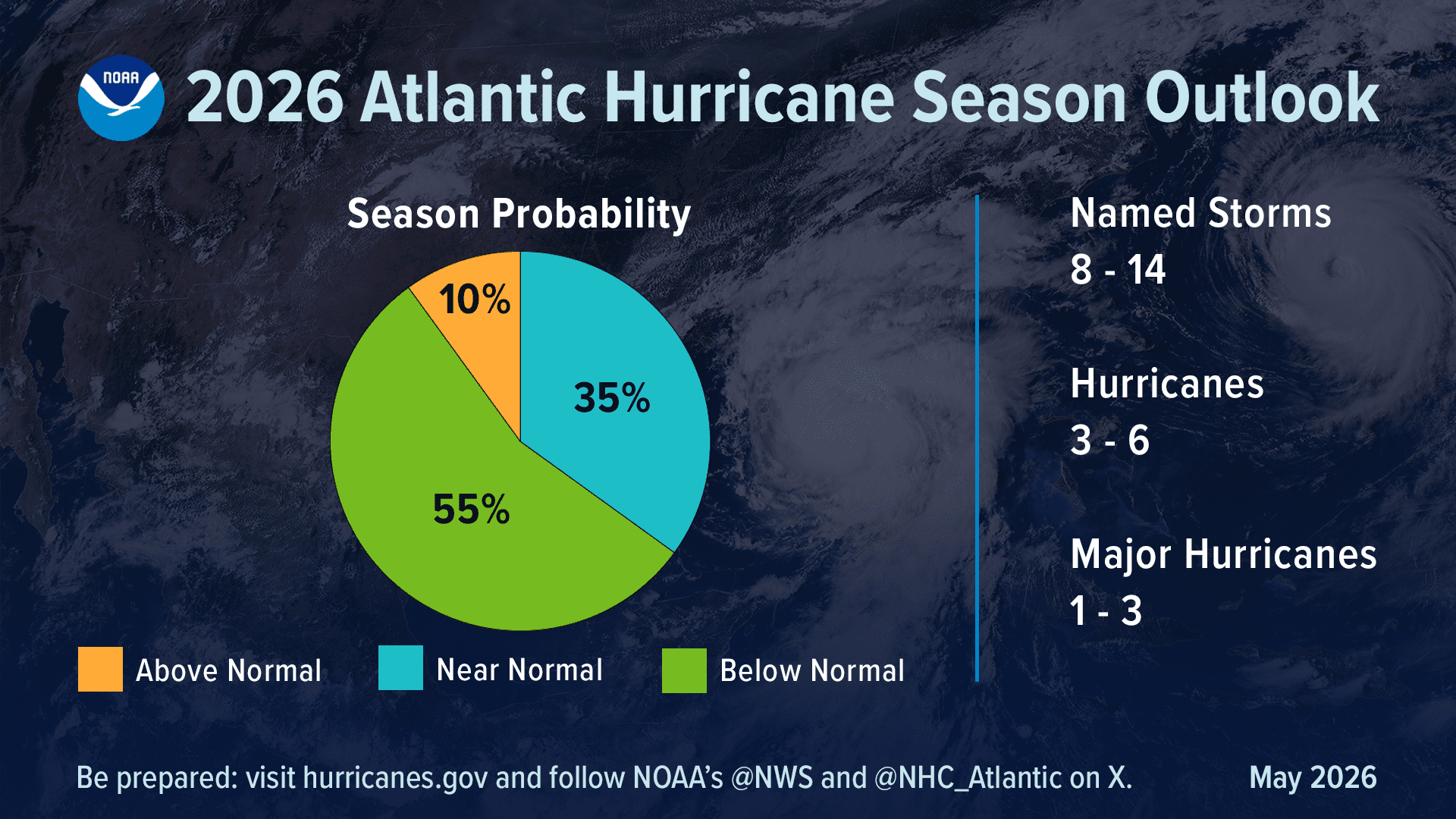
“NOAA’s outlook for the 2026 Atlantic hurricane season, which runs June 1 to Nov. 30, predicts a 35% chance of a near-normal season, a 10% chance of an above-normal season, and a 55% chance of a below-normal season,” according to a press release from NOAA on Thursday.
“The agency is forecasting a total of 8-14 named storms, with winds of 39 mph or higher,” the press release said. “Of those, 3-6 are forecast to become hurricanes with winds of 74 mph or higher, including 1-3 major hurricanes category 3, 4 or 5 with winds of 111 mph or higher. NOAA has a 70% confidence in these ranges,” NOAA reported.
“An average season has 14 named storms with seven hurricanes, including three major hurricanes,” the release added.
Under Secretary of Commerce for Oceans and Atmosphere and NOAA Administrator Neil Jacobs, Ph.D., spoke at the event and noted the importance of hurricane season preparation, even during a potentially less-active year.
“Even though we’re expecting a below-average season in the Atlantic, it’s very important to understand that it only takes one storm,” said Jacobs. “We have had Category 5 hurricanes make landfall in the past during below-average seasons,” he warned.
Notably, Jacobs added that the eastern and central Pacific hurricane seasons are anticipated to be above normal in terms of tropical activity.
El Niño Expected to Limit Atlantic Cyclones
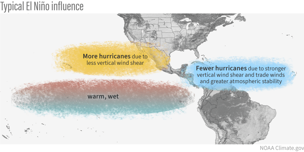
NOAA officials said a developing El Niño pattern is one of the primary factors behind the below-normal Atlantic forecast. During the briefing, Jacobs said there is a 98% chance of El Niño conditions occurring later this season and an 80% chance that the El Niño will become moderate to strong.
According to the National Oceanic and Atmospheric Administration, “Scientists call the two opposing climate patterns of El Niño and La Niña the ‛El Niño-Southern Oscillation’ (ENSO) cycle. El Niño and La Niña can both have global impacts on weather, wildfires, ecosystems, and economies.” An ENSO-neutral phase typically occurs between phases of a La Niña or an El Niño event.
El Niño, which involves a warming of the equatorial Pacific Ocean, usually helps to increase wind shear — a change in wind direction and velocity with height in the atmosphere. In the Atlantic Ocean, the increase in wind shear from El Niño helps to rip apart storms and prevent hurricane formation and intensification. This is the opposite of a La Niña cycle, when the ocean waters across the equatorial Pacific cool significantly. During La Niña, wind shear typically decreases in the Atlantic, and a reduction in wind shear can favor cyclone development.
Officials Urge Early Preparation
Despite the below-normal Atlantic outlook, nothing with the weather is guaranteed. Ken Graham, director of the NWS, repeatedly stressed that seasonal predictions should not be treated as a reason to delay preparations.
“Don’t let words like ‘below-average’ change the way you’re prepared,” Graham said. “The actions that you take today get you ready for the hurricane season.”
Graham also warned that rapidly intensifying storms can leave residents with far less time than they might expect. He noted that some of the strongest landfalling U.S. hurricanes were tropical storms only days before impact, underscoring the importance of preparing before a storm is approaching.
“There’s no such thing as ‘just’ a Tropical Storm, ‘just’ a Category 1, or ‘just’ a Cat 2,” Graham said, noting that residents should focus on a storm’s impacts, including flooding, storm surge, tornadoes, damaging winds, high surf and rip currents, rather than only its category.
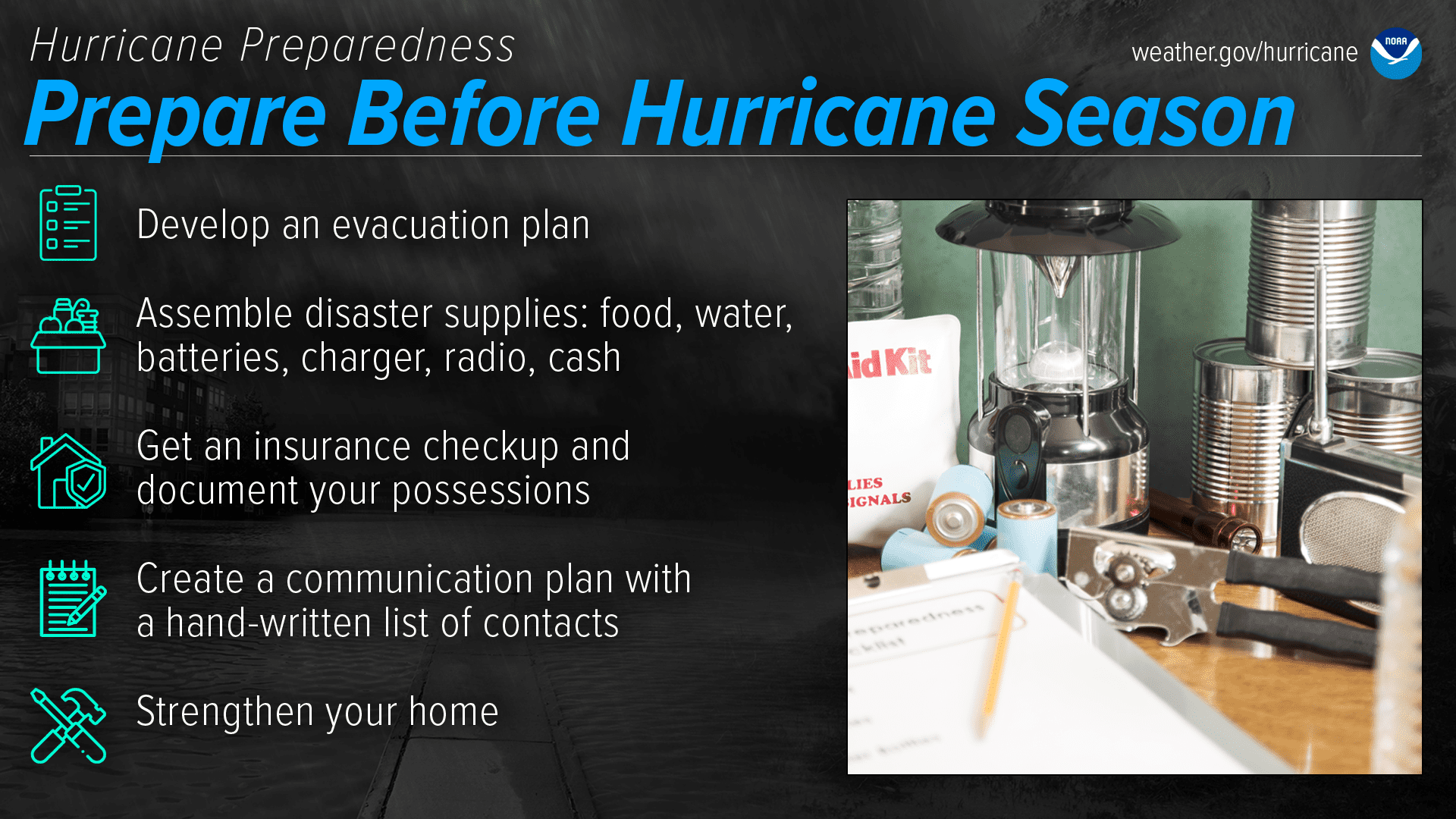
He encouraged the public to stock up before a storm threatens, noting that now is the time to purchase nonperishable food, water, medicine, batteries and other supplies.
Graham also emphasized that access to medication, dialysis and other medical needs may be disrupted for a week or longer after a storm. He urged residents to prepare for extended power outages, include pets in emergency plans, and check on family members and neighbors who may need assistance.
New Forecasting Tools and Hurricane Technology
The briefing also highlighted technology NOAA uses to forecast tropical systems, including Hurricane Hunter aircraft, satellites, new forecasting products and tools, including artificial intelligence-based forecast models, and unmanned drones and ocean gliders.
Additionally, as the Source previously reported, the NHC is updating its forecast cone graphics this year.
“In 2026, the forecast cone will now include tropical storm and hurricane watches and warnings for inland areas. The additional information follows a successful experimental phase last year, which demonstrated that the improved forecast cone enabled inland communities to better understand and prepare for the danger posed by tropical cyclone winds,” according to NOAA.
NOAA explained that the new operational cone will now include all land-based tropical storm and hurricane watches and warnings in effect for the continental United States, Hawaii, Puerto Rico, and the U.S. Virgin Islands. The updated graphic will also use one shade for the full five-day cone and include a legend symbol for places where a hurricane watch and tropical storm warning are both in effect.
Dangers Continue After a Storm
FEMA officials also stressed that residents should listen to local authorities before, during, and after a storm. Disaster response begins locally, officials said, and residents should heed guidance from emergency managers in their own communities, including the Virgin Islands Territorial Emergency Management Agency.
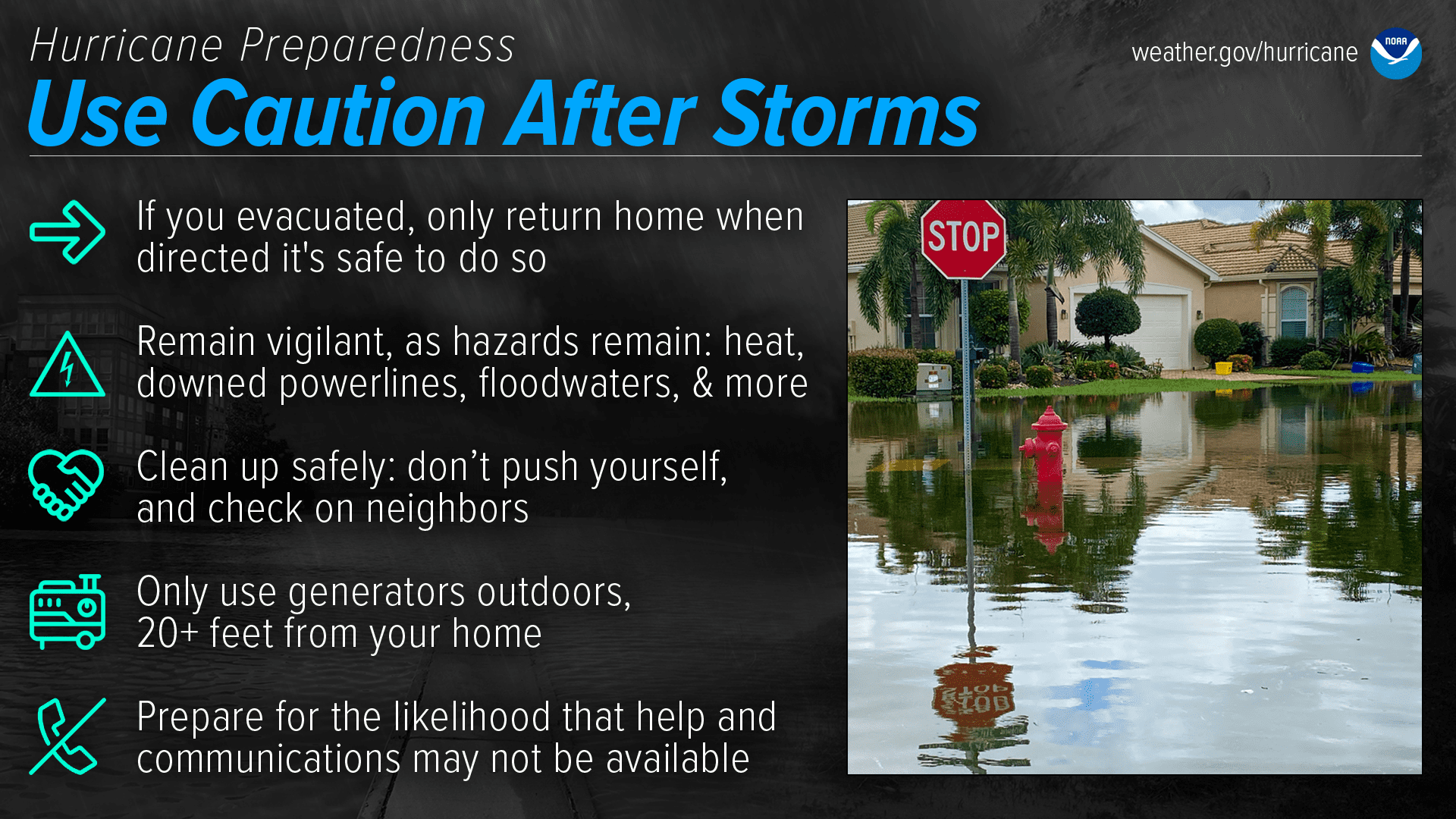
Officials cautioned that the danger does not end once a storm passes. Downed power lines, contaminated water, gas leaks, displaced wildlife, unsafe roads, chain saw injuries, and improper generator use can all create serious risks after a tropical system.
Graham specifically warned about generator safety, urging residents to operate generators outdoors and away from windows to prevent carbon monoxide poisoning.
FEMA officials also encouraged residents to think beyond their own households by checking on elderly relatives, neighbors and others in the community who may need assistance.
Tropical Weather Updates
Although the Atlantic remains quiet for now, there are some subtle hints of possible early-season tropical activity to monitor near the southeastern U.S. coast. A FOX Weather article reported that meteorologists are watching for possible tropical activity during the first two weeks of June, though forecasters stressed that it remains uncertain whether anything will form. If development does occur, “heavy rain will be the largest threat,” according to the article.
Additionally, the Climate Prediction Center’s Global Tropics Hazards Outlook has highlighted an area in the Pacific for possible cyclonic development during the first week of June.
However, no tropical cyclones are expected in the Atlantic basin in the next seven days as of Thursday afternoon, according to the NHC.
For local residents across the U.S. Virgin Islands, the message from NOAA, the NWS, and FEMA was clear: a below-normal forecast does not mean there is no risk. It only takes one storm to make a season dangerous, and individuals across the islands are encouraged to begin preparing now.
Information regarding the weather across the USVI, including marine forecasts, is available from the NWS and NOAA.
The local forecast is regularly updated on the Source Weather Page, and a weekly video forecast is available. Additionally, residents and visitors can view weather alerts and disaster preparedness information from VITEMA.