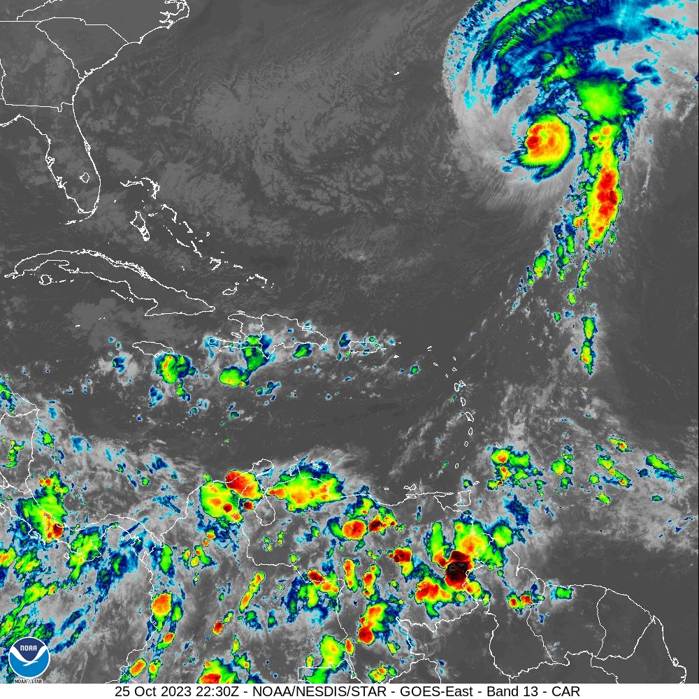
Hurricane Tammy, which passed to the northeast of the USVI last weekend, is located near Bermuda and far from the USVI and Puerto Rico. However, the system will continue to influence the weather pattern across the islands, including the marine weather. Swells created by the system are forecast to impact the territories on Wednesday.
“Marine conditions will deteriorate, as swells generated by the distant Hurricane Tammy propagate through the local Atlantic waters and Caribbean passages from today through the weekend,” according to an update on Wednesday afternoon from the National Weather Service (NWS) in San Juan, P.R.
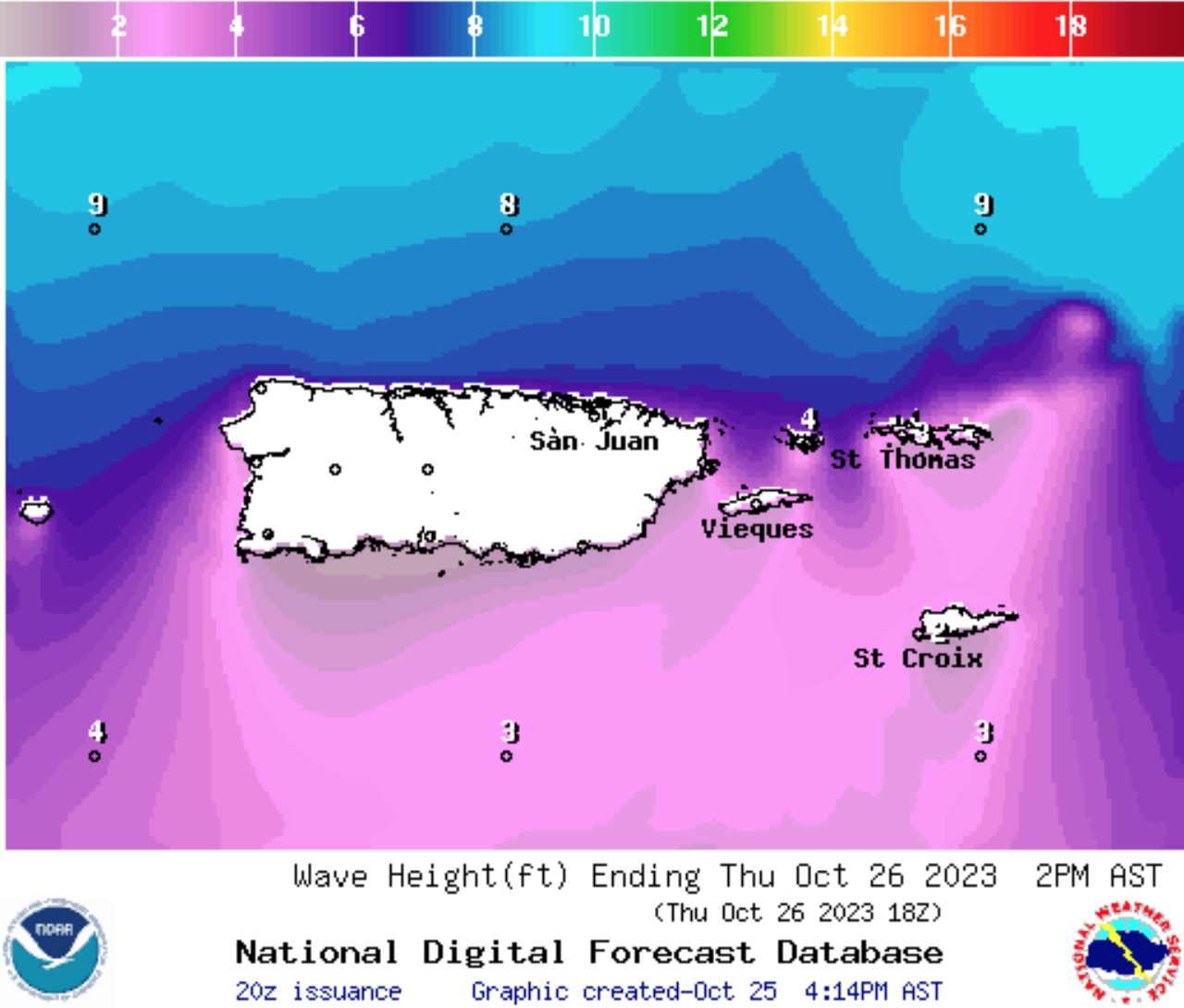
“These swells are likely to cause life-threatening rip current conditions. Additionally, these swells have the potential to generate high surf conditions over the weekend, leading to localized coastal flooding and beach erosion. Advisories are currently in place through Sunday morning due to the anticipated increase in wave heights, which may reach up to 10 feet,” the update continues.
Weather alerts, including a “Small Craft Advisory” and a “High Rip Current Risk,” have been issued for areas across both Puerto Rico and the USVI. Boaters, surfers, and swimmers are advised to exercise caution in or on the water. (Any further marine alerts will be posted on the Source Weather Page).
Wet-Weather Pattern Possible Through Next Week
In addition to rough seas, there will be the potential for additional rainfall through next week. The NWS explains that the overall weather pattern, partially influenced by Hurricane Tammy well to the northeast of the area, could result in unsettled weather and additional rain.
“…A wet-weather pattern will continue throughout the weekend, possibly into next week. During this time, flooding and thunderstorms remain the greatest threat over land with the chance of isolated flash and urban flooding, rapid river rises, and isolated mudslides in areas of steep terrain,” according to the NWS.
The NWS admits there is uncertainty regarding the amount of rain the islands could receive over the next few days.
“It is essential to state that any deviation from this outlined scenario has the potential to alter the expected rainfall patterns and potential risks, particularly early next week,” the NWS cautions.
Watching the Weather
Weather conditions can change rapidly, and USVI visitors and residents can find more information about the weather, including severe weather alerts, from the Virgin Islands Territorial Emergency Management Agency website and the National Weather Service.
A daily weather update is also published on the Source Weather Page, where readers can view a “Weekly Weather Update” video.