Gusty winds, choppy seas, passing showers and hot temperatures are expected across portions of the U.S. Virgin Islands and Puerto Rico this week, according to the National Weather Service in San Juan.
Heat and Weather Overview
As the month of May continues and the official start of the 2026 Atlantic hurricane season approaches, meteorologists at the NWS said hot and humid conditions will continue across portions of the U.S. Virgin Islands and Puerto Rico. Temperatures are forecast to reach the upper 80s to low 90s Fahrenheit, with a high heat index.
“Warmer temperatures for this time of the year are likely, with heat indices possibly exceeding 100 degrees Fahrenheit, particularly over urban and coastal areas of Puerto Rico and the U.S. Virgin Islands, the NWS explained in an update on Tuesday. Although the heat threat should remain limited, this level may affect individuals sensitive to heat even more without adequate hydration and long sun exposure,” the NWS said.
According to the NWS, “The heat index, also known as the apparent temperature, is what the temperature feels like to the human body when relative humidity is combined with the air temperature.”
Residents and visitors are encouraged to monitor their hydration, limit strenuous activity during peak afternoon heat, and check on vulnerable populations as well as pets.
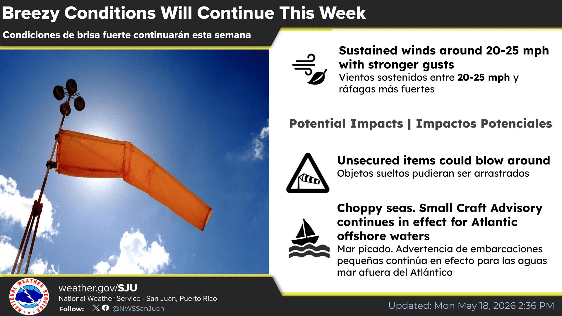
The NWS explained that breezy conditions are expected to continue across the region in the coming days with rainfall and thunderstorms possible.
“Breezy to locally windy east to east-southeast winds will steer periods of fast-moving showers towards windward sectors and can cause unsecured items to blow around,” the NWS said.
Forecasters also noted that a trough of low pressure is forecast to approach the region early next week. Minor and localized flooding could occur across some areas, particularly in Puerto Rico.
“Although no significant flooding or lightning threat is expected, ponding of water over roadways and poorly drained areas is very likely, along with minor flooding. In addition to rainfall, hazards that could be expected in this scenario include gusty winds and lightning,” according to the NWS.
Additionally, meteorologists said that minor concentrations of Saharan dust will move across the islands at times.
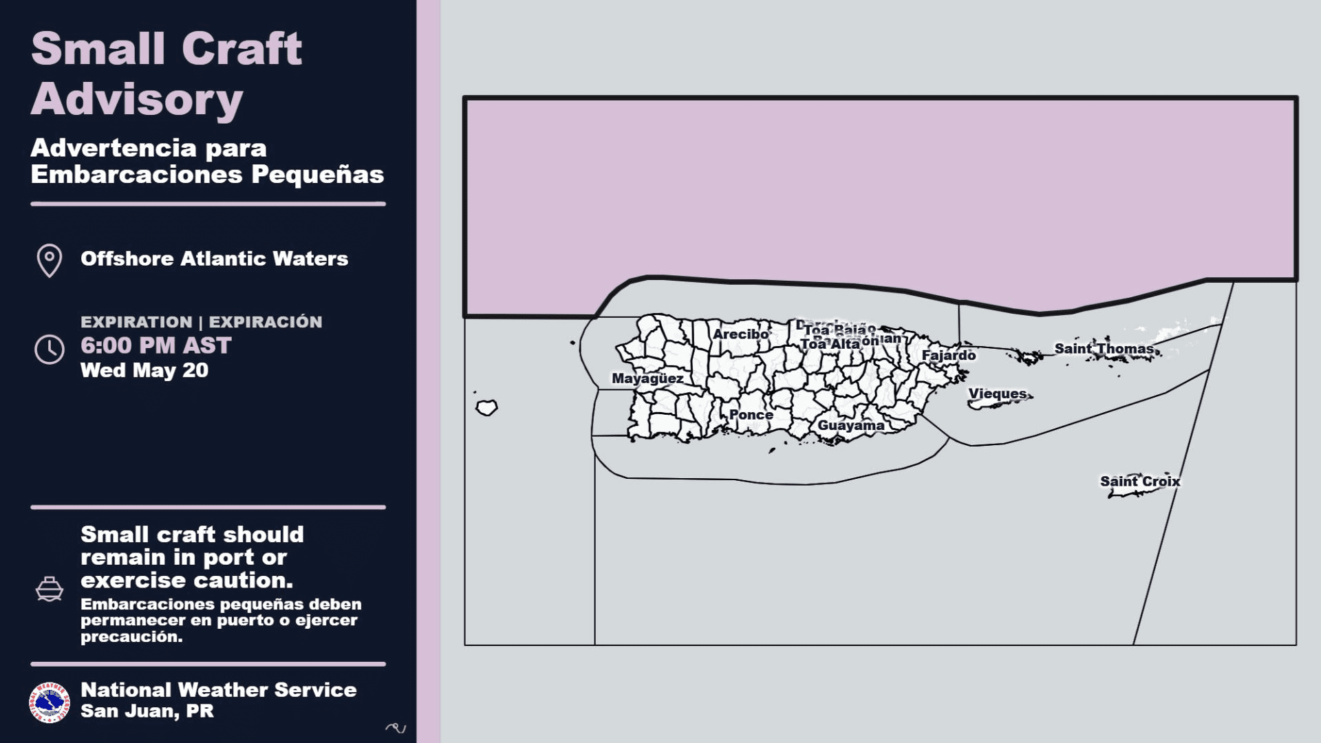
Marine conditions are also expected to remain hazardous due to persistent gusty winds. The NWS has issued a Small Craft Advisory for areas of the Atlantic waters through at least 6 p.m. AST on Wednesday.
“A strong surface high pressure over the western Atlantic will promote moderate to fresh trades through midweek,” the NWS said. “Winds will turn more east to southeast thereafter as the surface high moves into the central Atlantic. These breezy conditions will maintain choppy seas, particularly across the offshore and exposed Atlantic and Caribbean waters. A Small Craft Advisory is in effect for the offshore Atlantic waters through at least late Wednesday,” the NWS continued.
Boaters are encouraged to monitor the latest marine alerts before heading out.
Moderate Rip Current Risk
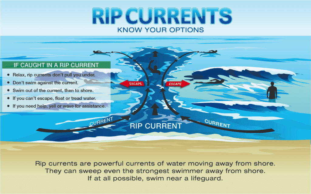
Beachgoers should also remain alert. A moderate risk of rip currents is expected along several exposed beaches this week.
“A moderate risk of life-threatening rip currents will prevail across the east, north, and south-facing beaches of Puerto Rico, Culebra, Vieques, and the U.S. Virgin Islands throughout the workweek due to persistent breezy easterly winds and choppy seas,” the NWS reported.
Swimmers are urged to use caution, avoid entering unsafe rough surf, and familiarize themselves with rip current safety tips.
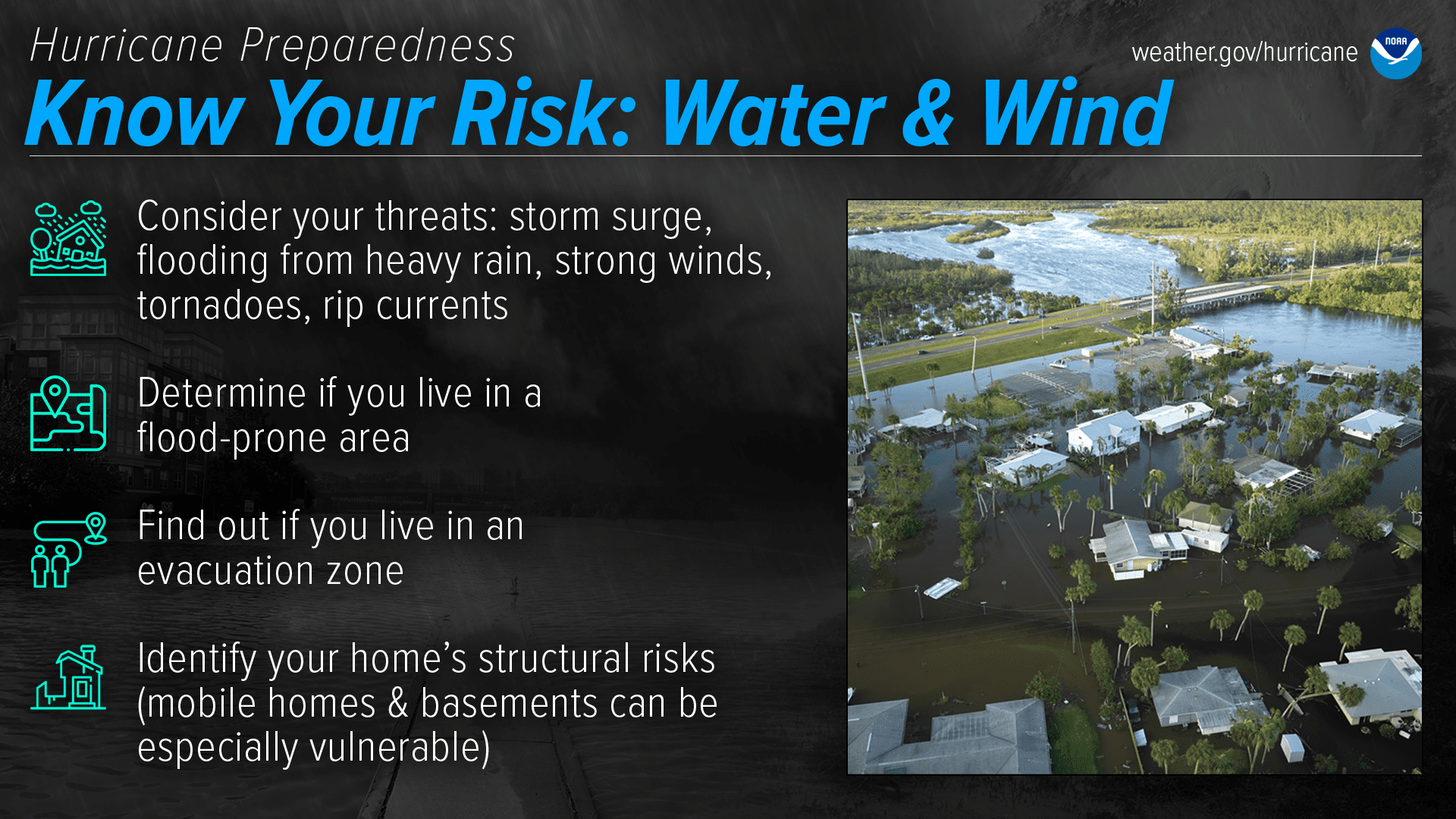
As the 2026 Atlantic hurricane season approaches, the National Hurricane Center has resumed daily Tropical Weather Outlooks for the Atlantic basin. The official start of hurricane season is June 1, and the season runs through Nov. 30.
NOAA is scheduled to release its official 2026 Atlantic hurricane season outlook on Thursday, May 21. The outlook will include NOAA’s forecast for expected activity during the season, along with information about factors that may influence hurricane development. The Source plans to provide coverage of NOAA’s forecasts.
Hurricane season forecasts have already been released by AccuWeather and Colorado State University. Forecasters from both groups predict a potentially less active Atlantic hurricane season, due in large part to the expected development of a strong El Niño, which can increase wind shear across the Atlantic basin and help to disrupt the development of cyclones.
However, a quiet season is far from guaranteed, and regardless of the seasonal outlook, residents are encouraged to remain prepared and informed. It only takes one storm to cause significant destruction.
Daily Weather Updates
Information regarding the weather across the USVI, including marine forecasts, is available from the NWS and NOAA. With the Atlantic hurricane season set to begin June 1, individuals across the islands are also encouraged to begin preparing now.
The local forecast is regularly updated on the Source Weather Page, and a weekly video forecast is available. Additionally, residents and visitors can view weather alerts and disaster preparedness information from the Virgin Islands Territorial Emergency Management Agency.