The National Weather Service is warning of several days of unsettled weather across Puerto Rico and the U.S. Virgin Islands, with heavy rainfall and hazardous seas expected through the weekend. Meanwhile, the National Hurricane Center is monitoring a tropical wave forecast to pass south of the territories next week.
Unsettled Weather Across the Region
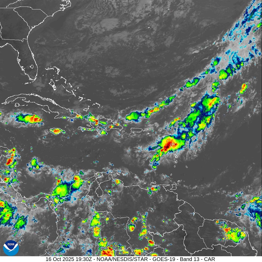
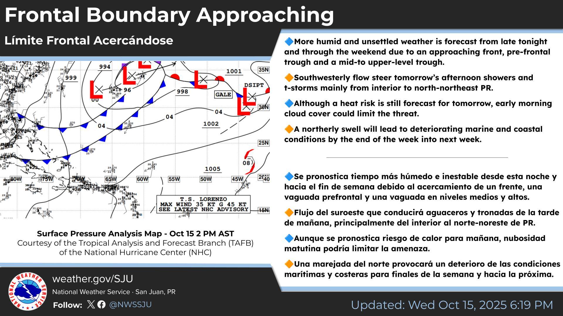
Forecasters at the NWS in San Juan, Puerto Rico, say a frontal boundary and upper-level trough of low pressure will keep Puerto Rico and the U.S. Virgin Islands in a moist and unstable pattern through the weekend. This setup is expected to produce periods of heavy rain, thunderstorms, and gusty winds, with the greatest flood risk across northern Puerto Rico.
The U.S. Virgin Islands could also see increasing shower and thunderstorm activity, especially Friday and Saturday. Meteorologists caution that while conditions may not remain stormy at all times, repeated rounds of rain could still lead to ponding on roads, reduced visibility, and localized flooding.
“A frontal boundary and prefrontal trough will enhance moisture, instability, and weak steering flow, allowing storms to persist longer and increase impacts through the weekend,” according to an update from the NWS on Thursday. “This pattern will result in increased moisture and instability, supporting periods of showers and thunderstorm activity across the region.”
The NWS noted that weather conditions are expected to improve on Monday as drier air moves across the local islands.
Hazardous Seas and Coastal Risks
In addition to the potential for rain, forecasters warn of increasingly hazardous marine conditions. Powerful northerly swells are forecast to build seas to six to eight feet offshore by late weekend into early next week, producing breaking waves of 10 to 15 feet along portions of the coastlines of Puerto Rico and the USVI.
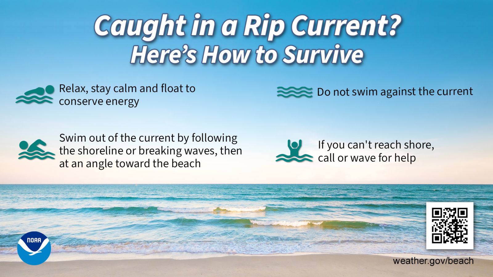
The swell event will bring an elevated risk of dangerous rip currents, especially by Sunday and Monday, and minor coastal flooding is also possible in low-lying areas near the shore as the swell peaks. The NWS explained that marine alerts will likely be issued.
“Northerly swells will lead to deteriorating seas and life-threatening rip currents from Friday into early next week,” the NWS said. “Small craft advisories, rip current statements, high surf alerts and coastal flood statements will be required, particularly from Sunday through Tuesday.”
Officials urge boaters and beachgoers to stay vigilant and avoid entering rough surf conditions.
National Hurricane Center Monitoring Tropical Wave
As of Thursday afternoon, the NHC was monitoring a tropical wave, called “Disturbance #1,” which is moving across the Atlantic. Disturbance #1 has a low chance of development in the next 48 hours and also a low chance over the next seven days. Current forecasts suggest the system may pass south of Puerto Rico and the Virgin Islands next week.
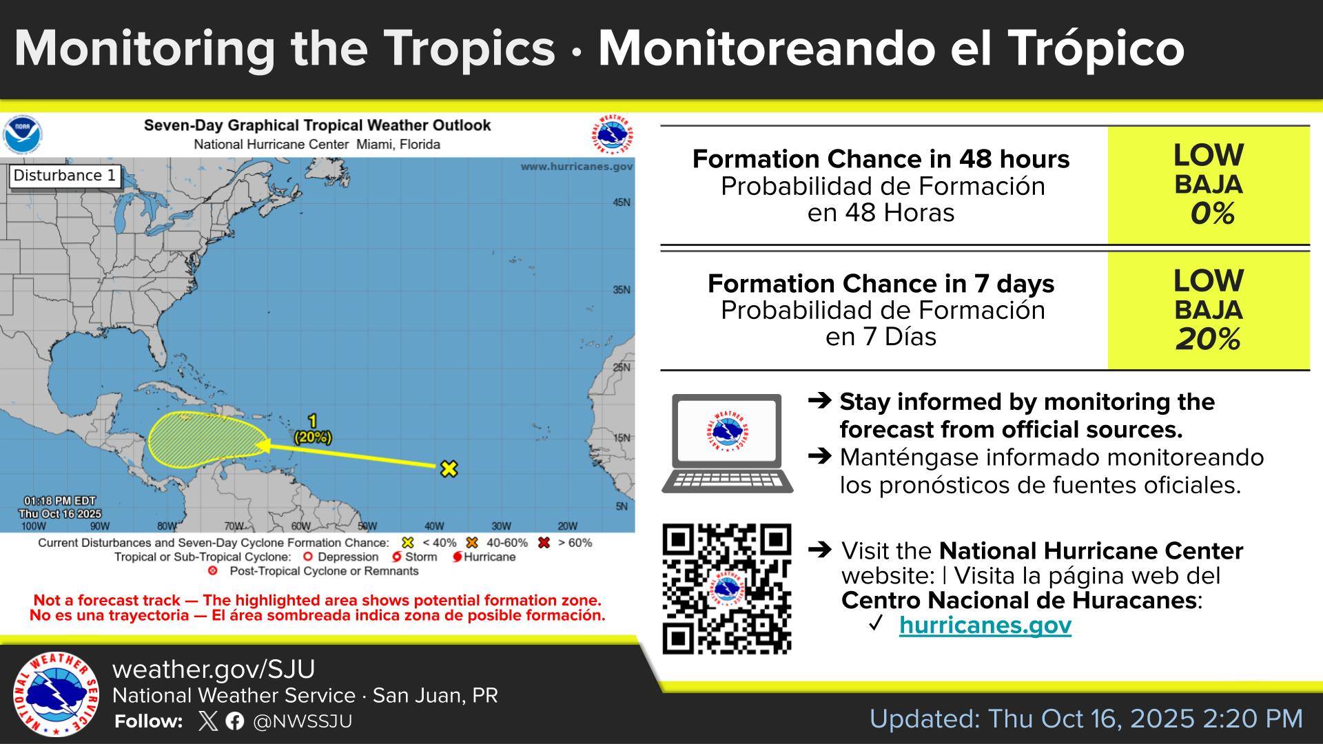
“A tropical wave located over the tropical central Atlantic is expected to move westward at 15 to 20 mph during the next several days,” according to an update from the NHC on Thursday. “Some slow development of this system is possible when it reaches the central portion of the Caribbean Sea by the middle part of next week,” the NHC noted.
While significant development is not expected at this time, the NWS in San Juan noted that the disturbance could bring an increase in showers and thunderstorms as it approaches the Caribbean.
“By the later part of the workweek, forecast model guidance shows a gradual increase in moisture and shower activity as a tropical wave or potential tropical system moves south of the region,” the NWS said. “We urge citizens and visitors to continue to monitor the forecast for any significant changes.”
The NHC is also monitoring a second disturbance in the North Atlantic, which has a low chance of development.
Watching the Weather
It is crucial to remember that the forecast can change very quickly. USVI residents and visitors are encouraged to continue to remain prepared. Weather information is available from the NWS, the NHC, and the National Oceanic and Atmospheric Administration.
Additionally, the local weather forecast for the U.S. Virgin Islands is regularly updated on the Source Weather Page and VI Source YouTube Channel. A weekly Tropical Outlook article from the Source will continue to be published throughout hurricane season to provide in-depth updates. Residents and visitors can find additional weather alerts and preparedness information from the Virgin Islands Territorial Emergency Management Agency.