A northerly swell is expected to affect the USVI and Puerto Rico beginning Thursday through part of the weekend.
The National Weather Service in San Juan, Puerto Rico, has issued several marine weather alerts due to the arrival of the swell. Breezy conditions are also anticipated.
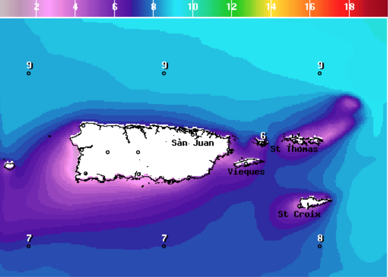
“Hazardous marine and coastal conditions are expected through at least the end of the week. Seas of up to 10 feet are expected by tonight for portions of the local waters, particularly the offshore Atlantic waters. There is a high risk of rip currents for the vast majority of north-facing beaches,” according to an update from the NWS on Thursday morning.
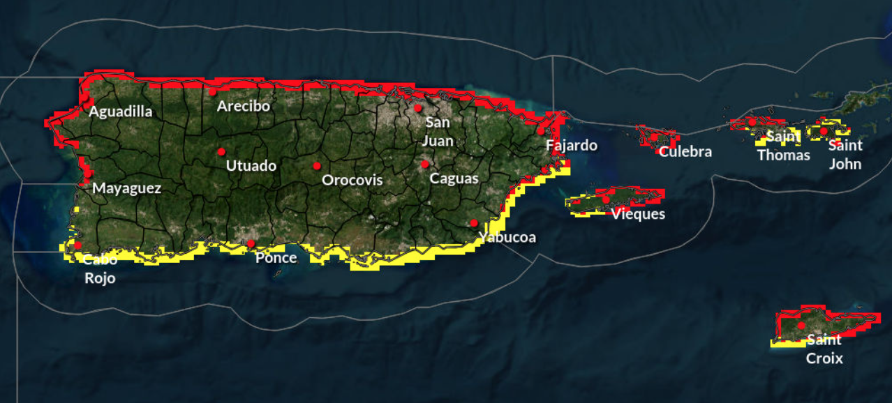
“There is a high risk of rip currents for north-facing beaches of Puerto Rico, as well as beaches of the USVI and Culebra. This risk will persist through the weekend,” the NWS update continues.
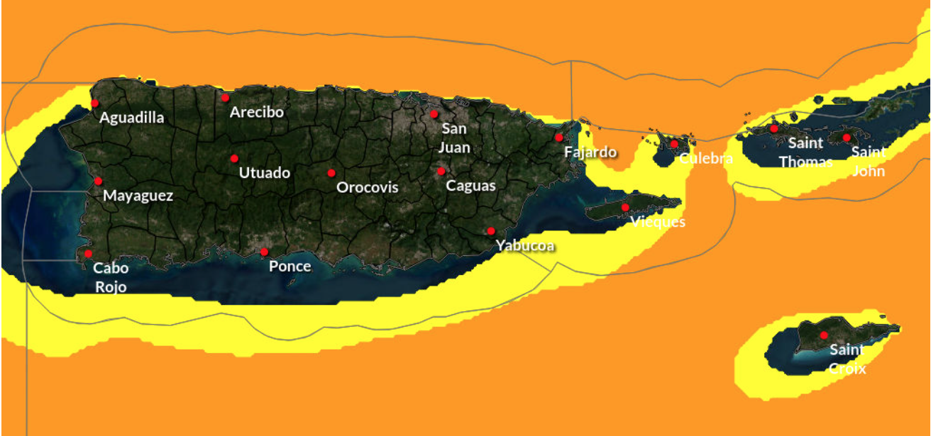
A “High Rip Current Risk” will be in effect for areas of the USVI and Puerto Rico, particularly north-facing coastlines, from 6 a.m. AST on Thursday until at least 6 p.m. AST on Sunday.
A “Small Craft Advisory” will be in effect for portions of the local waters around the northern USVI and Puerto Rico beginning at 2 p.m. AST on Thursday. This alert will remain in effect until at least 2 p.m. AST on Sunday.
Rip currents can be hazardous, and swimmers are advised to exercise caution.
“If you become caught in a rip current, yell for help. Remain calm, do not exhaust yourself, and stay afloat while waiting for help. If you have to swim out of a rip current, swim parallel to shore and back toward the beach when possible. Do not attempt to swim directly against a rip current as you will tire quickly,” according to the National Weather Service.
Ernesto Morales, a warning coordination meteorologist at the NWS in San Juan, provided additional tips on rip current safety in a recent interview with the Source.
Weather alerts will continually be updated on the Source Weather Page. Residents and visitors to the USVI can also sign up for emergency alerts from the Virgin Islands Territorial Emergency Management Agency and the National Weather Service.