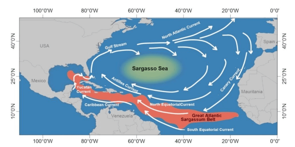
Sargassum continued to expand across the Atlantic basin during April, with the latest bulletin from the University of South Florida’s Optical Oceanography Lab showing increasing amounts of seaweed across the regions monitored by USF.
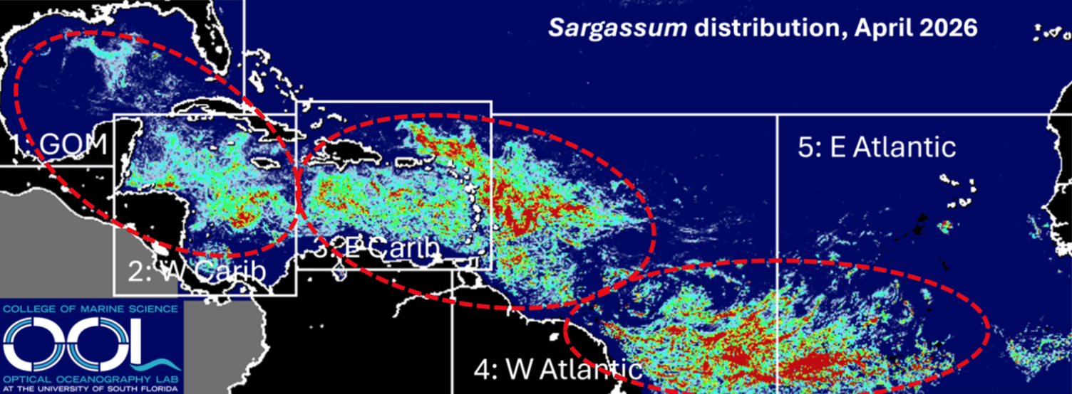
The Optical Oceanography Lab at USF monitors the presence of sargassum across the Atlantic, Caribbean, and Gulf regions using satellite imagery. The sargassum report released on April 30 from USF explained that the seaweed continued to expand during the previous several months.
“The trend in the last few months has continued, resulting in increased sargassum amount in every region shown in the map,” USF said. “Nearly every region also continued to see record-high sargassum amount for the month of April.”
USF noted that the growth of seaweed during April led to sargassum inundation events across the monitored region, including the Caribbean islands.
“By mid-April, sargassum expanded to the entire Caribbean Sea, with substantial amounts transported to the Gulf. Major beaching events have likely occurred around the Caribbean and Lesser Antilles islands. Moderate beaching events have also occurred along the southeast coast of Florida,” USF reported.
Sargassum Explained
As reported in a recent Source article, sargassum seaweed plays an important role offshore as habitat for marine life, but it can also create problems when winds and currents carry large mats ashore, according to the National Oceanic and Atmospheric Administration.
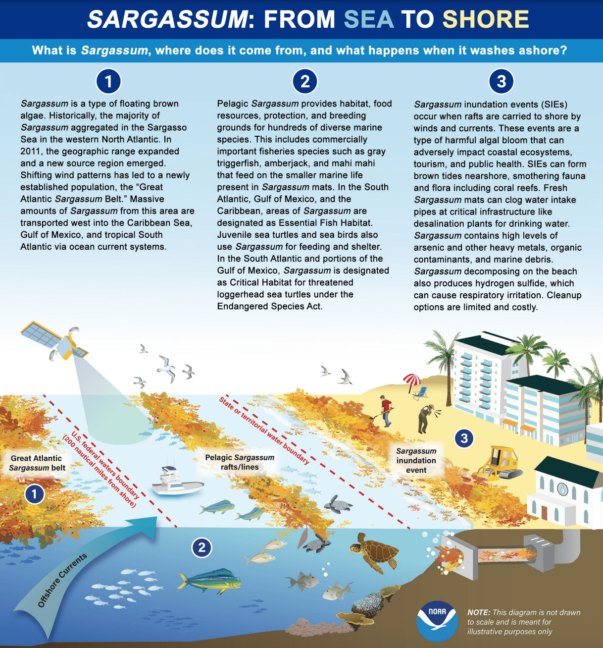
“Sargassum is a type of floating brown algae that provides food, protection, and habitat for many marine species. While sargassum plays an important role in the health and biodiversity of open ocean ecosystems, it can also be harmful in certain situations when rafts of this brown algae are carried to shore by winds and currents,” NOAA said.
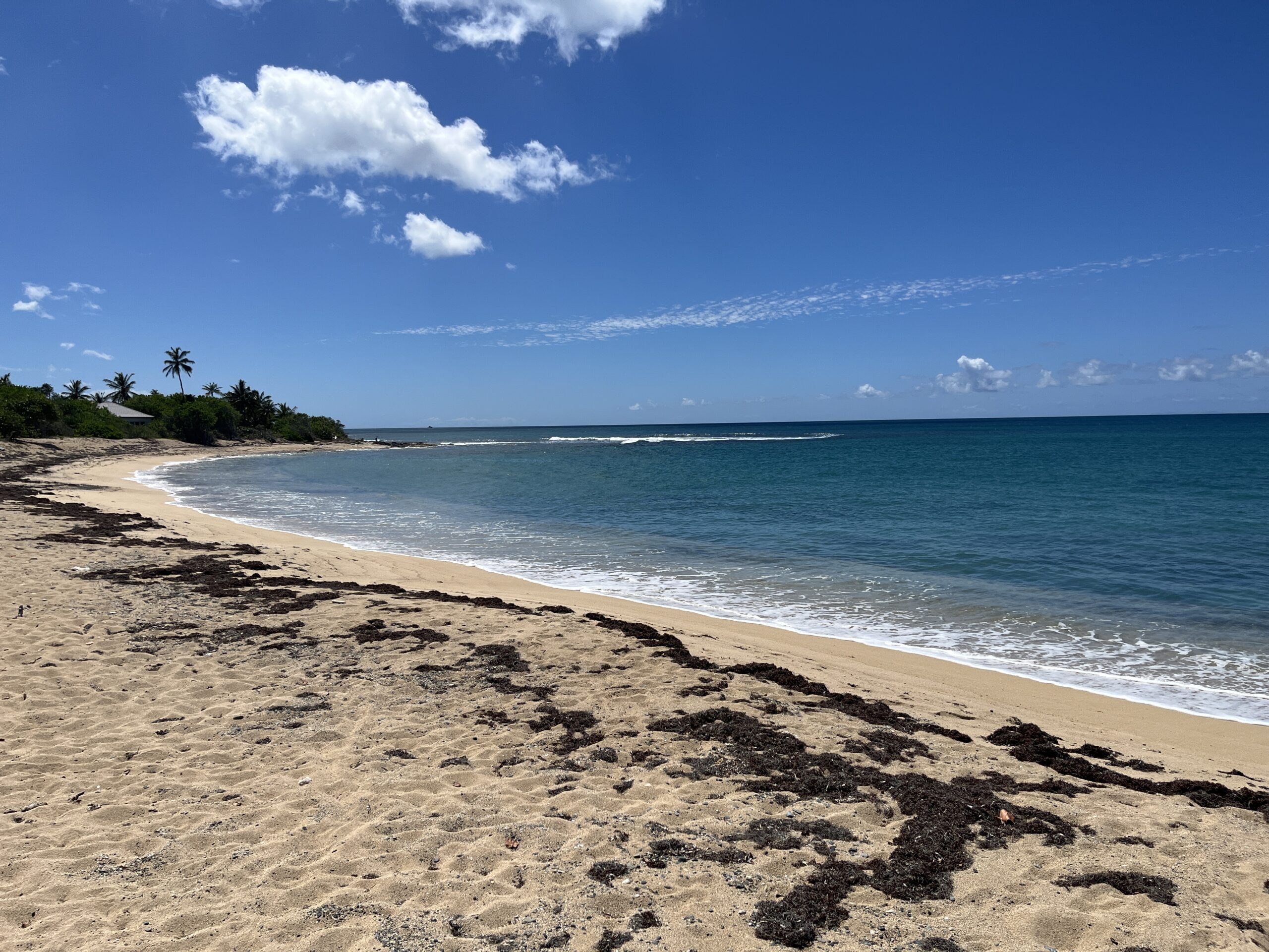
What This Means for the USVI
For the U.S. Virgin Islands, local impacts will continue to depend on winds, currents, tides, and nearshore conditions. Even during an active regional sargassum pattern, beach conditions can vary widely from one shoreline to another and from day to day.
However, because the USVI sits within the broader eastern Caribbean and Lesser Antilles region, additional sargassum arrivals remain possible in the weeks and months ahead.
USF researchers said sargassum amounts in most regions are expected to continue to rise in the coming months.
“Sargassum amount in most regions will continue to increase in the coming months,” USF explained. “Beaching events around the Caribbean and southeast coast of Florida will continue and likely increase. Some beaching events may also occur around Louisiana and Texas coasts. The year of 2026 is set to be another major sargassum year, meaning sargassum amounts are expected to exceed 75% of historical values, and the year is likely to become a record year by summer 2026.”
Monitoring Local Conditions
The USF monthly bulletins provide a broad regional outlook and are not meant to predict exact conditions at a specific beach or shoreline. Residents and visitors should continue to monitor local beach conditions, especially during periods of shifting winds or currents.
Previous monthly reports and daily imagery are available through USF’s Sargassum Watch System. High-resolution sargassum maps for selected coastal regions are also available through the Optical Oceanography Lab’s satellite data products.
Individuals can follow the progression of the current Sargassum bloom and stay up to date each month on where the algae may be headed.
Finally, in addition to monitoring sargassum, residents and visitors across the U.S. Virgin Islands are encouraged to follow the local weather forecast. Weather information is available from the NWS and NOAA. The local weather forecast for the U.S. Virgin Islands is regularly updated on the Source Weather Page, and individuals can also find helpful weather information and alerts from the Virgin Islands Territorial Emergency Management Agency.