If you’re like most people in the Virgin Islands, describing to someone where you live is not simply a matter of giving a number on a street that can easily be found on a map.
All this is about to change on St. John starting on Monday, as the Street Addressing Initiative works toward its goal of providing a clear, logical system of street addresses for the territory.
It’s part of a process that began in 2013 that can have consequences beyond the obvious one of getting an ambulance or fire truck to a residence in a timely manner.
Teams of workers from the Street Addressing Initiative, part of the Geographic Information System, a subdivision of the Office of the Lieutenant Governor, are setting up temporary headquarters in the Battery in Cruz Bay.
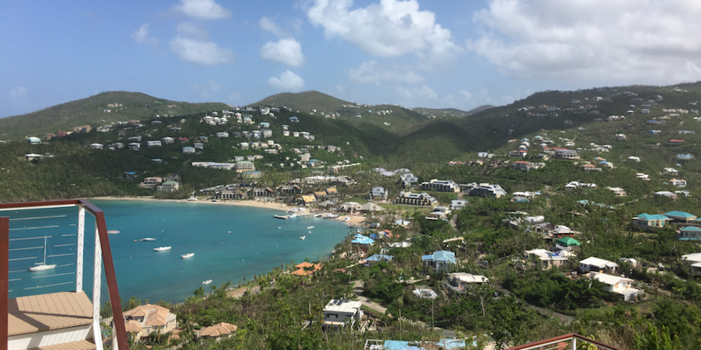
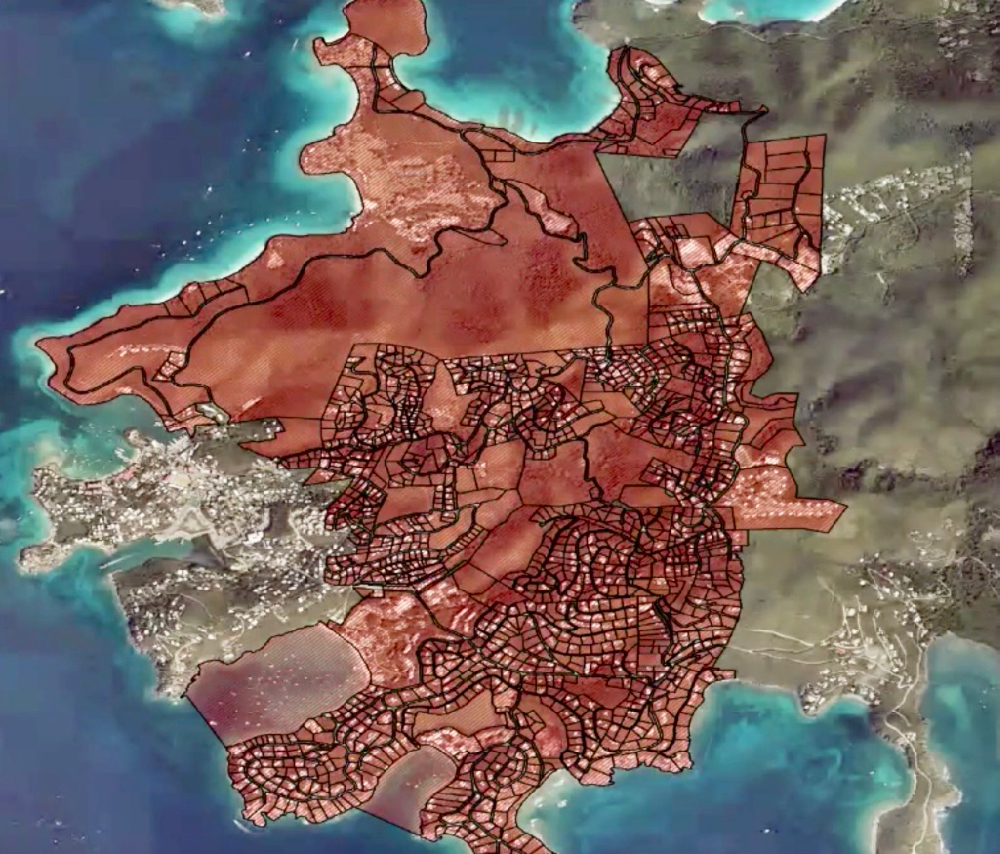
For the next month, field teams will fan out around the western portion of St. John – including Great Cruz Bay, Chocolate Hole, Sans Souci & Guinea Gut, Pastory, Bethany, Grunwald, Glucksberg, Bellevue, Gifft Hill and Susannaberg. They’ll look at the roads to see where they actually begin and end, and they’ll determine a numbering system that makes sense given the property boundaries.
Field team members will take pictures of each residence and assign it a universally unique identifier, or UUID, which can be scanned into a database compatible with the Federal Geographic Data Committee.
Field teams also will leave packets of information at the more than 900 homes and other structures, informing residents what their new addresses will be.
Here’s where residents are being asked to take the lead if they live on a road whose name has not yet been recorded with the Office of the Lieutenant Governor.
“We want the community to drive the naming process,” said Chris George, administrator of the territory’s Geographic Information System. “The government does not want to be in the street naming business.”

When Lt. Gov. Tregenza Roach announced the launch of the St. John program on Oct. 28 via Facebook Live, he made a pitch to community members to choose names for their streets that reflect their culture and history.
“Here’s your chance to give character to your neighborhood, to pay tribute to someone who has enhanced the cultural and historical elements,” Roach said.
The V.I. government will not solicit names from communities, so groups of neighbors should apply now to establish an official name for the street where they live if one has not already been recorded with the Cadastral Division of the Tax Assessor’s Office.
The process is pretty simple. To file a request, call George at the GIS Division office at 340-693-6191 or send an email to sai@lgo.vi.gov. You’ll be asked to provide your estate name and plot number, as well as a proposed name for the road. Someone on staff will confirm the plot numbers and names of other property owners along the road. They’ll then email you a form for neighboring property owners to sign to show that the majority agree to the name.
The process of naming streets and numbering buildings has already been completed for streets in downtown historical districts on all three islands. Those are streets that have traditional Danish names that have appeared on maps for centuries. Most recent subdivisions also have official names.
Aside from these, “current addresses are based on estate names and lot numbers which were never assigned in an orderly manner and have resulted in a confusing pattern of numbering that makes finding an individual house or business difficult,” according to the Street Address Initiative website.
The new system is critical for facilitating responses by emergency service providers such as the police department, fire service and VITEMA, as well as for utility companies including WAPA, Viya and viNGN. Other partners include the U.S. Postal Service, Housing Finance Authority and the Office of the Tax Assessor.
There is another benefit of a standardized street address system that is largely unknown: A well-ordered street address system could mean more funding for the territory because the current estate-based address system does not conform with the Federal Geographic Data Committee. The explanation is a bit gnarly, but it is worth repeating.
Federal funding for the territory is based on the population as determined by the census every 10 years.
However, the population of the Virgin Islands has been shrinking since the closing of Hovensa in 2012 and the hurricanes of 2017; this could mean less funding for the territory based on the 2020 Census. Further, the U.S. Virgin Islands could be stuck with a low population figure that could determine a lower level of funding for the next decade, even if the population rebounds.
There is one way that census data could be updated and made official more frequently than every 10 years.
Every year, the Virgin Islands participates in the American Community Survey, which is conducted throughout the United States and Puerto Rico.
During this survey, a sample of between 2,500 and 3,000 households is taken, and from this data, wider trends are extrapolated. In the Virgin Islands, however, this data cannot be used to apply for federal funding, despite a request by a previous administration to a congressional subcommittee, according to Frank Mills, the census manager for the St. Thomas-St. John District.
“The primary reason we were given is we do not have a street addressing system,” said Mills. “We are working under the assumption that when we get the street addressing system in place, we will have the right to claim inclusion,” Mills said.
Staff from the Street Addressing Initiative made a big push starting in October 2019 to bring addresses within the historic downtown areas into compliance with federal standards.
They chose St. John as their next area to map, partly because it was the smallest island, but also because it has vast areas within the Virgin Islands National Park that are sparsely populated. Once they complete the western portion of the island, they anticipate moving on to Coral Bay in the eastern portion and then checking off St. John.
Mapping teams were poised to move into the western portion of St. John in March, just as the COVID-19 pandemic hit and non-essential activities were halted.
George said he was particularly disappointed to have to tell interns from the University of the Virgin Islands and the territory’s high schools that they couldn’t go into the field, especially because they would be the beneficiaries of the improved mapping in the future. George said he hopes to re-engage these interns to do fieldwork when health concerns have been addressed.
St. John residents should soon be on the lookout for Street Addressing Initiative team members wearing yellow vests, and for information packets left on their doorsteps or gates. They’ll be out carrying handheld devices that will record the data as they travel the roads of St. John. That data will be beamed up to Spatial Focus LLC, a GIS consulting firm, based in Redlands, California, which is processing and managing the data for the territory.
The project is being funded through a $5 million Community Development Block Grant that is now being finalized, and if all goes as planned the street naming for the territory including new road signs will be completed by late 2021 or early 2022, according to George.
Who knows what the results of the new address system will be? Perhaps reliable pizza delivery?