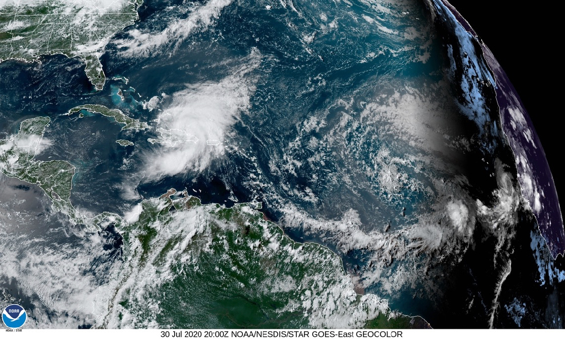
The storm that was known as Potential Tropical Cyclone 9 was upgraded to Tropical Storm Isaias as it passed through the U.S. Virgin Islands Wednesday night and Thursday morning on its way to the Dominican Republic and Cuba, while a new system on began the long journey from the African coast towards the Caribbean.
Isaias is continuing to move west-northwest at almost 20 mph.
In the meantime, showers and thunderstorms associated with a small area of low pressure a few hundred miles south-southeast of the Cabo Verde Islands have increased and became better organized Thursday.
Environmental conditions appear conducive for further development, and this system could become a tropical depression during the next day or so while it drifts generally north-northwestward.
After that time, environmental conditions are forecast to become less favorable for development.
The National Hurricane Center gave the system a 50 percent chance of tropical formation within the next five days.