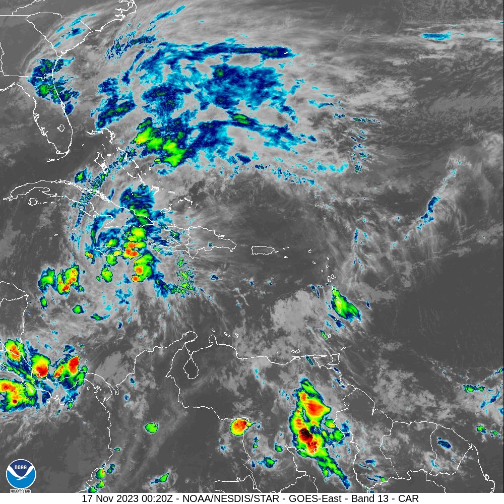
Weather conditions are expected to deteriorate across the USVI and Puerto Rico through the weekend and into early next week, bringing the potential for heavy rain across the U.S. territories, and seas are forecast to be choppy and hazardous. The unsettled weather is primarily due to moisture associated with a tropical disturbance in the southwest Caribbean and an incoming northerly swell.
The tropical system in the southwest Caribbean, currently dubbed “Potential Tropical Cyclone 22 (PTC 22),” is moving toward the northeast, and it is expected to pass over the Greater Antilles and bring heavy rain to areas across the region.
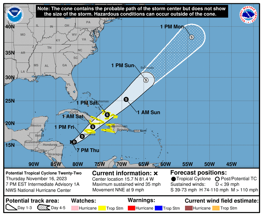
The National Weather Service in San Juan, Puerto Rico, indicated that the system may strengthen, and a tropical storm will likely form by Friday. In response to the potential cyclone, tropical storm watches have been issued across several islands in the western Caribbean, including Jamaica and portions of Cuba, Haiti, the Bahamas, and Turks and Caicos.
If a tropical cyclone forms, with maximum sustained winds of at least 39 mph, it will acquire the name “Vince,” the second to last name in the 2023 Atlantic Hurricane Season, which will officially end on Nov. 30.
Potential Tropical Storm to Bring Rainfall to the Islands
The USVI and Puerto Rico are not expected to be in the direct path of this system. However, both territories are forecast to receive rain associated with the storm, and rainfall may be heavy at times. Flash flooding and mudslides are possible.
“Based on the latest guidance, the most likely time for the heaviest rainfall activity is Sunday into Monday,” according to the NWS. “Areas most likely to receive the highest rainfall accumulations are portions of the south, southeast, and east sections of Puerto Rico, as well as Vieques, Culebra, and the U.S. Virgin Islands. Potential rainfall totals will likely reach two to four inches. Elsewhere, the potential exists for rainfall totals to exceed one to two inches,” the NWS warned.
The NWS also noted that an incoming northerly swell is anticipated to affect the USVI and Puerto Rico. The rip current risk will be high, particularly across the north and east-facing coastlines of the local islands. A “High Rip Current Risk” and a “Small Craft Advisory” will be in effect for portions of the USVI and P.R. through the weekend, and swimmers and boaters are advised to exercise caution.
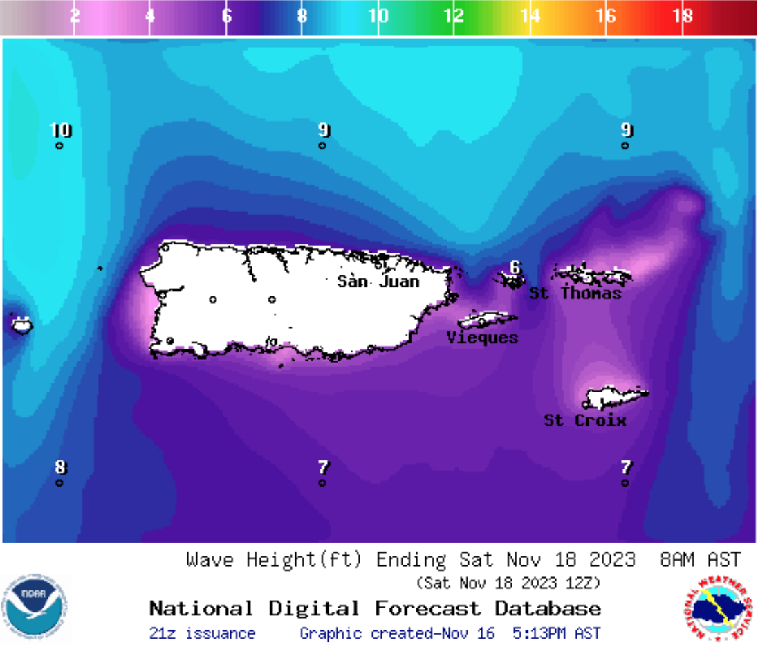
“A northerly swell and increasing winds will promote hazardous marine and coastal conditions through the weekend and early next week,” according to the NWS. Seas between seven and 10 feet are likely from Thursday through Sunday,” the NWS update explained.
Weather updates will be published on the Source Weather Page. Additionally, USVI visitors and residents are encouraged to follow the National Hurricane Center for the latest weather alerts. Information about severe weather, including emergency shelters and warnings, is also available from the Virgin Islands Territorial Emergency Management Agency and the National Weather Service.