The surge in recreational boating brought on by the COVID 19 pandemic has led to overcrowding at popular anchorages and has led to complaints that the Department of Planning and Natural Resources is not up to the task of monitoring so many boats at so many locations.
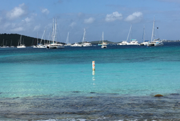
But one St. Thomas tech entrepreneur believes that DPNR can patrol the entire territory with just two boats – one on St. Thomas and St. John, and another on St. Croix – by using the right technology.
John Joseph, president of Caribbean Collaboration I.T. Services – CCIT – said that DPNR can start by implementing an app-based reservation system for mooring balls.
Joseph said these systems are already in place. BoatyBall which is widely used in the British Virgin Islands, “is an excellent model,” he said. “You can reserve a mooring just like reserving a hotel room. And the website provides links to restaurants and facilities.”
For mooring balls at remote dive sites, the website also includes detailed descriptions of marine life and underwater topography.
Joseph’s company, CCIT, is in the process of developing a mooring app system now, but he prefers to remain “tight-lipped” about his product at this stage of development.
Rumors have been circulating that DPNR will be implementing a similar system for the 200 new mooring balls that are scheduled to be installed by DPNR in collaboration with the Virgin Islands Professional Charter Association.
Oriel Blake, executive director of the Virgin Islands Professional Charter Association, confirmed that negotiations were underway for a system “very like” BoatyBall.
With an app-based mooring reservation system like BoatyBall, private operators or government enforcement officers can look at a screen and see which mooring balls have been reserved and paid for.
Using common technologies like webcams or drones, they can also determine if boats are tied up to the mooring balls without paying for them or anchoring illegally.
Then if violators are identified, DPNR can send out enforcement officers on a boat to investigate.
In recent years, however, much more sophisticated technology – known as geofencing – has become widely available. For example, geofencing uses a global positioning system (GPS) or radio frequency identification (RFID) to set up a boundary around a geographical area.
“Geofencing allow[s] an administrator to set up triggers so when a device enters (or exits) the boundaries defined by the administrator, an alert is issued. Many geofencing applications incorporate Google Earth, allowing administrators to define boundaries on top of a satellite view of a specific geographical area,” according to https://whatis.techtarget.com/definition/geofencing.
Anyone who remembers the 2002 film “Minority Report” is familiar with the concept of geofencing. In the film, set in 2054, Tom Cruise walks into a shopping mall and is greeted by animated “billboards” which address him by name and ask how they can help him shop; geofencing is now being used for marketing products and services in ways that might surprise you.
Using geofencing, a marine enforcement officer in the Virgin Islands could monitor marine traffic in a wide area or narrow the scope to determine exactly who was coming and going out of – say, Magens Bay – in real-time.
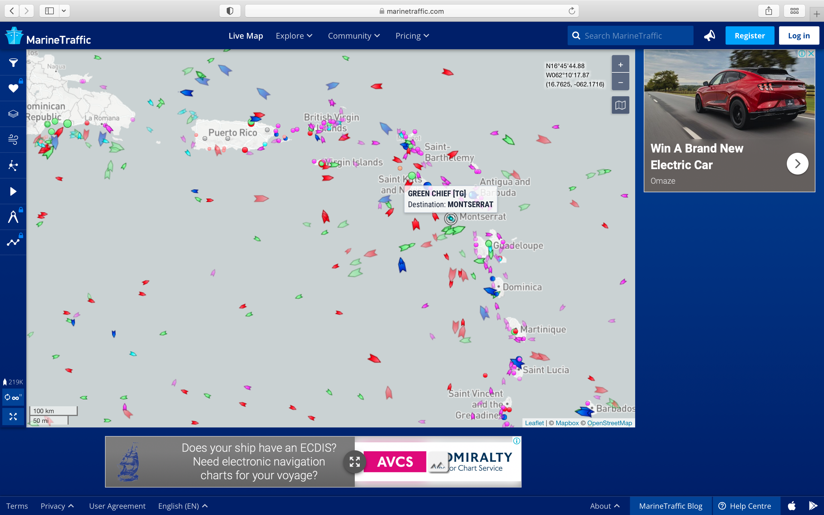
Furthermore, satellite technology now allows anyone with a computer or smartphone to monitor vessels anywhere in the world using Automatic Identification System technology.
According to the U.S. Department of Homeland Security’s website “Although AIS is primarily and foremost a navigation tool for collision avoidance, the Coast Guard believes that the AIS will improve security also. AIS and our Nationwide AIS Project (NAIS) increase the Coast Guard’s awareness of vessels in the maritime domain, especially vessels approaching U.S. ports. In addition, the AIS corroborates and provides identification and position of vessels not always possible through voice radio communication or radar alone.”
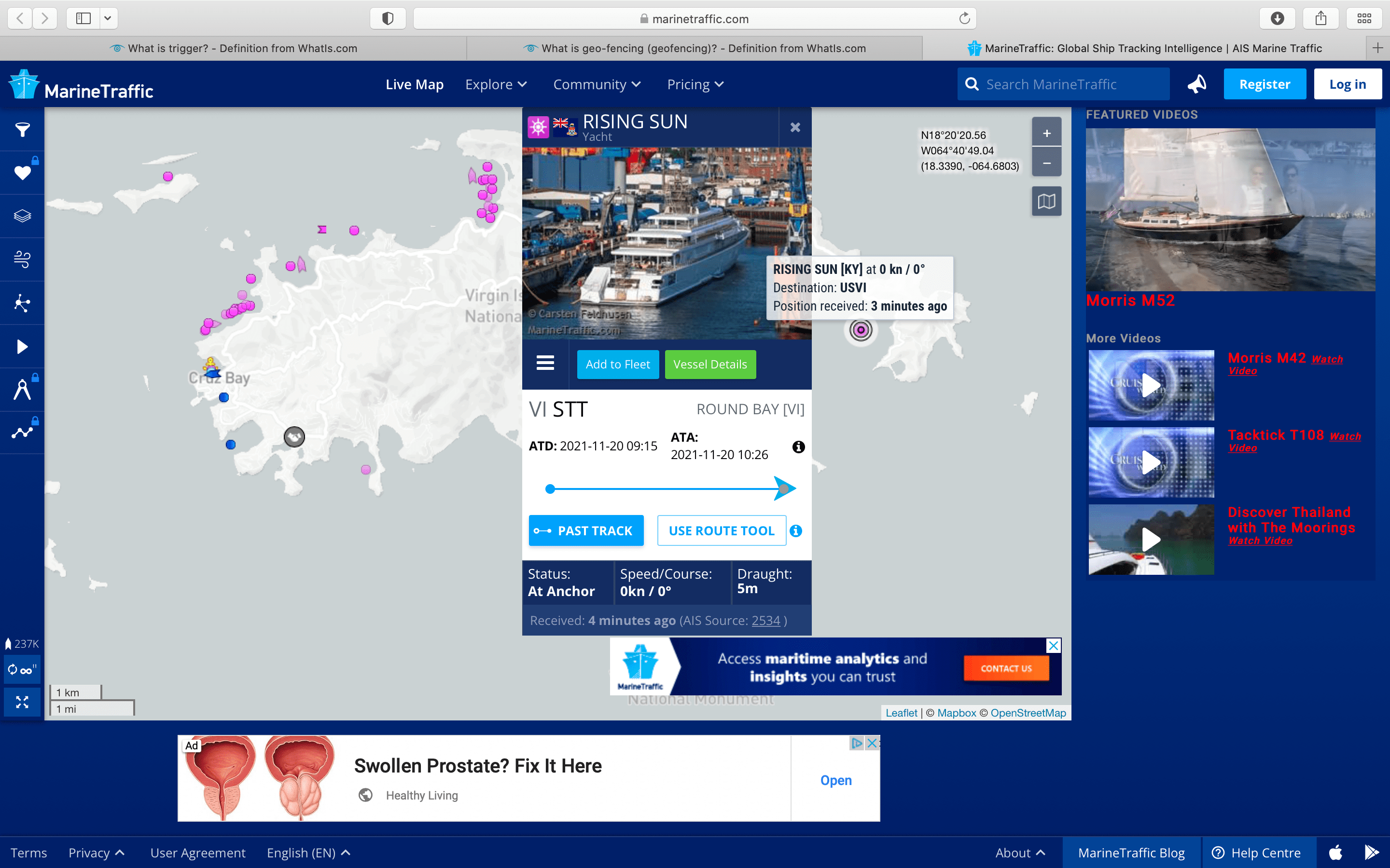
Many Virgin Islands residents have become fans of AIS technology, consulting the site Marine Traffic which uses AIS, to satisfy their curiosity when an unknown vessel comes into view, or just to take a look around at marine activity. For example, while writing this article, I logged on to the site and saw a pink spot on a map of St. John indicating the presence of a yacht in Round Bay on the East End of the island.
By clicking that pink spot, I could see that the vessel was Rising Sun, a yacht built in 2004 operating under a Cayman Islands flag. (Another quick search on Google revealed that this 452-foot yacht was built by Larry Ellison but is now owned by David Geffen; guests have included Bruce Springsteen, Oprah Winfrey, Steven Spielberg, and Sir Paul McCartney.)
Of course, for a vessel to be tracked, it has to register with Marine Tracker; most commercial vessels are required to do so, but Joseph said many private yacht owners are also willing to register for safety reasons; if a vessel is under distress, it’s easy to pinpoint exactly where to send help.
Furthermore, charter companies are now requiring tracking for insurance purposes. “If you want to research exactly what happened to that boat, you can see where it was and where it went wrong,” he said.
Joseph said that no government or private entity needs to launch its own satellites to keep track of marine traffic. The companies that already do that offer packages that can be customized for clients’ individual needs.
This use of technology raises a number of questions. For example, are all vessels being tracked, even if the owners don’t subscribe to a tracking system? Could a tracking or geofencing system be triggered simply by the presence of a GPS, the kind found in any modern cell phone?
If so, does that surveillance technology compromise boaters’ privacy rights?
Joseph didn’t answer that question, but he did point out that big tech companies “are following your click-paths now.”
Of course, vessel operators always have the option of turning off their boat’s tracking device and phone’s GPS, but Joseph said it’s likely that “the appropriate [military or law enforcement] powers can still find them.”
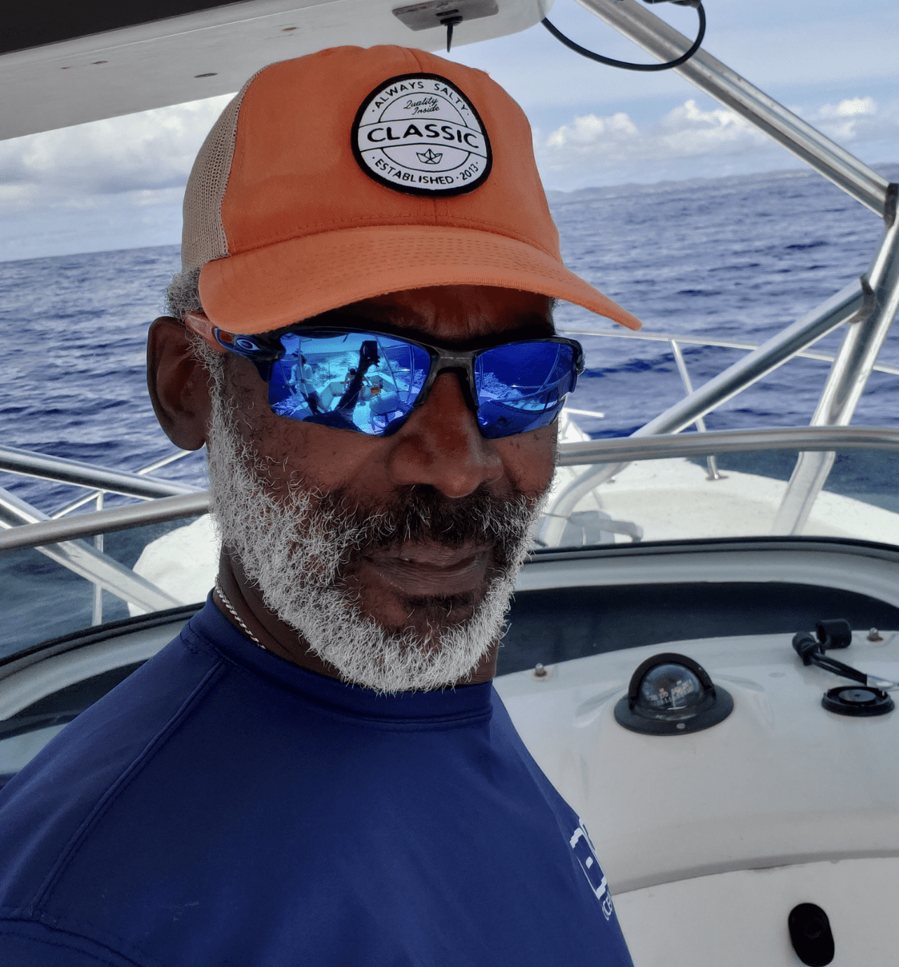
Joseph speaks as both a boater and a technology expert. Born and raised in the Virgin Islands, he served in the military and then went to work in private industry, eventually becoming the I.T. director for a stateside chemical distribution company.
When that company started using AIS to keep track of trucks that delivered their products, Joseph said their delivery record improved dramatically. “It’s amazing how behavior changes when humans know they’re being tracked,” he said.
Joseph moved back to St. Thomas several years ago, and in addition to running CCIT, he also operates two charter boats as a Coast Guard-licensed captain.
He is not alarmed at the notion that government agencies might eventually require that boaters allow themselves to be tracked. Their goal, he said, “is not to track you but to ensure that you practice good boating techniques. Marine enforcement agencies could say, ‘If you want to enjoy our pristine waters, this is what you need to do as stewards of Mother Earth.'”
Links to Boating in the USVI: